General Information
Internal Identifier UFZ_CT_05
| Soil Type | Luvisol |
|---|
| Classification | WRB |
|---|
|
| Location | Luettewitz |
|---|
| Latitude | 51.1183 |
|---|
| Longitude | 13.2286 |
|---|
|
| Landuse | agricultural crop rotation |
|---|
| Tillage | conventional tillage |
|---|
| Crop | winter wheat, sugar beet, winter wheat |
|---|
|
| Sampling Depth | 10.0 |
|---|
| Sample Height | 10.0 |
|---|
| Sampling Date | March 27, 2018 |
|---|
| Voxel size | 0.06 |
|---|
| Pores white? | True |
|---|
|
| XY Plane |
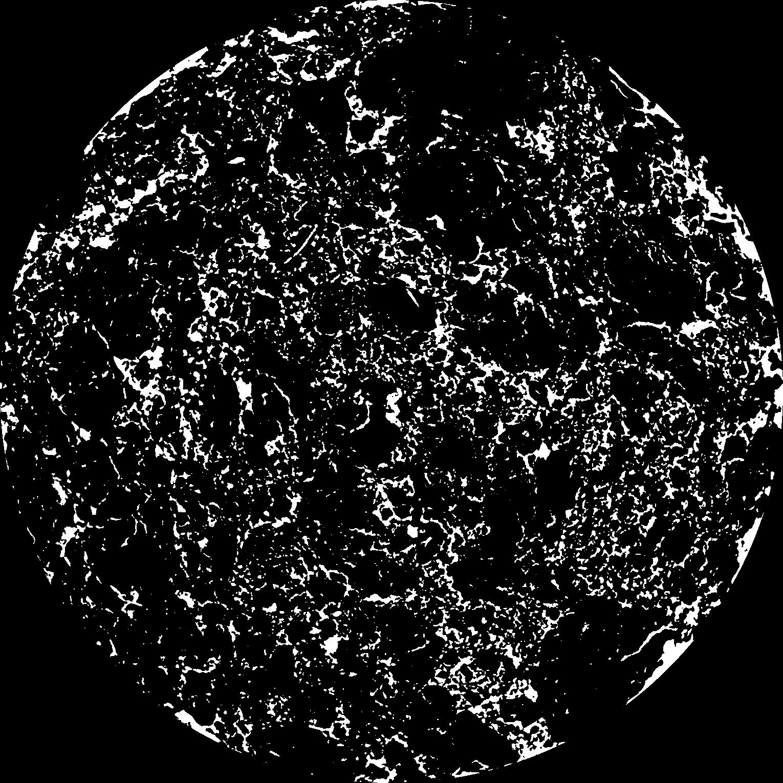
|
|---|
|
| XY Plane Grey |
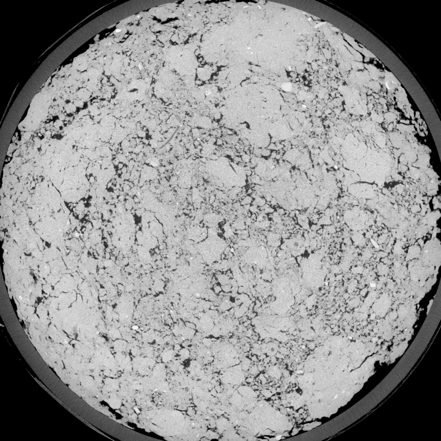
|
|---|
|
| Texture | silt loam |
|---|
| Sand | 4.0 |
|---|
| Silt | 78.0 |
|---|
| Clay | 18.0 |
|---|
|
| Bulk density | 1.31 |
|---|
| org. Carbon | 12.1 |
|---|
| six month after last tillage, field trial running for 26 years |
|---|
| Binary File Download |
|---|
|
Results
| Porosity | Surface | Mean Curvature | Euler | MeanPoreSize | Gamma | PoreDist |
| 0.1364 | 1.323666667 | 0.550277778 | 0.082962963 | 0.0 | 0.8492 | 0.332284927 |
| Opening size | Volume | Surface | MeanCurvature | Euler number |
|---|
| 0.12 | 0.1364 | 1.323666667 | 0.550277778 | 0.082962963 |
| 0.15 | 0.1319 | 1.199666667 | 0.438333333 | -0.118472222 |
| 0.18 | 0.1268 | 1.103333333 | 0.368055556 | -0.185324074 |
| 0.21 | 0.1211 | 1.013166667 | 0.3225 | -0.110787037 |
| 0.24 | 0.1179 | 0.969666667 | 0.318888889 | 0.041197222 |
| 0.27 | 0.09844 | 0.733333333 | 0.221861111 | 0.041014815 |
| 0.3 | 0.08893 | 0.6325 | 0.189222222 | 0.074583333 |
| 0.36 | 0.07634 | 0.503666667 | 0.149555556 | 0.096898148 |
| 0.42 | 0.05578 | 0.318666667 | 0.085305556 | 0.061064815 |
| 0.48 | 0.0454 | 0.236333333 | 0.058888889 | 0.041185185 |
| 0.54 | 0.03357 | 0.152316667 | 0.033 | 0.022213426 |
| 0.6000000000000001 | 0.02895 | 0.122783333 | 0.024975 | 0.015054167 |
| 0.6599999999999999 | 0.0221 | 0.083816667 | 0.015175 | 0.008888889 |
| 0.72 | 0.01915 | 0.067833333 | 0.011475 | 0.00578287 |
| 0.78 | 0.01569 | 0.05155 | 0.008119444 | 0.00395912 |
| 0.8400000000000001 | 0.01422 | 0.044683333 | 0.006775 | 0.002935509 |
| 0.8999999999999999 | 0.01169 | 0.03415 | 0.004794444 | 0.001958981 |
| 1.2 | 0.005871 | 0.013511667 | 0.00157 | 0.000570648 |
| 1.5 | 0.003279 | 0.006 | 0.000567917 | 0.000182366 |
| 1.8 | 0.002055 | 0.00306 | 0.000227311 | 0.000052944 |
| 2.1 | 0.001444 | 0.001836667 | 0.000113303 | 0.000023531 |
| 2.7 | 0.0008752 | 0.000936333 | 0.000045181 | 0.000005883 |
| 3.3000000000000003 | 0.0005993 | 0.000635333 | 0.000030708 | 0.000003471 |
| 3.9 | 0.0004005 | 0.000442333 | 0.000024002 | 0.000003471 |
Reference: An open Soil Structure Library based on X-ray CT data
 Soil Structure Library