General Information
Internal Identifier UFZ_CT_11
| Soil Type | Luvisol |
|---|
| Classification | WRB |
|---|
|
| Location | Luettewitz |
|---|
| Latitude | 51.1183 |
|---|
| Longitude | 13.2286 |
|---|
|
| Landuse | agricultural crop rotation |
|---|
| Tillage | conventional tillage |
|---|
| Crop | winter wheat, sugar beet, winter wheat |
|---|
|
| Sampling Depth | 10.0 |
|---|
| Sample Height | 10.0 |
|---|
| Sampling Date | March 27, 2018 |
|---|
| Voxel size | 0.06 |
|---|
| Pores white? | True |
|---|
|
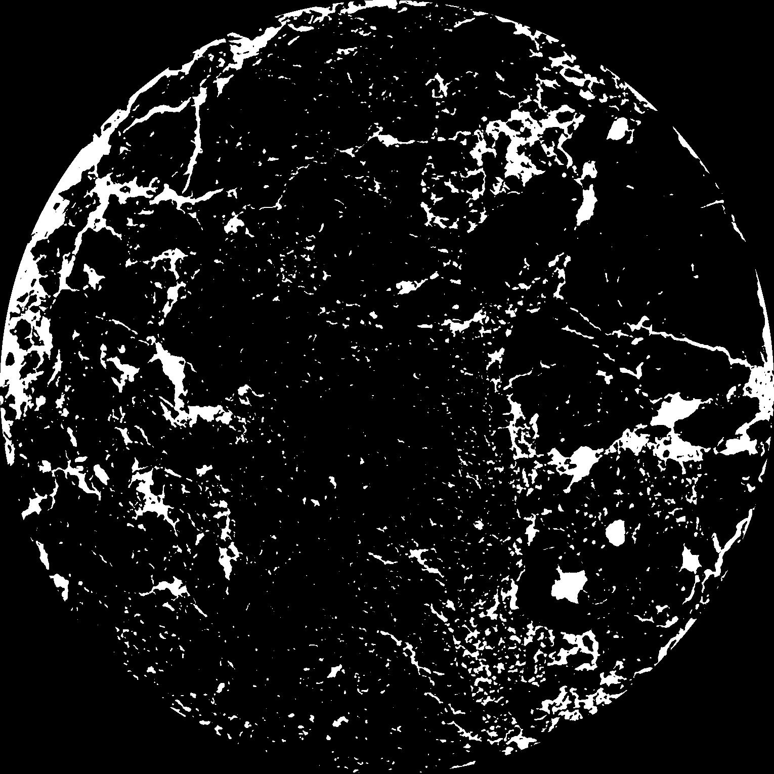
| XY Plane |
|
|---|
|
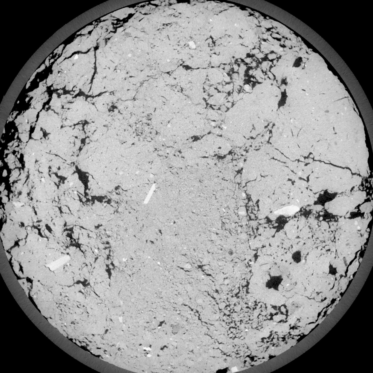
| XY Plane Grey |
|
|---|
|
| Texture | silt loam |
|---|
| Sand | 4.0 |
|---|
| Silt | 78.0 |
|---|
| Clay | 18.0 |
|---|
|
| Bulk density | 1.4 |
|---|
| org. Carbon | 12.1 |
|---|
| six month after last tillage, field trial running for 26 years |
|---|
| Binary File Download |
|---|
|
Results
| Porosity | Surface | Mean Curvature | Euler | MeanPoreSize | Gamma | PoreDist |
| 0.1309 | 0.8955 | 0.301111111 | 0.175092593 | 0.0 | 0.8855 | 0.533981753 |
| Opening size | Volume | Surface | MeanCurvature | Euler number |
|---|
| 0.12 | 0.1309 | 0.8955 | 0.301111111 | 0.175092593 |
| 0.15 | 0.1282 | 0.821 | 0.232944444 | 0.0136125 |
| 0.18 | 0.1251 | 0.7635 | 0.19075 | -0.057222222 |
| 0.21 | 0.122 | 0.7145 | 0.165416667 | -0.044673148 |
| 0.24 | 0.1203 | 0.691833333 | 0.162916667 | 0.017330556 |
| 0.27 | 0.1102 | 0.5735 | 0.11625 | -0.013177315 |
| 0.3 | 0.1052 | 0.523666667 | 0.102472222 | 0.000523565 |
| 0.36 | 0.09805 | 0.455 | 0.085888889 | 0.018006944 |
| 0.42 | 0.08514 | 0.352333333 | 0.06025 | 0.015883333 |
| 0.48 | 0.07727 | 0.297666667 | 0.048472222 | 0.014288889 |
| 0.54 | 0.06653 | 0.231833333 | 0.034305556 | 0.012206481 |
| 0.6000000000000001 | 0.06153 | 0.203333333 | 0.028805556 | 0.009100463 |
| 0.6599999999999999 | 0.05297 | 0.1608 | 0.021019444 | 0.007912037 |
| 0.72 | 0.04878 | 0.140216667 | 0.01745 | 0.005494444 |
| 0.78 | 0.04336 | 0.117183333 | 0.013694444 | 0.004482593 |
| 0.8400000000000001 | 0.04095 | 0.106716667 | 0.012027778 | 0.003200185 |
| 0.8999999999999999 | 0.0365 | 0.090066667 | 0.009527778 | 0.002564861 |
| 1.2 | 0.02425 | 0.051016667 | 0.004647222 | 0.00104125 |
| 1.5 | 0.01597 | 0.030333333 | 0.002618972 | 0.000652963 |
| 1.8 | 0.01023 | 0.017933333 | 0.0014895 | 0.000341194 |
| 2.1 | 0.006026 | 0.0094 | 0.000694639 | 0.000176481 |
| 2.7 | 0.002321 | 0.00334 | 0.000237894 | 0.000052944 |
| 3.3000000000000003 | 0.0006411 | 0.000881167 | 0.000062475 | 0.000017648 |
| 3.9 | 0.00004243 | 0.00005701 | 0.000004236 | 0.000000892 |
Reference: An open Soil Structure Library based on X-ray CT data
 Soil Structure Library