General Information
Internal Identifier UFZ_CT_13
| Soil Type | Luvisol |
|---|
| Classification | WRB |
|---|
|
| Location | Luettewitz |
|---|
| Latitude | 51.1183 |
|---|
| Longitude | 13.2286 |
|---|
|
| Landuse | agricultural crop rotation |
|---|
| Tillage | conventional tillage |
|---|
| Crop | winter wheat, sugar beet, winter wheat |
|---|
|
| Sampling Depth | 10.0 |
|---|
| Sample Height | 10.0 |
|---|
| Sampling Date | March 27, 2018 |
|---|
| Voxel size | 0.06 |
|---|
| Pores white? | True |
|---|
|
| XY Plane |
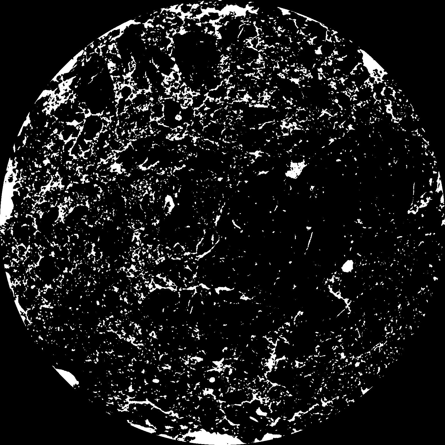
|
|---|
|
| XY Plane Grey |
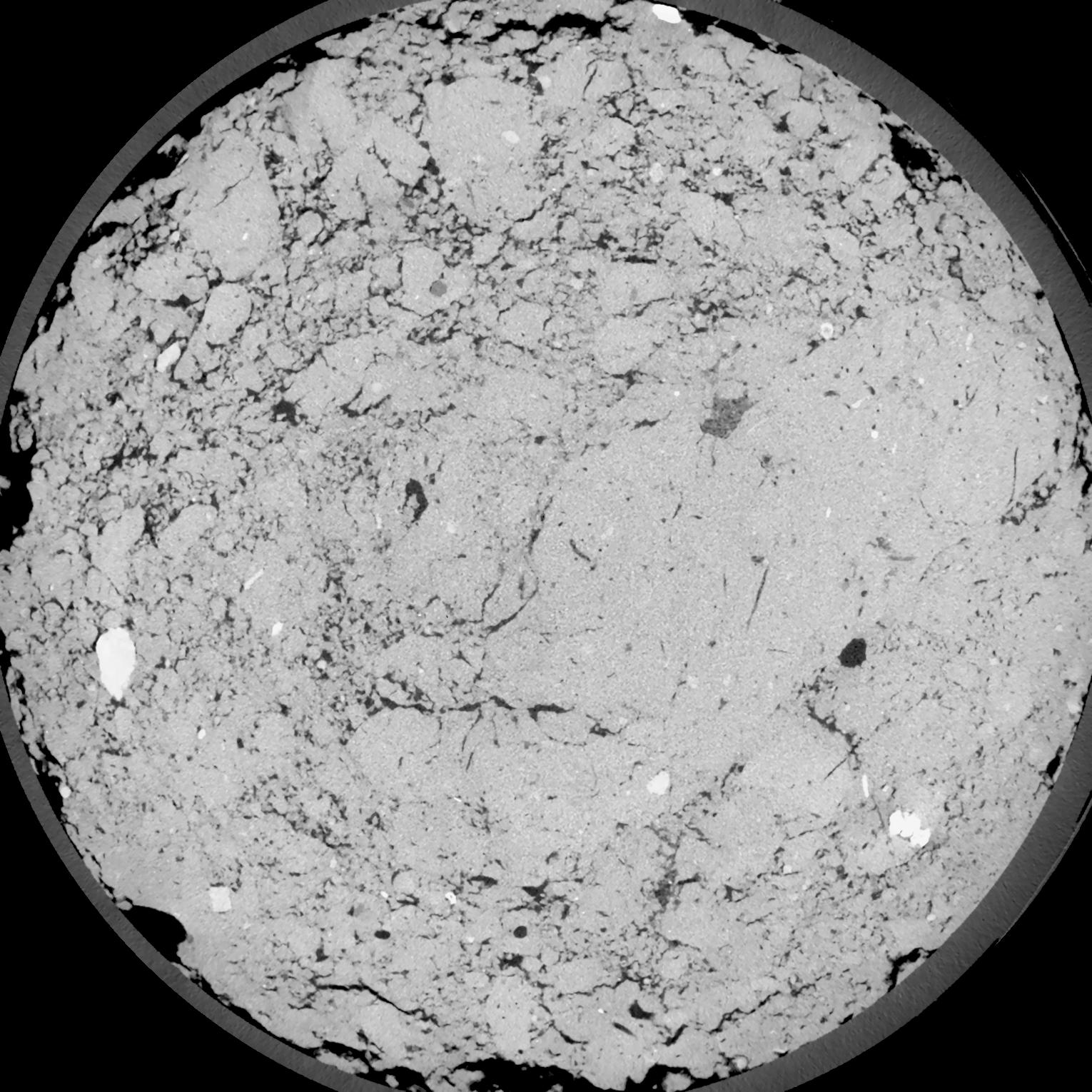
|
|---|
|
| Texture | silt loam |
|---|
| Sand | 4.0 |
|---|
| Silt | 78.0 |
|---|
| Clay | 18.0 |
|---|
|
| Bulk density | 1.41 |
|---|
| org. Carbon | 12.1 |
|---|
| six month after last tillage, field trial running for 26 years |
|---|
| Binary File Download |
|---|
|
Results
| Porosity | Surface | Mean Curvature | Euler | MeanPoreSize | Gamma | PoreDist |
| 0.115 | 1.110666667 | 0.501388889 | 0.344212963 | 0.0 | 0.8042 | 0.39859578 |
| Opening size | Volume | Surface | MeanCurvature | Euler number |
|---|
| 0.12 | 0.115 | 1.110666667 | 0.501388889 | 0.344212963 |
| 0.15 | 0.1109 | 0.9985 | 0.391944444 | 0.060231481 |
| 0.18 | 0.1064 | 0.910166667 | 0.3225 | -0.039238889 |
| 0.21 | 0.1013 | 0.829166667 | 0.277277778 | -0.006400463 |
| 0.24 | 0.09863 | 0.792 | 0.272638889 | 0.107546296 |
| 0.27 | 0.08216 | 0.587666667 | 0.180111111 | 0.063472222 |
| 0.3 | 0.07446 | 0.505 | 0.151194444 | 0.077546296 |
| 0.36 | 0.06437 | 0.400833333 | 0.117222222 | 0.083564815 |
| 0.42 | 0.04822 | 0.255166667 | 0.065305556 | 0.047962963 |
| 0.48 | 0.04014 | 0.1915 | 0.045 | 0.03195 |
| 0.54 | 0.03083 | 0.126083333 | 0.025066667 | 0.016683796 |
| 0.6000000000000001 | 0.02725 | 0.1036 | 0.019125 | 0.011312963 |
| 0.6599999999999999 | 0.02177 | 0.073116667 | 0.011677778 | 0.006477315 |
| 0.72 | 0.01942 | 0.060783333 | 0.008969444 | 0.004065093 |
| 0.78 | 0.01657 | 0.047983333 | 0.006497222 | 0.002741435 |
| 0.8400000000000001 | 0.01536 | 0.042566667 | 0.005527778 | 0.002006065 |
| 0.8999999999999999 | 0.01319 | 0.034033333 | 0.0041 | 0.001435417 |
| 1.2 | 0.007888 | 0.016186667 | 0.001582028 | 0.000494167 |
| 1.5 | 0.00507 | 0.008733333 | 0.000732778 | 0.000200019 |
| 1.8 | 0.003529 | 0.005283333 | 0.000396028 | 0.000105894 |
| 2.1 | 0.002371 | 0.002946667 | 0.000179311 | 0.000041181 |
| 2.7 | 0.001447 | 0.001532833 | 0.000084008 | 0.000017649 |
| 3.3000000000000003 | 0.0008702 | 0.0007615 | 0.000036003 | 0.000011766 |
| 3.9 | 0.000709 | 0.000563167 | 0.000023649 | 0.000003355 |
| 4.5 | 0.0005889 | 0.000432 | 0.000015531 | 0.000005033 |
| 5.1 | 0.0005261 | 0.000393167 | 0.000014825 | 0.000001678 |
| 5.699999999999999 | 0.0004445 | 0.000344833 | 0.000013766 | 0.000001678 |
| 6.3 | 0.0003162 | 0.000268167 | 0.000012001 | 0.000001678 |
Reference: An open Soil Structure Library based on X-ray CT data
 Soil Structure Library