General Information
Internal Identifier UFZ_NT_01
| Soil Type | Luvisol |
|---|
| Classification | WRB |
|---|
|
| Location | Luettewitz |
|---|
| Latitude | 51.1183 |
|---|
| Longitude | 13.2286 |
|---|
|
| Landuse | agricultural crop rotation |
|---|
| Tillage | no tillage |
|---|
| Crop | winter wheat, sugar beet, winter wheat |
|---|
|
| Sampling Depth | 10.0 |
|---|
| Sample Height | 10.0 |
|---|
| Sampling Date | March 27, 2018 |
|---|
| Voxel size | 0.06 |
|---|
| Pores white? | True |
|---|
|
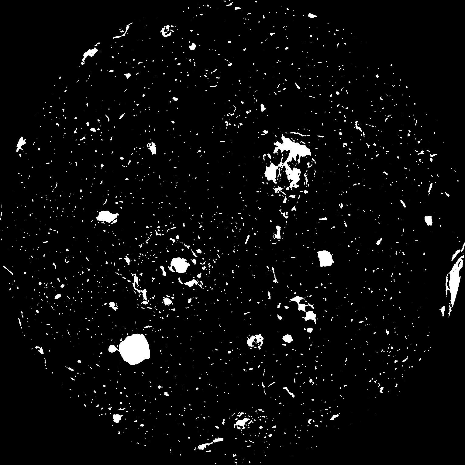
| XY Plane |
|
|---|
|
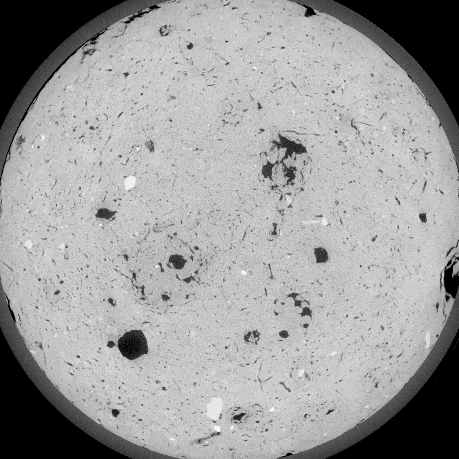
| XY Plane Grey |
|
|---|
|
| Texture | silt loam |
|---|
| Sand | 3.0 |
|---|
| Silt | 77.0 |
|---|
| Clay | 20.0 |
|---|
|
| Bulk density | 1.59 |
|---|
| org. Carbon | 12.8 |
|---|
| six month after last tillage, field trial running for 26 years |
|---|
| Binary File Download |
|---|
|
Results
| Porosity | Surface | Mean Curvature | Euler | MeanPoreSize | Gamma | PoreDist |
| 0.04478 | 0.4425 | 0.329722222 | 0.854166667 | 0.0 | 0.5005 | 0.4162342 |
| Opening size | Volume | Surface | MeanCurvature | Euler number |
|---|
| 0.12 | 0.04478 | 0.4425 | 0.329722222 | 0.854166667 |
| 0.15 | 0.04197 | 0.3655 | 0.226083333 | 0.370601852 |
| 0.18 | 0.03924 | 0.304 | 0.158722222 | 0.193333333 |
| 0.21 | 0.03676 | 0.258166667 | 0.120527778 | 0.137731481 |
| 0.24 | 0.0358 | 0.243666667 | 0.115277778 | 0.166851852 |
| 0.27 | 0.03034 | 0.162133333 | 0.057444444 | 0.058611111 |
| 0.3 | 0.02837 | 0.137916667 | 0.0445 | 0.04442037 |
| 0.36 | 0.02595 | 0.110183333 | 0.031611111 | 0.029413426 |
| 0.42 | 0.02255 | 0.077233333 | 0.017202778 | 0.012353704 |
| 0.48 | 0.02081 | 0.063183333 | 0.012413889 | 0.007806481 |
| 0.54 | 0.0186 | 0.0475 | 0.007536111 | 0.004476759 |
| 0.6000000000000001 | 0.01764 | 0.0414 | 0.005941667 | 0.003023704 |
| 0.6599999999999999 | 0.01625 | 0.03375 | 0.004102778 | 0.002253102 |
| 0.72 | 0.01562 | 0.030366667 | 0.003369444 | 0.00144713 |
| 0.78 | 0.01485 | 0.02695 | 0.002715694 | 0.001158889 |
| 0.8400000000000001 | 0.0145 | 0.025366667 | 0.002443222 | 0.000805926 |
| 0.8999999999999999 | 0.01385 | 0.02285 | 0.002022472 | 0.000682407 |
| 1.2 | 0.01201 | 0.01675 | 0.001162306 | 0.000341199 |
| 1.5 | 0.01063 | 0.013216667 | 0.000787111 | 0.000229426 |
| 1.8 | 0.009564 | 0.01105 | 0.0005965 | 0.000147069 |
| 2.1 | 0.008459 | 0.009158333 | 0.000469806 | 0.000111773 |
| 2.7 | 0.00648 | 0.006113333 | 0.000262606 | 0.000052944 |
| 3.3000000000000003 | 0.004825 | 0.003988333 | 0.000146481 | 0.000023531 |
| 3.9 | 0.004314 | 0.003368333 | 0.000111536 | 0.000011765 |
| 4.5 | 0.003858 | 0.002993333 | 0.000100242 | 0.000005883 |
| 5.1 | 0.002682 | 0.002151667 | 0.000080828 | 0.000005883 |
| 5.699999999999999 | 0.000695 | 0.000507667 | 0.000018354 | 0.00000176 |
| 6.3 | 0.000358 | 0.000296833 | 0.00001306 | 0.00000176 |
Reference: An open Soil Structure Library based on X-ray CT data
 Soil Structure Library