General Information
Internal Identifier UFZ_NT_02
| Soil Type | Luvisol |
|---|
| Classification | WRB |
|---|
|
| Location | Luettewitz |
|---|
| Latitude | 51.1183 |
|---|
| Longitude | 13.2286 |
|---|
|
| Landuse | agricultural crop rotation |
|---|
| Tillage | no tillage |
|---|
| Crop | winter wheat, sugar beet, winter wheat |
|---|
|
| Sampling Depth | 10.0 |
|---|
| Sample Height | 10.0 |
|---|
| Sampling Date | March 27, 2018 |
|---|
| Voxel size | 0.06 |
|---|
| Pores white? | True |
|---|
|
| XY Plane |
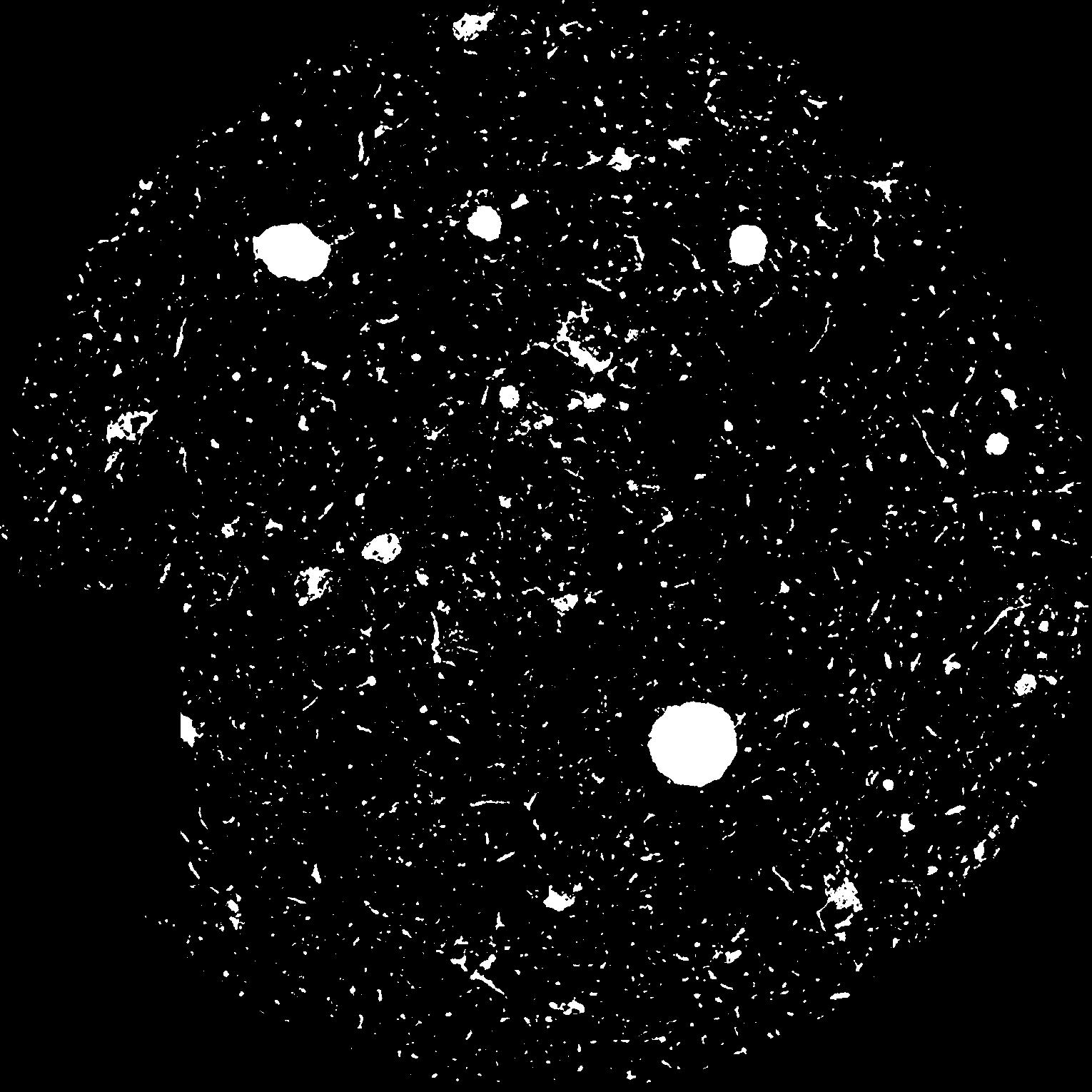
|
|---|
|
| XY Plane Grey |
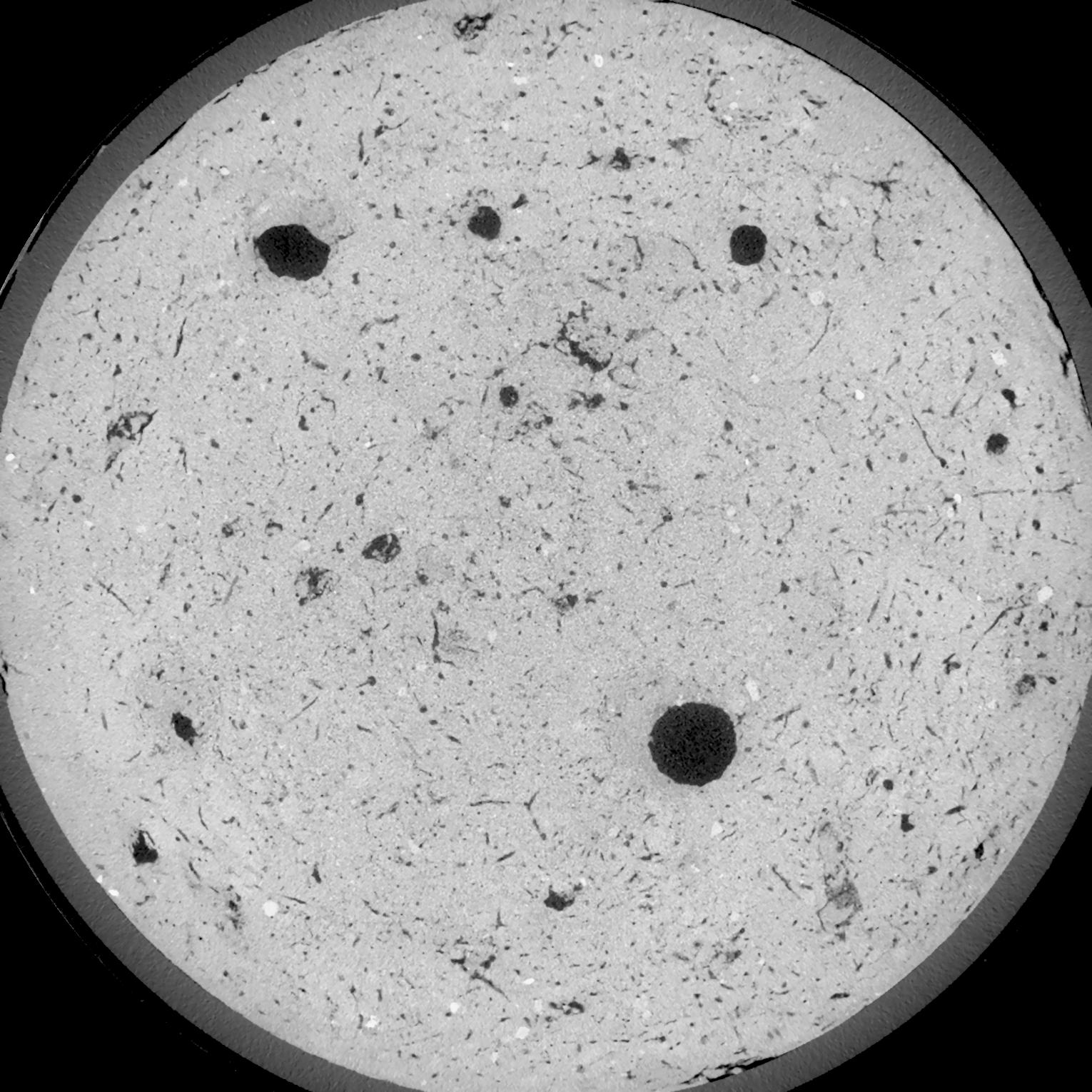
|
|---|
|
| Texture | silt loam |
|---|
| Sand | 3.0 |
|---|
| Silt | 77.0 |
|---|
| Clay | 20.0 |
|---|
|
| Bulk density | 1.51 |
|---|
| org. Carbon | 12.8 |
|---|
| six month after last tillage, field trial running for 26 years |
|---|
| Binary File Download |
|---|
|
Results
| Porosity | Surface | Mean Curvature | Euler | MeanPoreSize | Gamma | PoreDist |
| 0.07083 | 0.680666667 | 0.471388889 | 0.985648148 | 0.0 | 0.6116 | 0.327908686 |
| Opening size | Volume | Surface | MeanCurvature | Euler number |
|---|
| 0.12 | 0.07083 | 0.680666667 | 0.471388889 | 0.985648148 |
| 0.15 | 0.06685 | 0.5745 | 0.339166667 | 0.488425926 |
| 0.18 | 0.06277 | 0.484 | 0.243805556 | 0.269675926 |
| 0.21 | 0.0589 | 0.413166667 | 0.186583333 | 0.199814815 |
| 0.24 | 0.05735 | 0.389833333 | 0.1785 | 0.24875 |
| 0.27 | 0.04861 | 0.2615 | 0.089888889 | 0.087638889 |
| 0.3 | 0.04533 | 0.221833333 | 0.069638889 | 0.068009259 |
| 0.36 | 0.04123 | 0.175666667 | 0.048861111 | 0.046018519 |
| 0.42 | 0.03544 | 0.1209 | 0.025933333 | 0.019449537 |
| 0.48 | 0.03247 | 0.09725 | 0.018016667 | 0.011898611 |
| 0.54 | 0.02897 | 0.07315 | 0.010827778 | 0.006356019 |
| 0.6000000000000001 | 0.02751 | 0.06425 | 0.008633333 | 0.004206435 |
| 0.6599999999999999 | 0.02523 | 0.0524 | 0.006075 | 0.003091713 |
| 0.72 | 0.02414 | 0.04695 | 0.005019444 | 0.001903056 |
| 0.78 | 0.02275 | 0.0411 | 0.004058333 | 0.001558194 |
| 0.8400000000000001 | 0.02214 | 0.038483333 | 0.003663889 | 0.001090093 |
| 0.8999999999999999 | 0.02099 | 0.03425 | 0.00305 | 0.000979259 |
| 1.2 | 0.0178 | 0.02415 | 0.001782611 | 0.000541991 |
| 1.5 | 0.01547 | 0.018183333 | 0.001151083 | 0.000338731 |
| 1.8 | 0.01373 | 0.01431 | 0.000757889 | 0.000153968 |
| 2.1 | 0.01233 | 0.011705 | 0.000549861 | 0.000110856 |
| 2.7 | 0.01017 | 0.008208333 | 0.000300417 | 0.000036953 |
| 3.3000000000000003 | 0.008986 | 0.006836667 | 0.000240192 | 0.000036953 |
| 3.9 | 0.007951 | 0.005716667 | 0.000188089 | 0.000024635 |
| 4.5 | 0.006024 | 0.00397 | 0.000124161 | 0.000012318 |
| 5.1 | 0.005402 | 0.003296667 | 0.000085731 | 0.000006159 |
| 5.699999999999999 | 0.005174 | 0.003181667 | 0.000084992 | 0.000002927 |
| 6.3 | 0.00471 | 0.003028333 | 0.000086469 | 0.000002927 |
| 6.8999999999999995 | 0.001359 | 0.000962 | 0.000035106 | 0.000003903 |
Reference: An open Soil Structure Library based on X-ray CT data
 Soil Structure Library