General Information
Internal Identifier UFZ_NT_05
| Soil Type | Luvisol |
|---|
| Classification | WRB |
|---|
|
| Location | Luettewitz |
|---|
| Latitude | 51.1183 |
|---|
| Longitude | 13.2286 |
|---|
|
| Landuse | agricultural crop rotation |
|---|
| Tillage | no tillage |
|---|
| Crop | winter wheat, sugar beet, winter wheat |
|---|
|
| Sampling Depth | 10.0 |
|---|
| Sample Height | 10.0 |
|---|
| Sampling Date | March 27, 2018 |
|---|
| Voxel size | 0.06 |
|---|
| Pores white? | True |
|---|
|
| XY Plane |
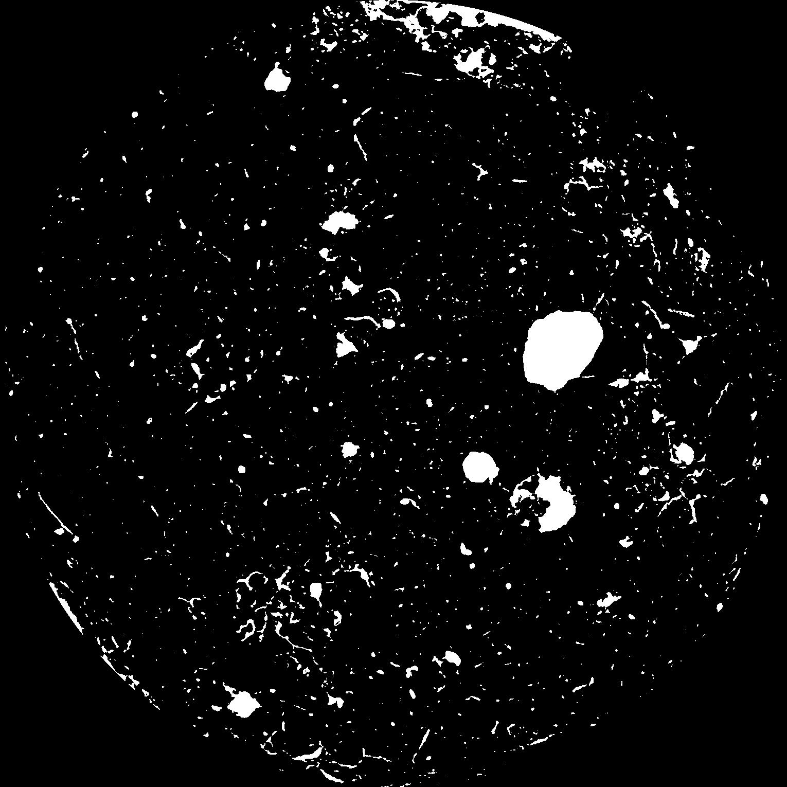
|
|---|
|
| XY Plane Grey |
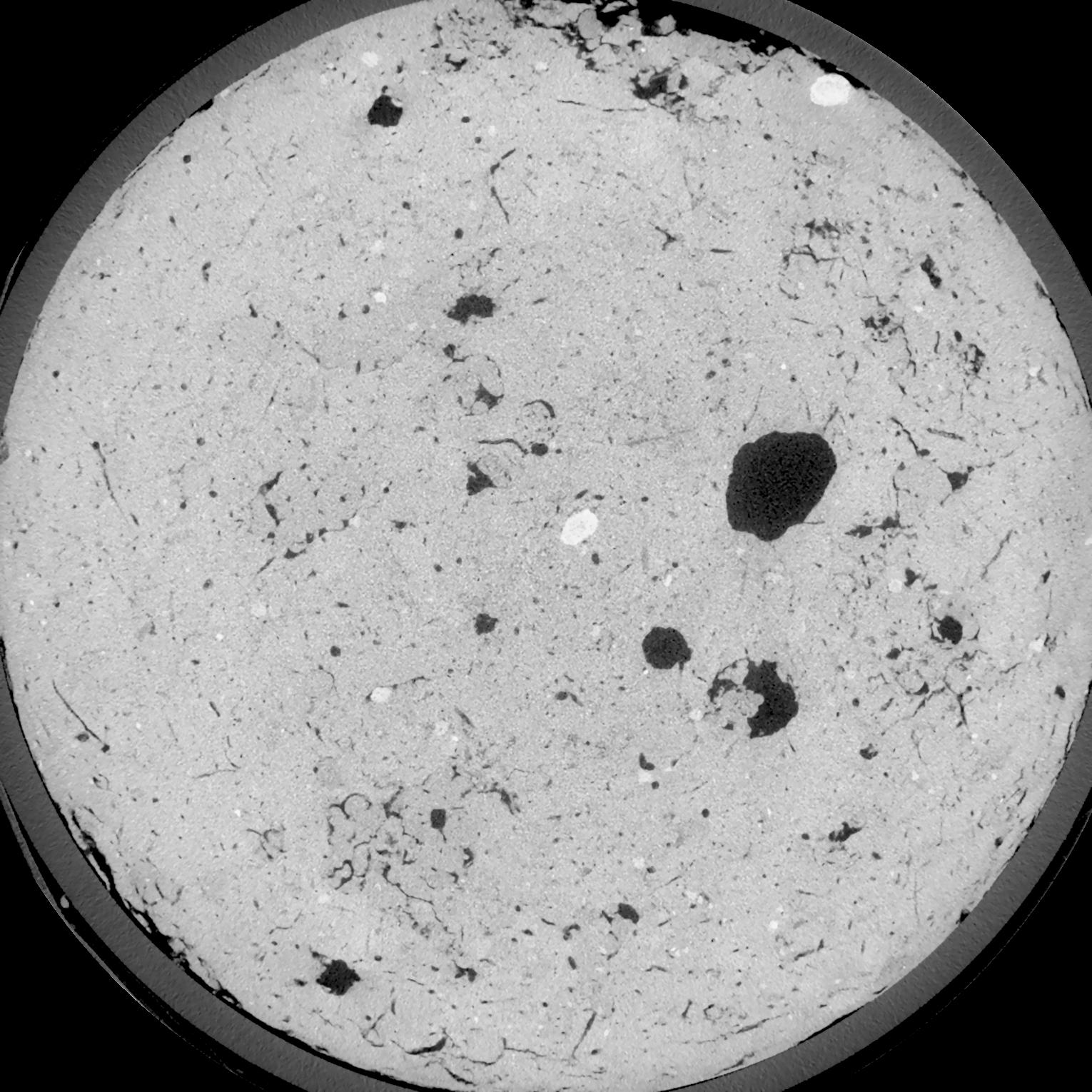
|
|---|
|
| Texture | silt loam |
|---|
| Sand | 3.0 |
|---|
| Silt | 77.0 |
|---|
| Clay | 20.0 |
|---|
|
| Bulk density | 1.42 |
|---|
| org. Carbon | 12.8 |
|---|
| six month after last tillage, field trial running for 26 years |
|---|
| Binary File Download |
|---|
|
Results
| Porosity | Surface | Mean Curvature | Euler | MeanPoreSize | Gamma | PoreDist |
| 0.07028 | 0.6005 | 0.337777778 | 0.659722222 | 0.0 | 0.7291 | 0.40252712 |
| Opening size | Volume | Surface | MeanCurvature | Euler number |
|---|
| 0.12 | 0.07028 | 0.6005 | 0.337777778 | 0.659722222 |
| 0.15 | 0.06733 | 0.520333333 | 0.240027778 | 0.257407407 |
| 0.18 | 0.06434 | 0.457166667 | 0.179527778 | 0.113888889 |
| 0.21 | 0.06153 | 0.4085 | 0.145 | 0.085138889 |
| 0.24 | 0.0603 | 0.390666667 | 0.140472222 | 0.126018519 |
| 0.27 | 0.0531 | 0.293833333 | 0.084222222 | 0.044500926 |
| 0.3 | 0.05008 | 0.260166667 | 0.070222222 | 0.039983333 |
| 0.36 | 0.04603 | 0.2175 | 0.054777778 | 0.0343125 |
| 0.42 | 0.03946 | 0.159216667 | 0.034305556 | 0.019859259 |
| 0.48 | 0.03573 | 0.130483333 | 0.025761111 | 0.014435648 |
| 0.54 | 0.03093 | 0.0979 | 0.016533333 | 0.009476852 |
| 0.6000000000000001 | 0.0288 | 0.08455 | 0.013155556 | 0.006541204 |
| 0.6599999999999999 | 0.02549 | 0.066666667 | 0.009033333 | 0.00482963 |
| 0.72 | 0.02392 | 0.05835 | 0.007238889 | 0.00304713 |
| 0.78 | 0.02205 | 0.050033333 | 0.005661111 | 0.002329444 |
| 0.8400000000000001 | 0.02123 | 0.046333333 | 0.005013889 | 0.001688287 |
| 0.8999999999999999 | 0.01974 | 0.0406 | 0.004061111 | 0.001335324 |
| 1.2 | 0.01573 | 0.027416667 | 0.002267694 | 0.000711759 |
| 1.5 | 0.0128 | 0.019866667 | 0.001453444 | 0.000411773 |
| 1.8 | 0.01051 | 0.015018333 | 0.001021778 | 0.000211769 |
| 2.1 | 0.008233 | 0.010761667 | 0.000690028 | 0.000182356 |
| 2.7 | 0.005259 | 0.005905 | 0.000321194 | 0.000070588 |
| 3.3000000000000003 | 0.003395 | 0.003488333 | 0.000178592 | 0.000035295 |
| 3.9 | 0.002007 | 0.002015 | 0.000109061 | 0.00002353 |
| 4.5 | 0.0008441 | 0.0006065 | 0.000023295 | 0.00000466 |
| 5.1 | 0.0007593 | 0.000518167 | 0.000018353 | 0.000001864 |
| 5.699999999999999 | 0.0007191 | 0.000493333 | 0.000017648 | 0.000003728 |
| 6.3 | 0.0006711 | 0.000466333 | 0.000016942 | 0.000001864 |
| 6.8999999999999995 | 0.0006056 | 0.000431333 | 0.000016236 | 0.000003728 |
| 7.5 | 0.0004328 | 0.000340833 | 0.000014118 | 0.000001864 |
Reference: An open Soil Structure Library based on X-ray CT data
 Soil Structure Library