General Information
Internal Identifier UFZ_NT_09
| Soil Type | Luvisol |
|---|
| Classification | WRB |
|---|
|
| Location | Luettewitz |
|---|
| Latitude | 51.1183 |
|---|
| Longitude | 13.2286 |
|---|
|
| Landuse | agricultural crop rotation |
|---|
| Tillage | no tillage |
|---|
| Crop | winter wheat, sugar beet, winter wheat |
|---|
|
| Sampling Depth | 10.0 |
|---|
| Sample Height | 10.0 |
|---|
| Sampling Date | March 27, 2018 |
|---|
| Voxel size | 0.06 |
|---|
| Pores white? | True |
|---|
|
| XY Plane |
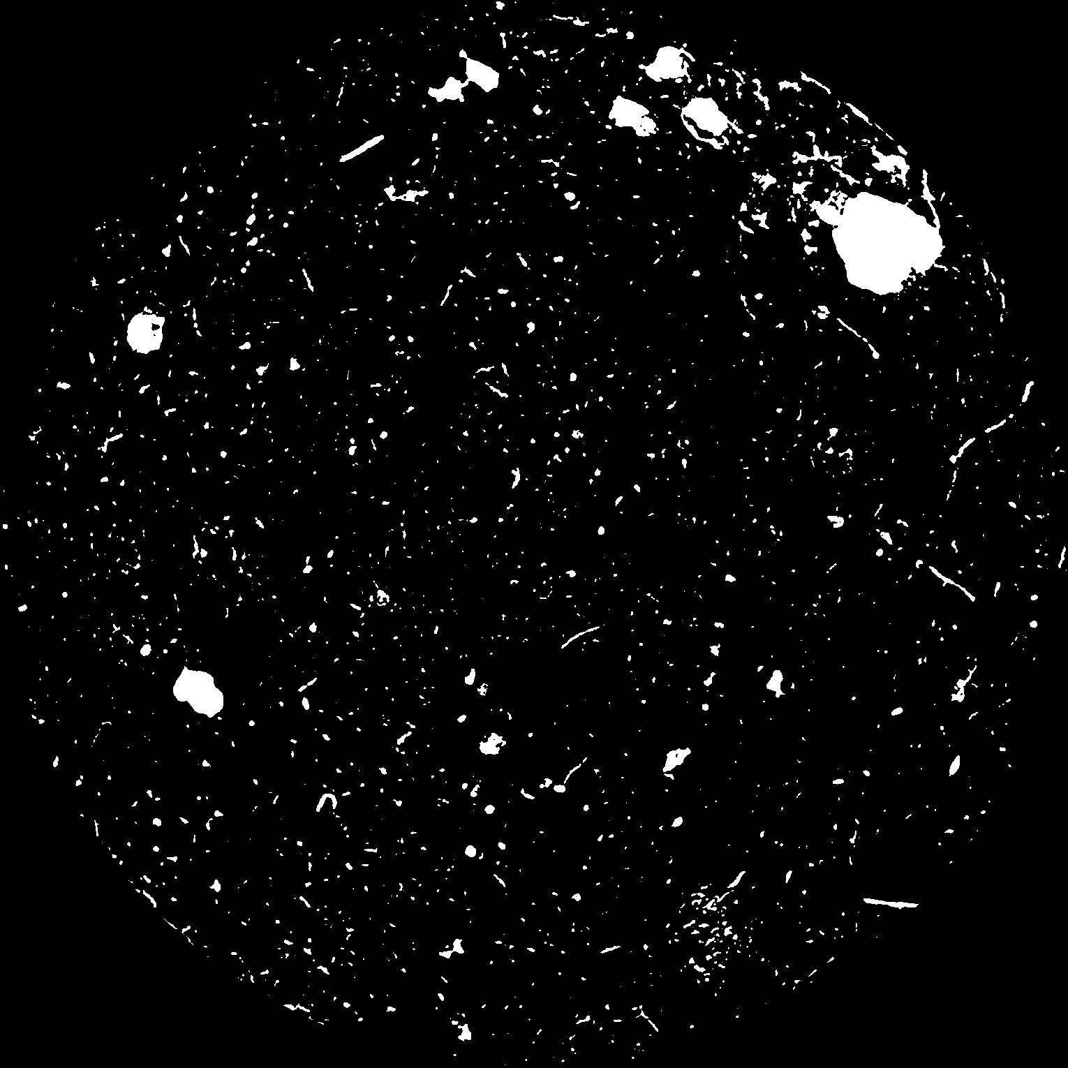
|
|---|
|
| XY Plane Grey |
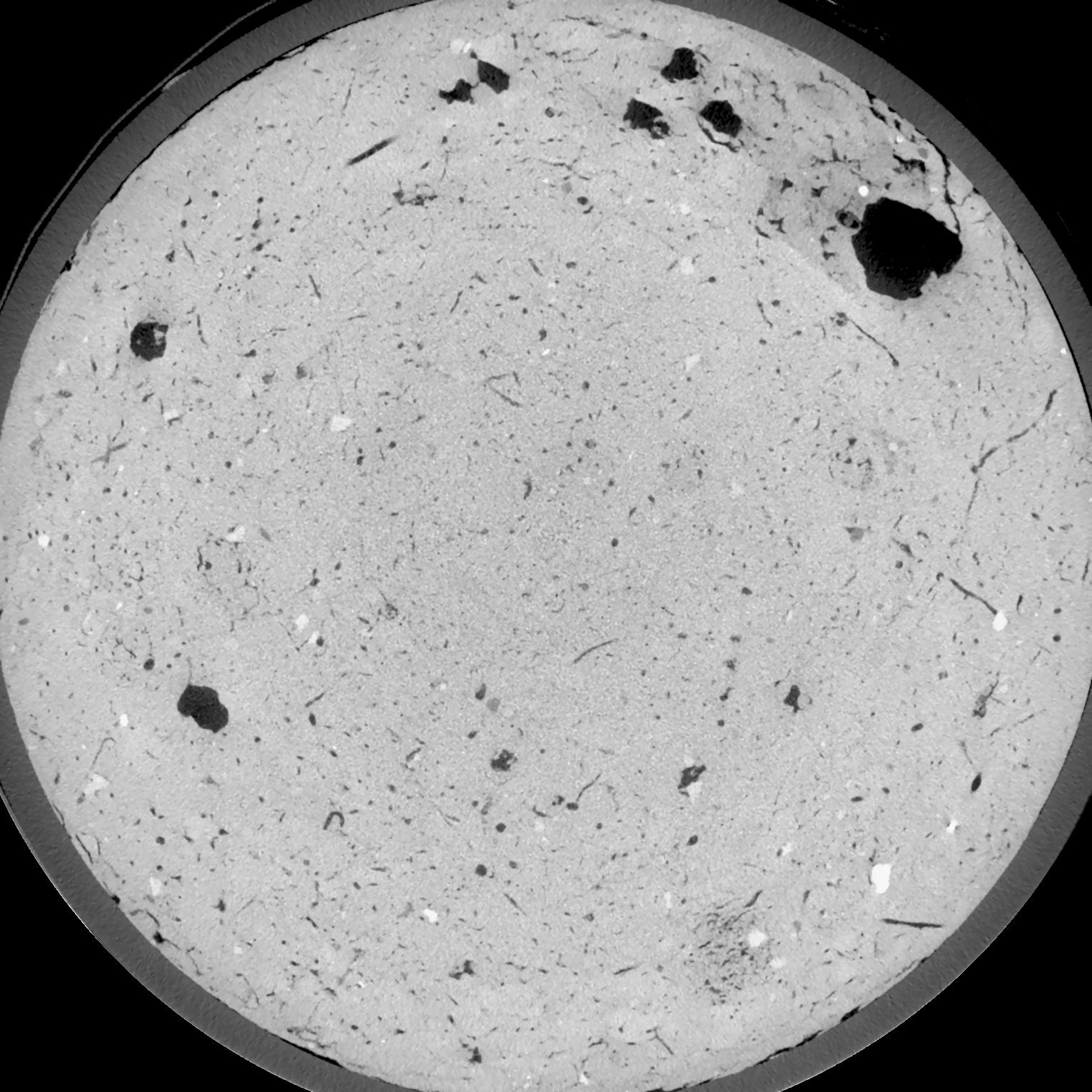
|
|---|
|
| Texture | silt loam |
|---|
| Sand | 3.0 |
|---|
| Silt | 77.0 |
|---|
| Clay | 20.0 |
|---|
|
| Bulk density | 1.59 |
|---|
| org. Carbon | 12.8 |
|---|
| six month after last tillage, field trial running for 26 years |
|---|
| Binary File Download |
|---|
|
Results
| Porosity | Surface | Mean Curvature | Euler | MeanPoreSize | Gamma | PoreDist |
| 0.05242 | 0.4975 | 0.352222222 | 0.891203704 | 0.0 | 0.563 | 0.39941937 |
| Opening size | Volume | Surface | MeanCurvature | Euler number |
|---|
| 0.12 | 0.05242 | 0.4975 | 0.352222222 | 0.891203704 |
| 0.15 | 0.04942 | 0.414333333 | 0.241222222 | 0.370694444 |
| 0.18 | 0.04652 | 0.3495 | 0.170305556 | 0.185509259 |
| 0.21 | 0.04384 | 0.3 | 0.12975 | 0.130509259 |
| 0.24 | 0.04278 | 0.284166667 | 0.124361111 | 0.164490741 |
| 0.27 | 0.03673 | 0.196 | 0.064194444 | 0.053981481 |
| 0.3 | 0.03442 | 0.168666667 | 0.050861111 | 0.042983333 |
| 0.36 | 0.03151 | 0.136466667 | 0.037194444 | 0.030424074 |
| 0.42 | 0.0272 | 0.096516667 | 0.021372222 | 0.014206019 |
| 0.48 | 0.02489 | 0.078233333 | 0.015491667 | 0.009418056 |
| 0.54 | 0.02203 | 0.058416667 | 0.009613889 | 0.005794444 |
| 0.6000000000000001 | 0.02078 | 0.050616667 | 0.007652778 | 0.004000093 |
| 0.6599999999999999 | 0.01888 | 0.040133333 | 0.005119444 | 0.002823611 |
| 0.72 | 0.01804 | 0.03565 | 0.004163889 | 0.001741204 |
| 0.78 | 0.01704 | 0.031283333 | 0.003361111 | 0.001429444 |
| 0.8400000000000001 | 0.0166 | 0.029266667 | 0.003016667 | 0.001047083 |
| 0.8999999999999999 | 0.01579 | 0.026283333 | 0.002555 | 0.000870602 |
| 1.2 | 0.01339 | 0.018166667 | 0.001381806 | 0.000435306 |
| 1.5 | 0.01149 | 0.013151667 | 0.000828028 | 0.000270593 |
| 1.8 | 0.009955 | 0.009745 | 0.000496611 | 0.000111769 |
| 2.1 | 0.008832 | 0.007576667 | 0.000305306 | 0.000076472 |
| 2.7 | 0.007491 | 0.005695 | 0.000197297 | 0.000029413 |
| 3.3000000000000003 | 0.006551 | 0.004586667 | 0.000142944 | 0.00002353 |
| 3.9 | 0.005747 | 0.003791667 | 0.000105178 | 0.000011765 |
| 4.5 | 0.004957 | 0.003225 | 0.000092119 | 0.000005882 |
| 5.1 | 0.003906 | 0.002405 | 0.000063531 | 0.000005882 |
| 5.699999999999999 | 0.003349 | 0.002108333 | 0.000058942 | 0.000002796 |
| 6.3 | 0.001654 | 0.0010885 | 0.000034589 | 0.000002796 |
| 6.8999999999999995 | 0.0008487 | 0.000612667 | 0.000023295 | 0.000002796 |
| 7.5 | 0.0004417 | 0.000345167 | 0.000014471 | 0.000001864 |
Reference: An open Soil Structure Library based on X-ray CT data
 Soil Structure Library