General Information
Internal Identifier UFZ_NT_12
| Soil Type | Luvisol |
|---|
| Classification | WRB |
|---|
|
| Location | Luettewitz |
|---|
| Latitude | 51.1183 |
|---|
| Longitude | 13.2286 |
|---|
|
| Landuse | agricultural crop rotation |
|---|
| Tillage | no tillage |
|---|
| Crop | winter wheat, sugar beet, winter wheat |
|---|
|
| Sampling Depth | 10.0 |
|---|
| Sample Height | 10.0 |
|---|
| Sampling Date | March 27, 2018 |
|---|
| Voxel size | 0.06 |
|---|
| Pores white? | True |
|---|
|
| XY Plane |
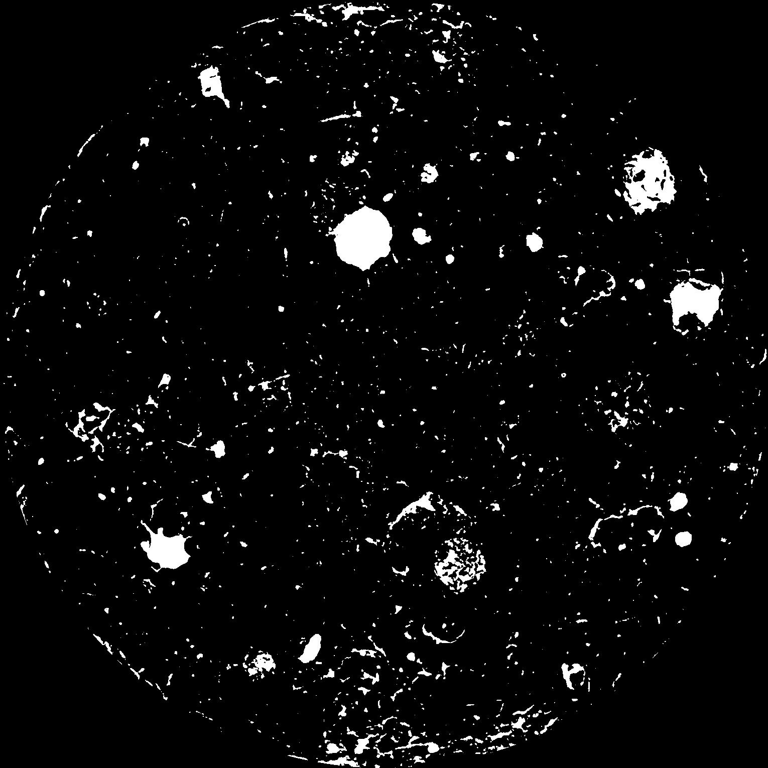
|
|---|
|
| XY Plane Grey |
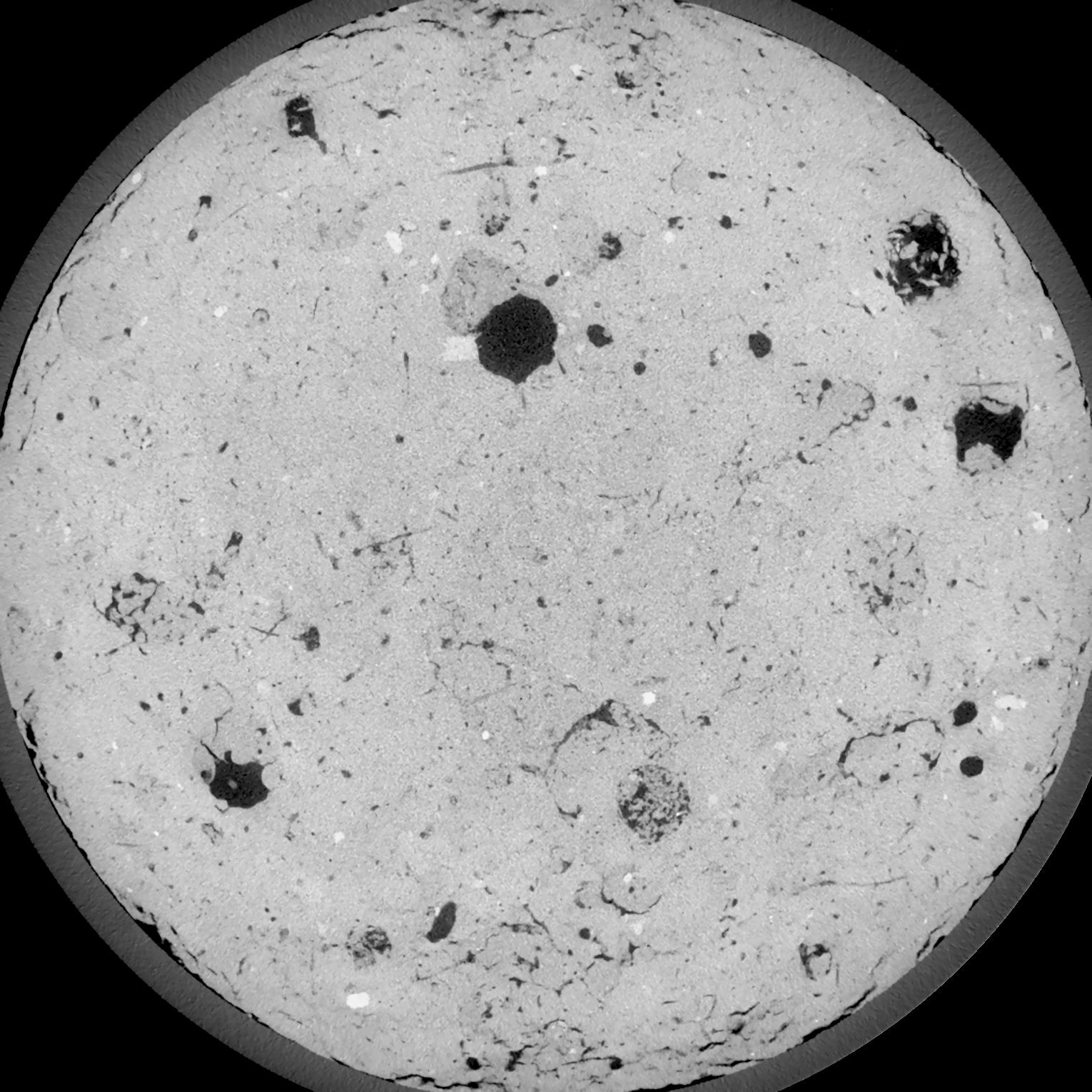
|
|---|
|
| Texture | silt loam |
|---|
| Sand | 3.0 |
|---|
| Silt | 77.0 |
|---|
| Clay | 20.0 |
|---|
|
| Bulk density | 1.5 |
|---|
| org. Carbon | 12.8 |
|---|
| six month after last tillage, field trial running for 26 years |
|---|
| Binary File Download |
|---|
|
Results
| Porosity | Surface | Mean Curvature | Euler | MeanPoreSize | Gamma | PoreDist |
| 0.07285 | 0.602333333 | 0.321388889 | 0.60787037 | 0.0 | 0.7019 | 0.4327508 |
| Opening size | Volume | Surface | MeanCurvature | Euler number |
|---|
| 0.12 | 0.07285 | 0.602333333 | 0.321388889 | 0.60787037 |
| 0.15 | 0.07016 | 0.528 | 0.232527778 | 0.230787037 |
| 0.18 | 0.06745 | 0.471333333 | 0.178583333 | 0.100555556 |
| 0.21 | 0.06475 | 0.425166667 | 0.1465 | 0.076157407 |
| 0.24 | 0.06351 | 0.4075 | 0.142333333 | 0.118472222 |
| 0.27 | 0.05594 | 0.307666667 | 0.087083333 | 0.046026389 |
| 0.3 | 0.05265 | 0.2715 | 0.072722222 | 0.042773148 |
| 0.36 | 0.04819 | 0.225 | 0.056444444 | 0.037561111 |
| 0.42 | 0.04096 | 0.161433333 | 0.034472222 | 0.02149537 |
| 0.48 | 0.03701 | 0.131366667 | 0.025638889 | 0.015271759 |
| 0.54 | 0.03204 | 0.097983333 | 0.016352778 | 0.009694907 |
| 0.6000000000000001 | 0.02989 | 0.08475 | 0.013077778 | 0.00678287 |
| 0.6599999999999999 | 0.02647 | 0.066633333 | 0.009036111 | 0.004853241 |
| 0.72 | 0.02488 | 0.058466667 | 0.007397222 | 0.003247269 |
| 0.78 | 0.02284 | 0.04945 | 0.005716667 | 0.0025825 |
| 0.8400000000000001 | 0.02194 | 0.0454 | 0.005008333 | 0.001747176 |
| 0.8999999999999999 | 0.02031 | 0.0392 | 0.004025 | 0.001458935 |
| 1.2 | 0.01586 | 0.0246 | 0.002045417 | 0.000682407 |
| 1.5 | 0.01278 | 0.016433333 | 0.001117472 | 0.000370611 |
| 1.8 | 0.01088 | 0.012238333 | 0.000712639 | 0.000205894 |
| 2.1 | 0.00946 | 0.009591667 | 0.000497667 | 0.000188245 |
| 2.7 | 0.007588 | 0.006576667 | 0.0002739 | 0.000058829 |
| 3.3000000000000003 | 0.0061 | 0.004583333 | 0.000151775 | 0.000017648 |
| 3.9 | 0.005575 | 0.004 | 0.000122125 | 0.000017648 |
| 4.5 | 0.005197 | 0.003768333 | 0.000121772 | 0.000011765 |
| 5.1 | 0.004328 | 0.003155 | 0.000105183 | 0.000005883 |
| 5.699999999999999 | 0.00282 | 0.002196667 | 0.000084711 | 0.000011765 |
| 6.3 | 0.0002537 | 0.000234167 | 0.000011295 | 0.00000176 |
Reference: An open Soil Structure Library based on X-ray CT data
 Soil Structure Library