General Information
Internal Identifier ML_H053
| Soil Type | Regosol |
|---|
| Classification | WRB |
|---|
|
| Location | Garzweiler open-cast mine |
|---|
| Latitude | 51.063893 |
|---|
| Longitude | 6.502039 |
|---|
|
| Landuse | agricultural crop rotation |
|---|
| Tillage | reduced tillage |
|---|
| Crop | lucerne |
|---|
|
| Sampling Depth | 15.0 |
|---|
| Sample Height | 3.0 |
|---|
| Sampling Date | May 15, 2017 |
|---|
| Voxel size | 0.02 |
|---|
| Pores white? | True |
|---|
|
| XY Plane |
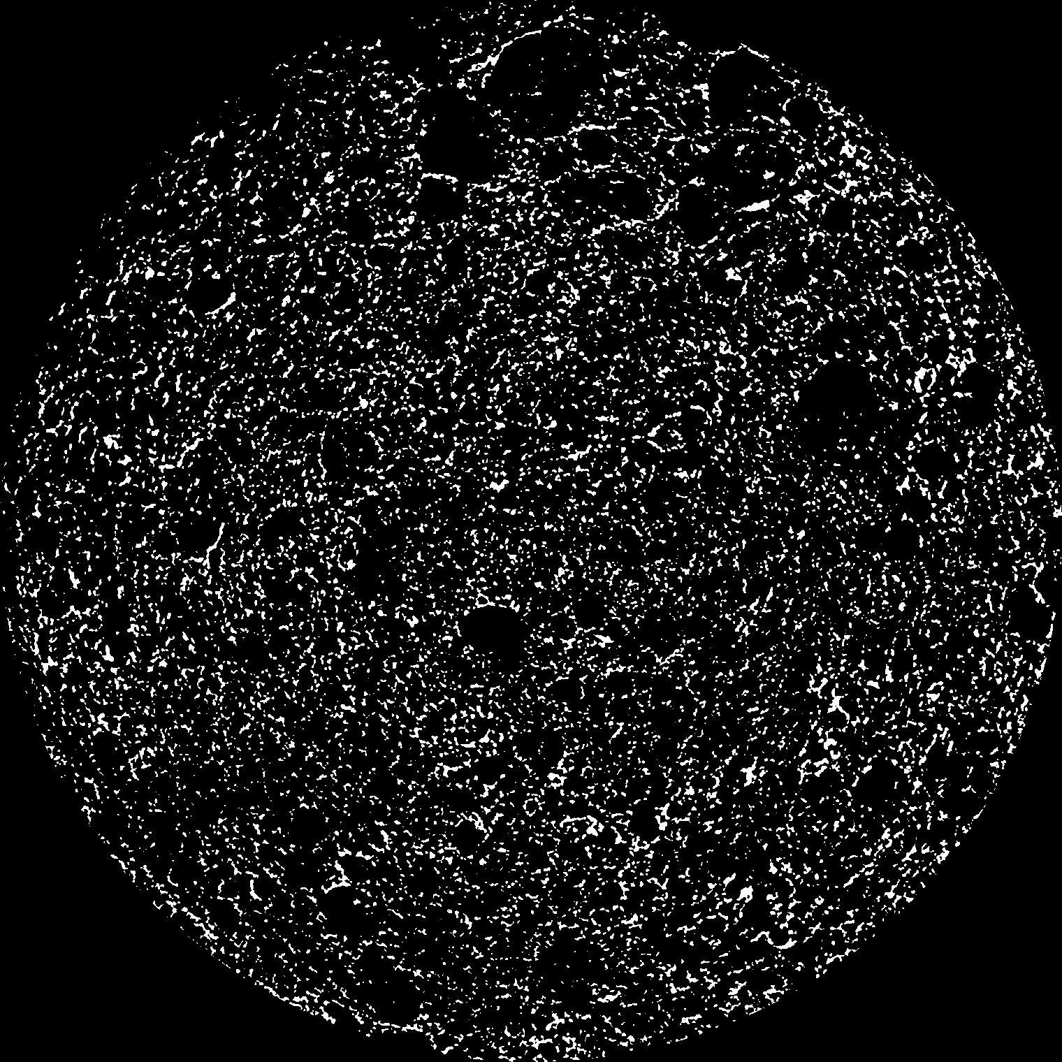
|
|---|
|
| XY Plane Grey |
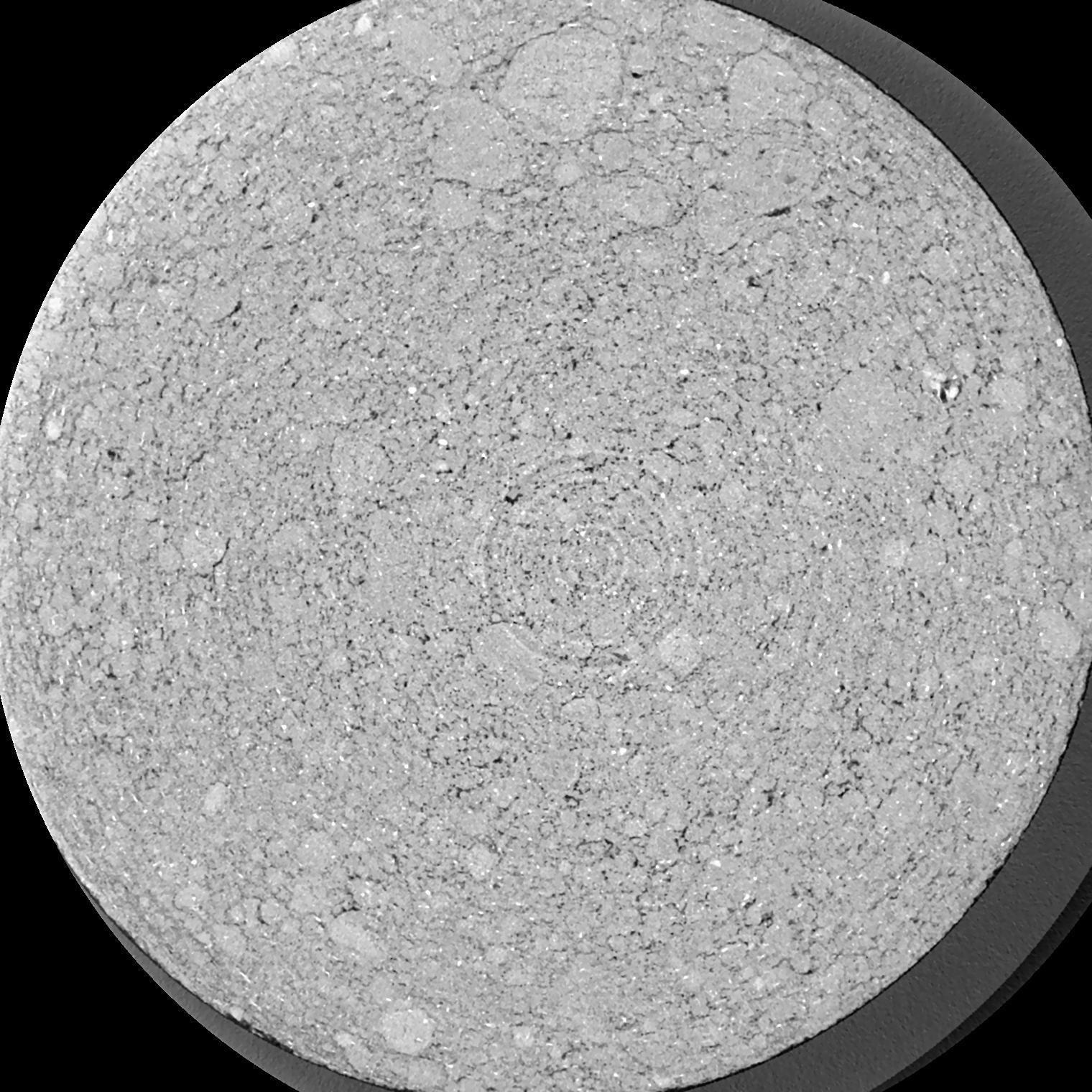
|
|---|
|
| Texture | silty clay loam |
|---|
| Sand | 3.5 |
|---|
| Silt | 65.1 |
|---|
| Clay | 31.4 |
|---|
|
|
Results
| Porosity | Surface | Mean Curvature | Euler | MeanPoreSize | Gamma | PoreDist |
| 0.113 | 5.065 | 10.2375 | 23.5375 | 0.0 | 0.3299 | 0.068611614 |
| Opening size | Volume | Surface | MeanCurvature | Euler number |
|---|
| 0.04 | 0.113 | 5.065 | 10.2375 | 23.5375 |
| 0.05 | 0.1039 | 4.3695 | 8.3125 | 24.4375 |
| 0.06 | 0.09403 | 3.758 | 6.6725 | 17.9375 |
| 0.07 | 0.08337 | 3.1965 | 5.485 | 17.3625 |
| 0.08 | 0.07811 | 2.967 | 5.3175 | 23.175 |
| 0.09000000000000001 | 0.04774 | 1.606 | 2.5325 | 10.485 |
| 0.1 | 0.03727 | 1.204 | 1.85875 | 8.23125 |
| 0.12000000000000001 | 0.02541 | 0.7715 | 1.176 | 5.28125 |
| 0.13999999999999999 | 0.01129 | 0.2962 | 0.393 | 1.5975 |
| 0.16 | 0.006445 | 0.1557 | 0.192275 | 0.7293125 |
| 0.18 | 0.002586 | 0.0543 | 0.057625 | 0.19425 |
| 0.19999999999999998 | 0.001622 | 0.03193 | 0.03205 | 0.0995925 |
| 0.22 | 0.0007003 | 0.012055 | 0.01032825 | 0.0285075 |
| 0.24 | 0.0004732 | 0.00764 | 0.006235 | 0.0151675 |
| 0.26 | 0.0002698 | 0.00408 | 0.003092 | 0.0073095 |
| 0.28 | 0.0002024 | 0.002948 | 0.002200175 | 0.004933875 |
| 0.30000000000000004 | 0.0001024 | 0.0013625 | 0.0009283 | 0.002010125 |
| 0.4 | 0.00001677 | 0.00018486 | 0.000105987 | 0.000182738 |
Reference: An open Soil Structure Library based on X-ray CT data
 Soil Structure Library