General Information
Internal Identifier ML_G093
| Soil Type | Regosol |
|---|
| Classification | WRB |
|---|
|
| Location | Garzweiler open-cast mine |
|---|
| Latitude | 51.063893 |
|---|
| Longitude | 6.502039 |
|---|
|
| Landuse | agricultural crop rotation |
|---|
| Tillage | no tillage |
|---|
| Crop | lucerne |
|---|
|
| Sampling Depth | 9.0 |
|---|
| Sample Height | 3.0 |
|---|
| Sampling Date | Nov. 15, 2016 |
|---|
| Voxel size | 0.02 |
|---|
| Pores white? | True |
|---|
|
| XY Plane |
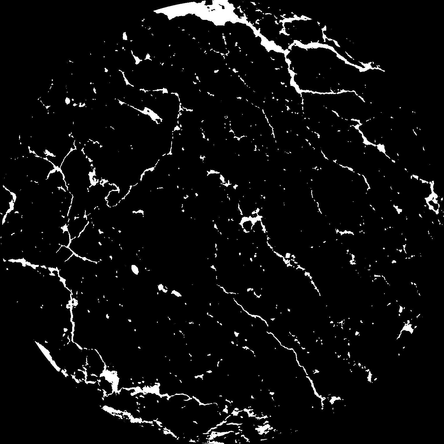
|
|---|
|
| XY Plane Grey |
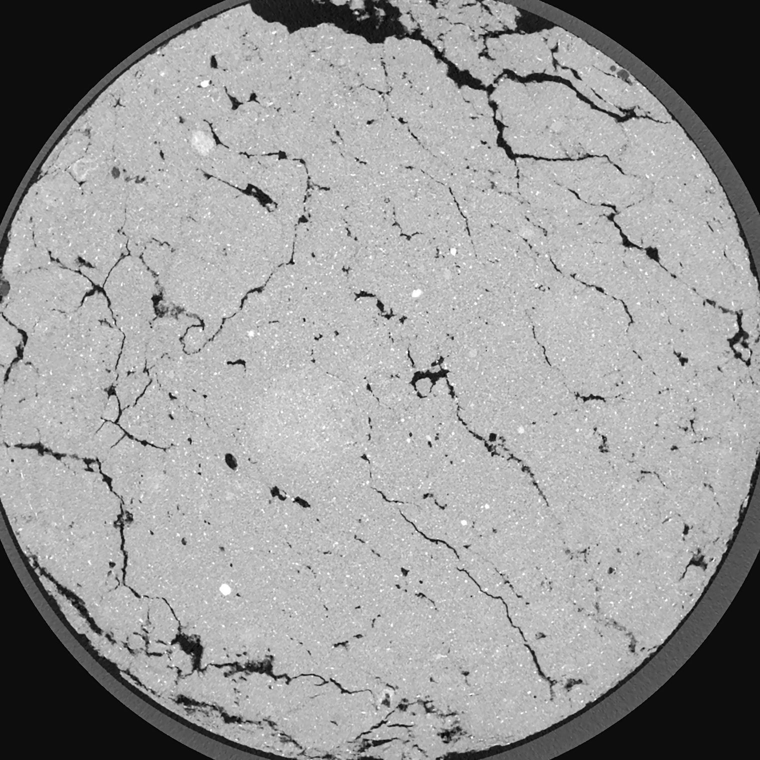
|
|---|
|
| Texture | silty clay loam |
|---|
| Sand | 3.5 |
|---|
| Silt | 65.1 |
|---|
| Clay | 31.4 |
|---|
|
|
Results
| Porosity | Surface | Mean Curvature | Euler | MeanPoreSize | Gamma | PoreDist |
| 0.05279 | 1.455 | 1.82775 | 4.085 | 0.0 | 0.4843 | 0.195900601 |
| Opening size | Volume | Surface | MeanCurvature | Euler number |
|---|
| 0.04 | 0.05279 | 1.455 | 1.82775 | 4.085 |
| 0.05 | 0.05125 | 1.34 | 1.56225 | 3.85375 |
| 0.06 | 0.04886 | 1.212 | 1.321 | 2.26125 |
| 0.07 | 0.04599 | 1.0795 | 1.12125 | 2.35625 |
| 0.08 | 0.04462 | 1.0245 | 1.103 | 3.46375 |
| 0.09000000000000001 | 0.03674 | 0.7245 | 0.64625 | 1.495 |
| 0.1 | 0.03358 | 0.6215 | 0.5245 | 1.2575 |
| 0.12000000000000001 | 0.02977 | 0.503 | 0.39575 | 0.95245 |
| 0.13999999999999999 | 0.02398 | 0.3494 | 0.2303 | 0.459 |
| 0.16 | 0.02104 | 0.28275 | 0.170375 | 0.300525 |
| 0.18 | 0.01742 | 0.2109 | 0.110425 | 0.1754375 |
| 0.19999999999999998 | 0.01583 | 0.18245 | 0.090225 | 0.11793 |
| 0.22 | 0.01334 | 0.144 | 0.065825 | 0.08798375 |
| 0.24 | 0.01203 | 0.1244 | 0.0546 | 0.0569775 |
| 0.26 | 0.01042 | 0.1037 | 0.0438 | 0.04823125 |
| 0.28 | 0.009616 | 0.093 | 0.03835 | 0.03180125 |
| 0.30000000000000004 | 0.008061 | 0.07525 | 0.0306 | 0.02835625 |
| 0.4 | 0.003824 | 0.031015 | 0.0114855 | 0.011130375 |
| 0.5 | 0.001433 | 0.01062 | 0.00376325 | 0.003975125 |
| 0.6 | 0.0004841 | 0.0034375 | 0.00121375 | 0.001325 |
| 0.7000000000000001 | 0.0001304 | 0.000957 | 0.000371025 | 0.000530025 |
Reference: An open Soil Structure Library based on X-ray CT data
 Soil Structure Library