General Information
Internal Identifier ML_G129
| Soil Type | Regosol |
|---|
| Classification | WRB |
|---|
|
| Location | Garzweiler open-cast mine |
|---|
| Latitude | 51.063893 |
|---|
| Longitude | 6.502039 |
|---|
|
| Landuse | agricultural crop rotation |
|---|
| Tillage | no tillage |
|---|
| Crop | lucerne |
|---|
|
| Sampling Depth | 9.0 |
|---|
| Sample Height | 3.0 |
|---|
| Sampling Date | Nov. 15, 2016 |
|---|
| Voxel size | 0.02 |
|---|
| Pores white? | True |
|---|
|
| XY Plane |
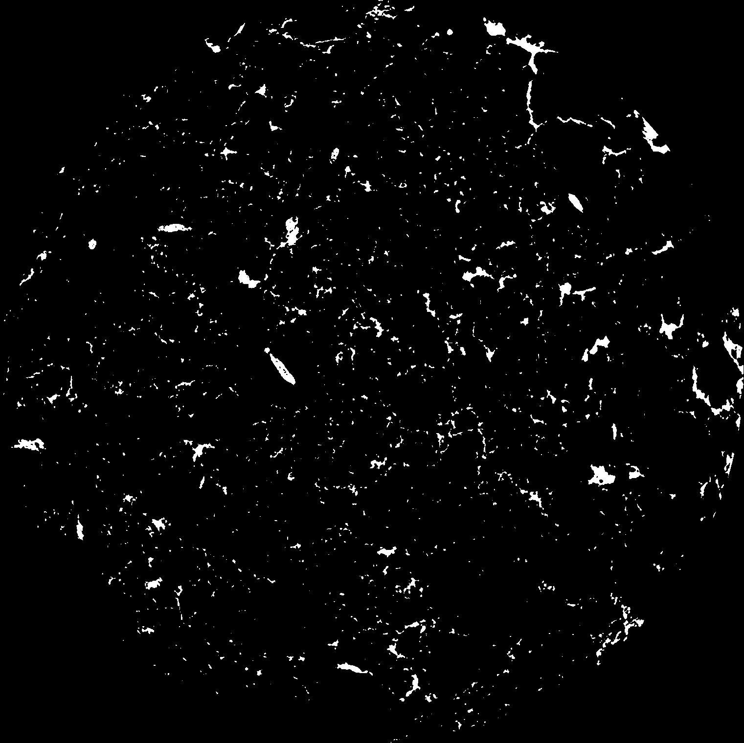
|
|---|
|
| XY Plane Grey |
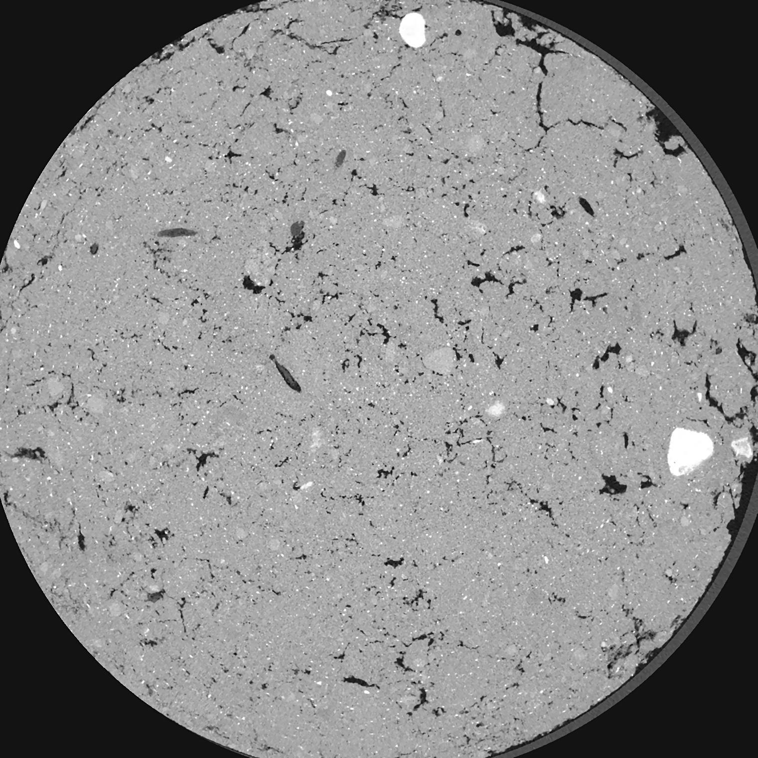
|
|---|
|
| Texture | silty clay loam |
|---|
| Sand | 3.5 |
|---|
| Silt | 65.1 |
|---|
| Clay | 31.4 |
|---|
|
|
Results
| Porosity | Surface | Mean Curvature | Euler | MeanPoreSize | Gamma | PoreDist |
| 0.02466 | 0.9375 | 1.97075 | 10.76 | 0.0 | 0.07497 | 0.195636453 |
| Opening size | Volume | Surface | MeanCurvature | Euler number |
|---|
| 0.04 | 0.02466 | 0.9375 | 1.97075 | 10.76 |
| 0.05 | 0.02229 | 0.7465 | 1.34775 | 7.61625 |
| 0.06 | 0.01993 | 0.5935 | 0.8805 | 3.3925 |
| 0.07 | 0.01819 | 0.501 | 0.66825 | 2.39125 |
| 0.08 | 0.01746 | 0.4687 | 0.63875 | 2.81375 |
| 0.09000000000000001 | 0.01379 | 0.3126 | 0.33225 | 1.0082375 |
| 0.1 | 0.01248 | 0.26645 | 0.2665 | 0.7880375 |
| 0.12000000000000001 | 0.01088 | 0.2139 | 0.2004 | 0.556275 |
| 0.13999999999999999 | 0.008467 | 0.1466 | 0.118775 | 0.2697 |
| 0.16 | 0.007231 | 0.11725 | 0.0896 | 0.185475 |
| 0.18 | 0.005647 | 0.08405 | 0.05915 | 0.11941875 |
| 0.19999999999999998 | 0.004907 | 0.06975 | 0.0476 | 0.08888125 |
| 0.22 | 0.003704 | 0.048735 | 0.031125 | 0.06461125 |
| 0.24 | 0.003097 | 0.03833 | 0.02346925 | 0.0416275 |
| 0.26 | 0.002352 | 0.02675 | 0.015211 | 0.02844875 |
| 0.28 | 0.002057 | 0.02214 | 0.01194825 | 0.01912625 |
| 0.30000000000000004 | 0.001601 | 0.01586 | 0.007821 | 0.0120545 |
| 0.4 | 0.0007189 | 0.00553 | 0.0020605 | 0.002089375 |
| 0.5 | 0.0003379 | 0.0021255 | 0.000681475 | 0.0006429 |
| 0.6 | 0.0002026 | 0.0010785 | 0.000292525 | 0.00032145 |
| 0.7000000000000001 | 0.0001393 | 0.00066 | 0.00016394 | 0.000160725 |
| 0.9 | 0.00007526 | 0.00028744 | 0.000051433 | 0.000026792 |
| 1.1 | 0.00005646 | 0.00022765 | 0.000045002 | 0.000026792 |
Reference: An open Soil Structure Library based on X-ray CT data
 Soil Structure Library