General Information
Internal Identifier ML_H131
| Soil Type | Regosol |
|---|
| Classification | WRB |
|---|
|
| Location | Garzweiler open-cast mine |
|---|
| Latitude | 51.063893 |
|---|
| Longitude | 6.502039 |
|---|
|
| Landuse | agricultural crop rotation |
|---|
| Tillage | no tillage |
|---|
| Crop | lucerne |
|---|
|
| Sampling Depth | 15.0 |
|---|
| Sample Height | 3.0 |
|---|
| Sampling Date | Nov. 15, 2016 |
|---|
| Voxel size | 0.02 |
|---|
| Pores white? | True |
|---|
|
| XY Plane |
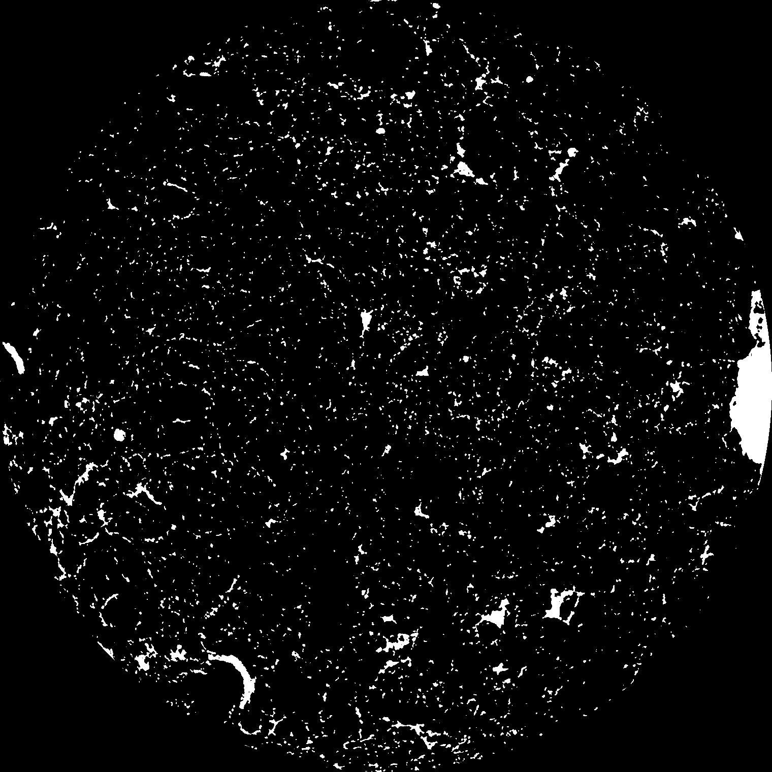
|
|---|
|
| XY Plane Grey |
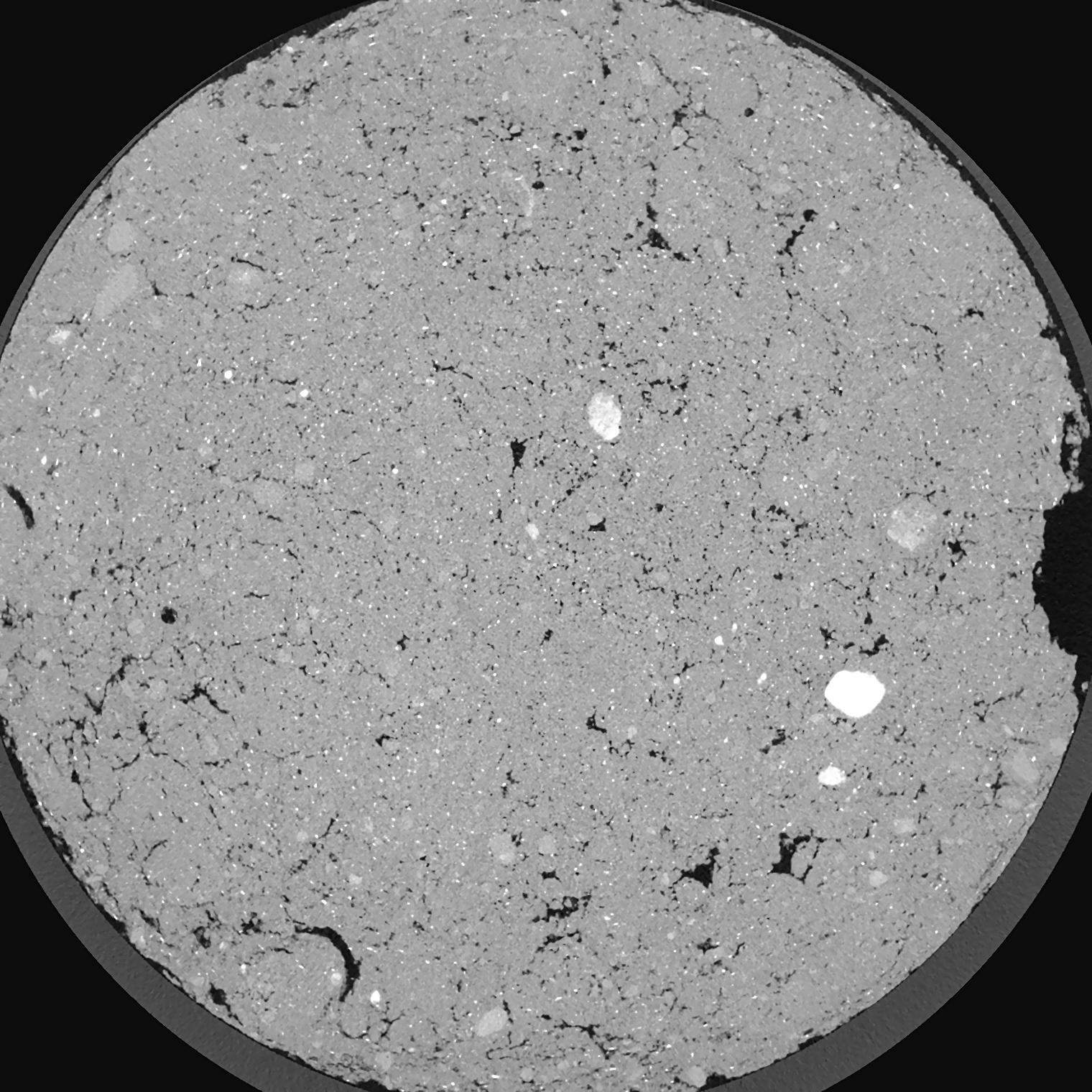
|
|---|
|
| Texture | silty clay loam |
|---|
| Sand | 3.5 |
|---|
| Silt | 65.1 |
|---|
| Clay | 31.4 |
|---|
|
|
Results
| Porosity | Surface | Mean Curvature | Euler | MeanPoreSize | Gamma | PoreDist |
| 0.04985 | 2.07 | 4.6625 | 27.825 | 0.0 | 0.05841 | 0.113511593 |
| Opening size | Volume | Surface | MeanCurvature | Euler number |
|---|
| 0.04 | 0.04985 | 2.07 | 4.6625 | 27.825 |
| 0.05 | 0.04546 | 1.73 | 3.55 | 20.975 |
| 0.06 | 0.04063 | 1.4035 | 2.451 | 10.5925 |
| 0.07 | 0.03607 | 1.148 | 1.79475 | 7.01625 |
| 0.08 | 0.03428 | 1.0685 | 1.7185 | 8.40625 |
| 0.09000000000000001 | 0.02437 | 0.6215 | 0.754 | 2.5075 |
| 0.1 | 0.02108 | 0.5015 | 0.57 | 1.88375 |
| 0.12000000000000001 | 0.01727 | 0.3712 | 0.39225 | 1.2371625 |
| 0.13999999999999999 | 0.01212 | 0.2197 | 0.192725 | 0.5056625 |
| 0.16 | 0.00982 | 0.16265 | 0.13135 | 0.3173875 |
| 0.18 | 0.007191 | 0.10485 | 0.0738 | 0.165875 |
| 0.19999999999999998 | 0.006199 | 0.0853 | 0.056875 | 0.11428625 |
| 0.22 | 0.00464 | 0.05795 | 0.034975 | 0.06883 |
| 0.24 | 0.003992 | 0.0469 | 0.0267 | 0.046585 |
| 0.26 | 0.003212 | 0.03518 | 0.01836325 | 0.02982125 |
| 0.28 | 0.002899 | 0.03064 | 0.01559075 | 0.02240625 |
| 0.30000000000000004 | 0.002326 | 0.023195 | 0.01115475 | 0.01595875 |
| 0.4 | 0.001059 | 0.008765 | 0.003614 | 0.004997 |
| 0.5 | 0.0004855 | 0.003361 | 0.0011477 | 0.0012895 |
| 0.6 | 0.0002239 | 0.001369 | 0.000435225 | 0.000483588 |
| 0.7000000000000001 | 0.0001295 | 0.000701 | 0.000193432 | 0.0001612 |
| 0.9 | 0.00004264 | 0.000228315 | 0.000064477 | 0.000053775 |
Reference: An open Soil Structure Library based on X-ray CT data
 Soil Structure Library