General Information
Internal Identifier ML_H353
| Soil Type | Regosol |
|---|
| Classification | WRB |
|---|
|
| Location | Garzweiler open-cast mine |
|---|
| Latitude | 51.063893 |
|---|
| Longitude | 6.502039 |
|---|
|
| Landuse | agricultural crop rotation |
|---|
| Tillage | conventional tillage |
|---|
| Crop | winter wheat, maize, winter barley, triticale, winter wheat |
|---|
|
| Sampling Depth | 15.0 |
|---|
| Sample Height | 3.0 |
|---|
| Sampling Date | March 15, 2017 |
|---|
| Voxel size | 0.02 |
|---|
| Pores white? | True |
|---|
|
| XY Plane |
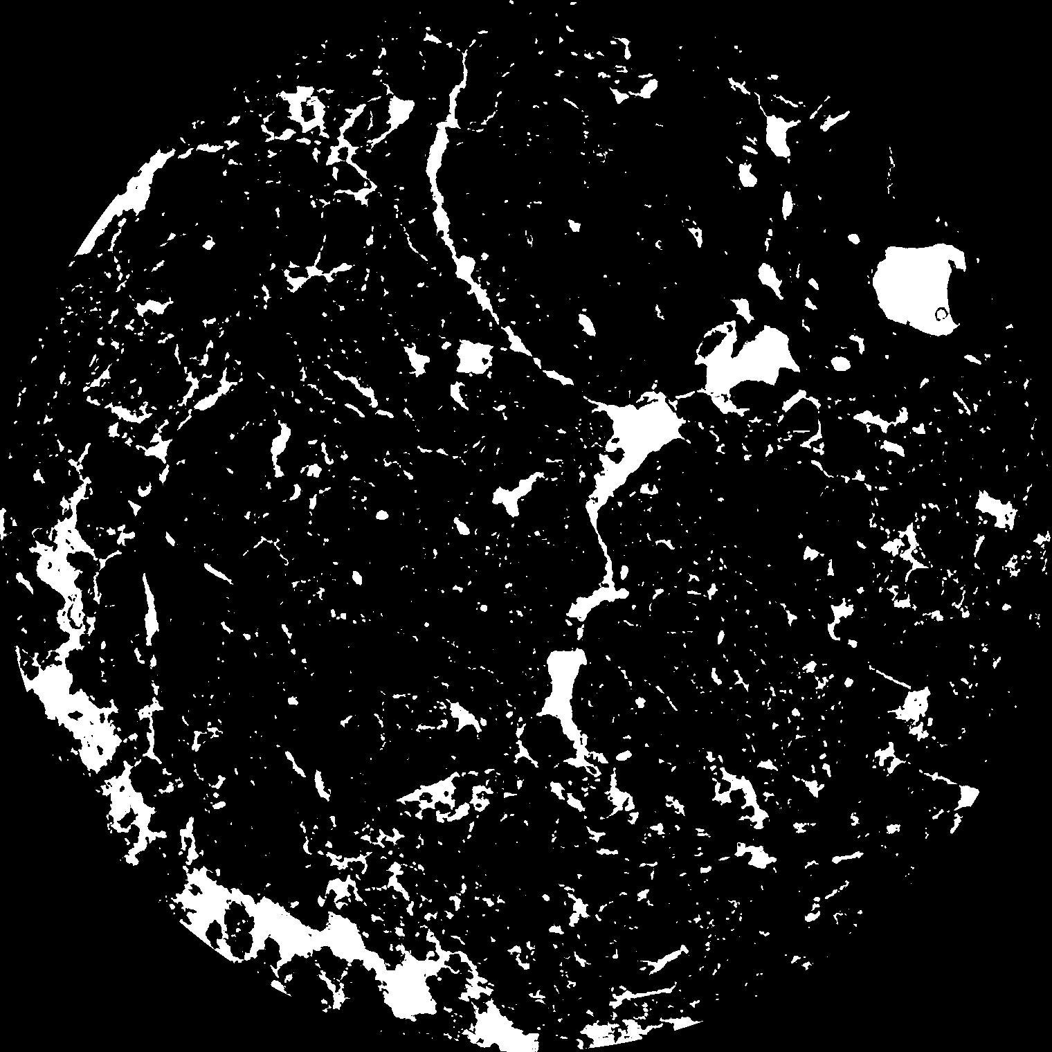
|
|---|
|
| XY Plane Grey |
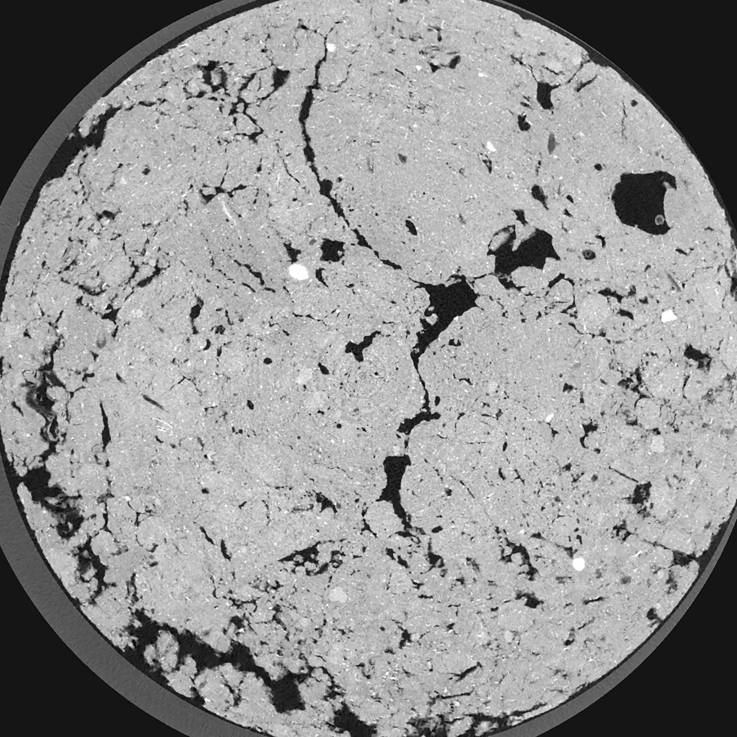
|
|---|
|
| Texture | silty clay loam |
|---|
| Sand | 3.5 |
|---|
| Silt | 65.1 |
|---|
| Clay | 31.4 |
|---|
|
|
Results
| Porosity | Surface | Mean Curvature | Euler | MeanPoreSize | Gamma | PoreDist |
| 0.1172 | 2.0055 | 2.18775 | 6.965 | 0.0 | 0.7527 | 0.157507949 |
| Opening size | Volume | Surface | MeanCurvature | Euler number |
|---|
| 0.04 | 0.1172 | 2.0055 | 2.18775 | 6.965 |
| 0.05 | 0.1152 | 1.845 | 1.76675 | 5.39875 |
| 0.06 | 0.1131 | 1.7195 | 1.431 | 2.73875 |
| 0.07 | 0.1111 | 1.618 | 1.23475 | 2.16875 |
| 0.08 | 0.11 | 1.574 | 1.206 | 2.88375 |
| 0.09000000000000001 | 0.1034 | 1.3265 | 0.8305 | 1.33 |
| 0.1 | 0.1004 | 1.2315 | 0.72675 | 1.1950625 |
| 0.12000000000000001 | 0.09599 | 1.0985 | 0.60025 | 0.9341625 |
| 0.13999999999999999 | 0.088 | 0.902 | 0.4245 | 0.5576625 |
| 0.16 | 0.08297 | 0.795 | 0.34525 | 0.39525 |
| 0.18 | 0.07565 | 0.6625 | 0.2575 | 0.319275 |
| 0.19999999999999998 | 0.07192 | 0.6 | 0.2215 | 0.2245375 |
| 0.22 | 0.0654 | 0.506 | 0.172925 | 0.225025 |
| 0.24 | 0.06191 | 0.45625 | 0.148 | 0.143975 |
| 0.26 | 0.0571 | 0.39735 | 0.1213 | 0.1245775 |
| 0.28 | 0.05486 | 0.36905 | 0.10925 | 0.08560625 |
| 0.30000000000000004 | 0.0505 | 0.3221 | 0.08995 | 0.076475 |
| 0.4 | 0.03774 | 0.2025 | 0.048175 | 0.03946 |
| 0.5 | 0.02859 | 0.13485 | 0.028725 | 0.02233875 |
| 0.6 | 0.02241 | 0.096 | 0.01840275 | 0.010925 |
| 0.7000000000000001 | 0.01729 | 0.06955 | 0.01297625 | 0.00913125 |
| 0.9 | 0.009635 | 0.03422 | 0.0059875 | 0.00342425 |
| 1.1 | 0.005202 | 0.016355 | 0.002596 | 0.0013045 |
| 1.3 | 0.00292 | 0.008145 | 0.00107945 | 0.000489175 |
| 1.5 | 0.001369 | 0.004002 | 0.000573975 | 0.000163062 |
| 1.7 | 0.0003798 | 0.001216 | 0.000205455 | 0.000108809 |
Reference: An open Soil Structure Library based on X-ray CT data
 Soil Structure Library