General Information
Internal Identifier ML_G394
| Soil Type | Regosol |
|---|
| Classification | WRB |
|---|
|
| Location | Garzweiler open-cast mine |
|---|
| Latitude | 51.063893 |
|---|
| Longitude | 6.502039 |
|---|
|
| Landuse | agricultural crop rotation |
|---|
| Tillage | conventional tillage |
|---|
| Crop | winter wheat, maize, winter barley, triticale, winter wheat |
|---|
|
| Sampling Depth | 49.0 |
|---|
| Sample Height | 3.0 |
|---|
| Sampling Date | March 15, 2017 |
|---|
| Voxel size | 0.02 |
|---|
| Pores white? | True |
|---|
|
| XY Plane |
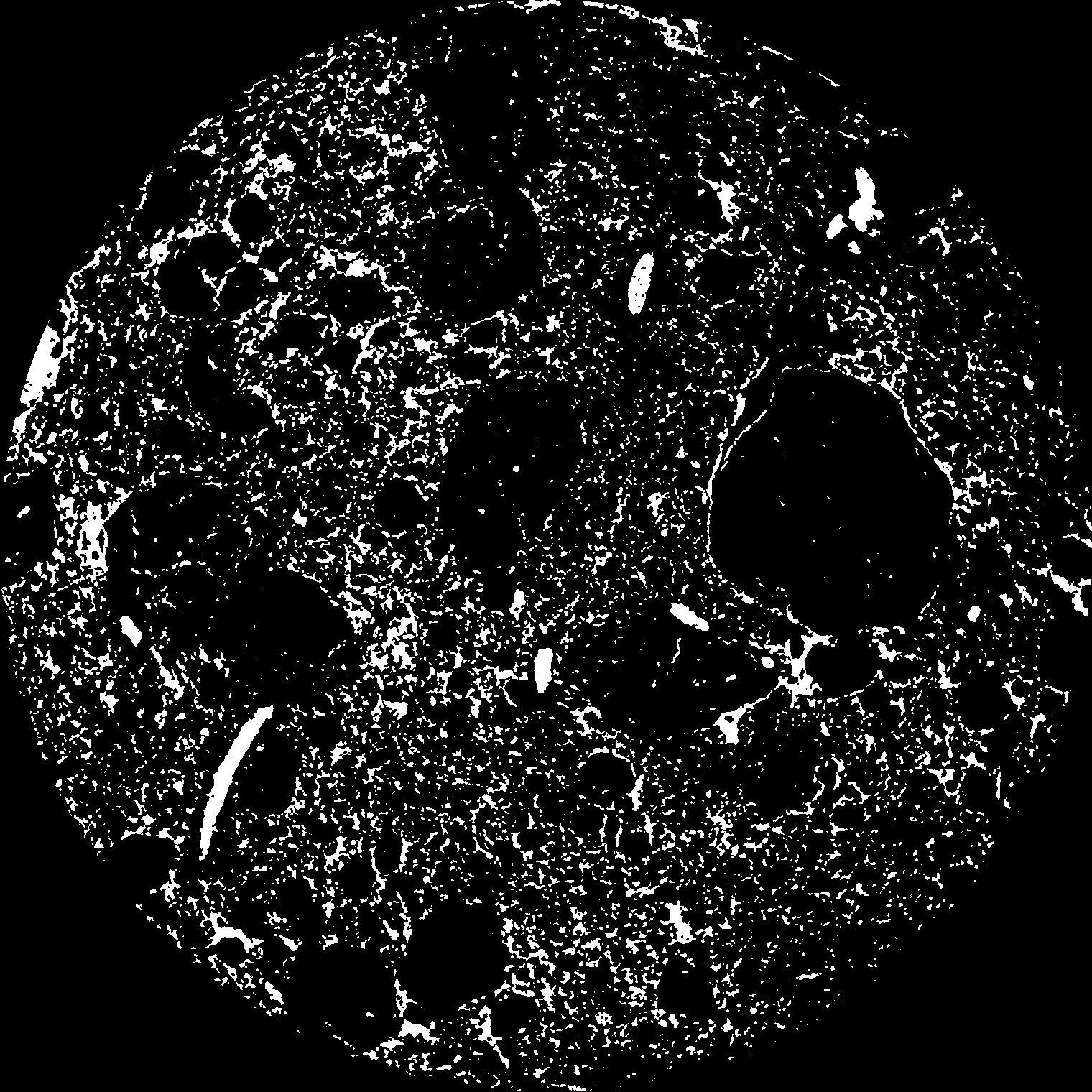
|
|---|
|
| XY Plane Grey |
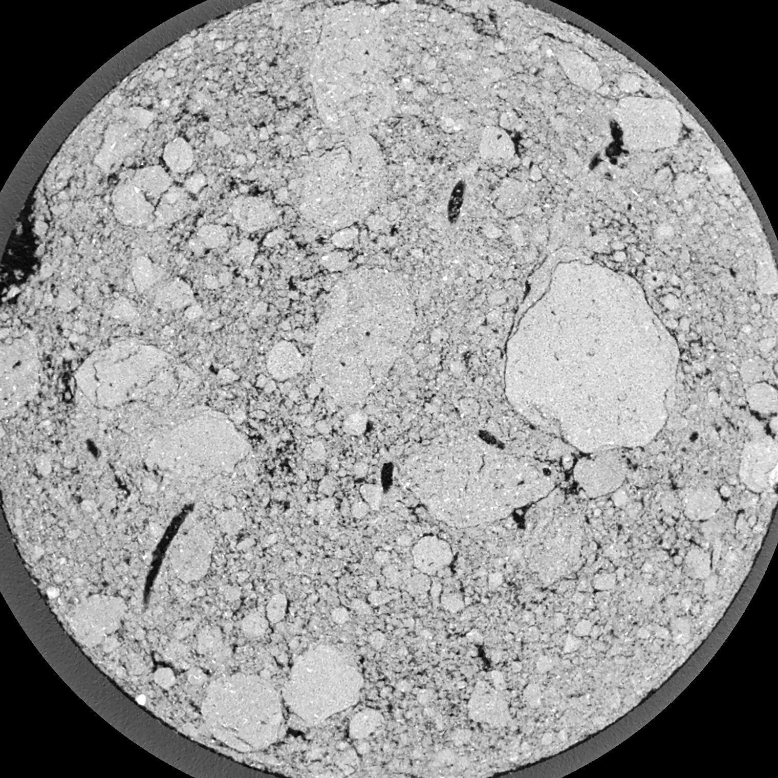
|
|---|
|
| Texture | silty clay loam |
|---|
| Sand | 3.5 |
|---|
| Silt | 65.1 |
|---|
| Clay | 31.4 |
|---|
|
|
Results
| Porosity | Surface | Mean Curvature | Euler | MeanPoreSize | Gamma | PoreDist |
| 0.1132 | 4.201 | 7.1425 | 9.06375 | 0.0 | 0.6527 | 0.093342628 |
| Opening size | Volume | Surface | MeanCurvature | Euler number |
|---|
| 0.04 | 0.1132 | 4.201 | 7.1425 | 9.06375 |
| 0.05 | 0.1066 | 3.694 | 5.815 | 11.10125 |
| 0.06 | 0.09955 | 3.257 | 4.6475 | 5.7675 |
| 0.07 | 0.09217 | 2.8775 | 3.895 | 6.06125 |
| 0.08 | 0.08846 | 2.717 | 3.795 | 10.3175 |
| 0.09000000000000001 | 0.0669 | 1.823 | 2.233 | 5.525 |
| 0.1 | 0.05791 | 1.5055 | 1.79875 | 5.0725 |
| 0.12000000000000001 | 0.04648 | 1.1215 | 1.315 | 4.125 |
| 0.13999999999999999 | 0.02973 | 0.6175 | 0.6415 | 1.945 |
| 0.16 | 0.02222 | 0.41985 | 0.40525 | 1.176475 |
| 0.18 | 0.01457 | 0.23605 | 0.193525 | 0.5080875 |
| 0.19999999999999998 | 0.01197 | 0.18055 | 0.138325 | 0.3297 |
| 0.22 | 0.008488 | 0.11255 | 0.0732 | 0.1505 |
| 0.24 | 0.007163 | 0.08845 | 0.0528 | 0.08870375 |
| 0.26 | 0.00574 | 0.0656 | 0.035025 | 0.05201625 |
| 0.28 | 0.00518 | 0.05705 | 0.029275 | 0.03522125 |
| 0.30000000000000004 | 0.004234 | 0.04414 | 0.02102475 | 0.0233175 |
| 0.4 | 0.001714 | 0.015235 | 0.00657125 | 0.008805125 |
| 0.5 | 0.0006292 | 0.00445 | 0.0014708 | 0.0013045 |
| 0.6 | 0.0003228 | 0.0019845 | 0.0005381 | 0.000326112 |
| 0.7000000000000001 | 0.0001534 | 0.0009865 | 0.0003033 | 0.000489175 |
Reference: An open Soil Structure Library based on X-ray CT data
 Soil Structure Library