General Information
Internal Identifier ML_H491
| Soil Type | Regosol |
|---|
| Classification | WRB |
|---|
|
| Location | Garzweiler open-cast mine |
|---|
| Latitude | 51.063893 |
|---|
| Longitude | 6.502039 |
|---|
|
| Landuse | agricultural crop rotation |
|---|
| Tillage | conventional tillage |
|---|
| Crop | winter wheat, maize, winter barley, triticale, winter wheat |
|---|
|
| Sampling Depth | 55.0 |
|---|
| Sample Height | 3.0 |
|---|
| Sampling Date | Nov. 21, 2016 |
|---|
| Voxel size | 0.02 |
|---|
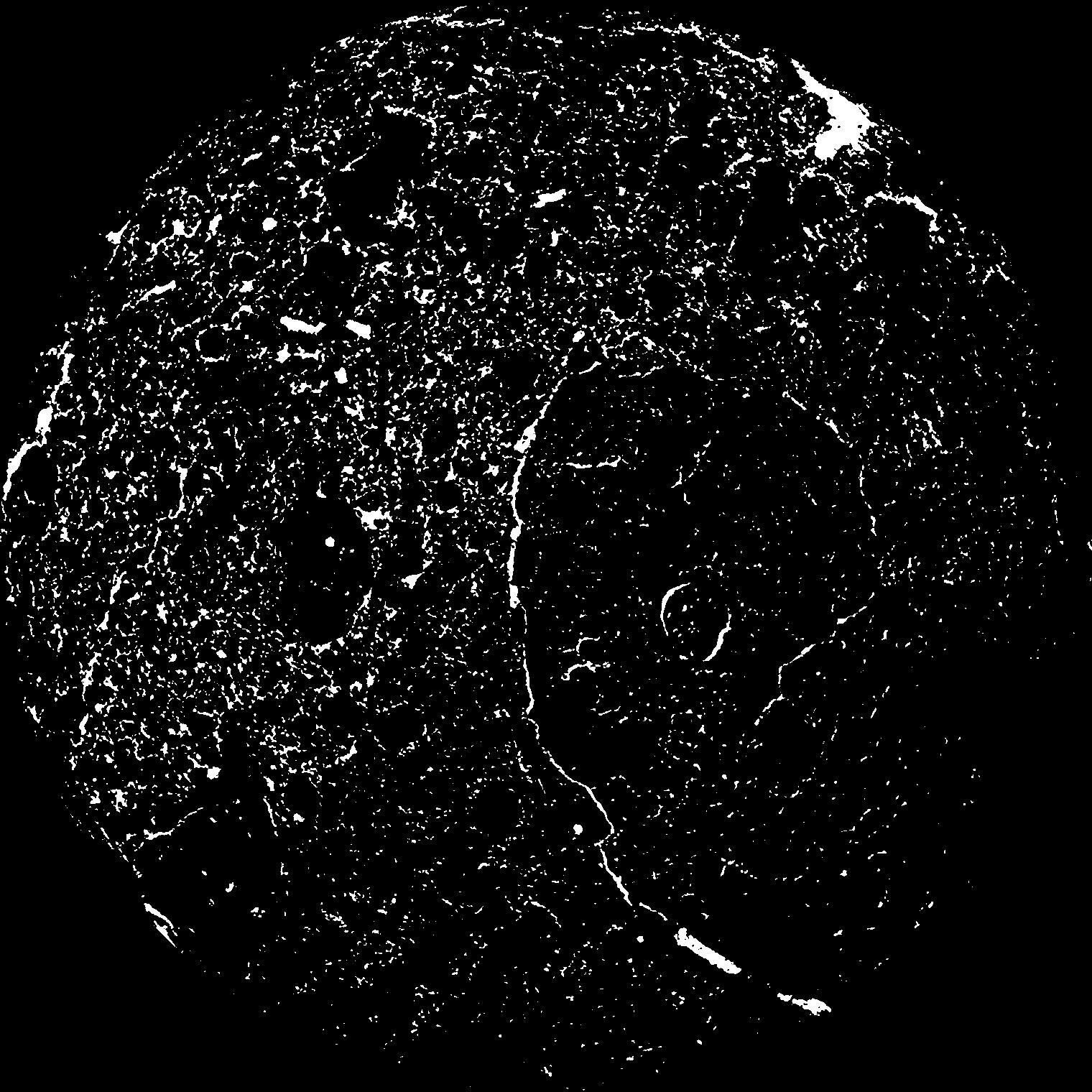
| Pores white? | True |
|---|
|
| XY Plane |
|
|---|
|
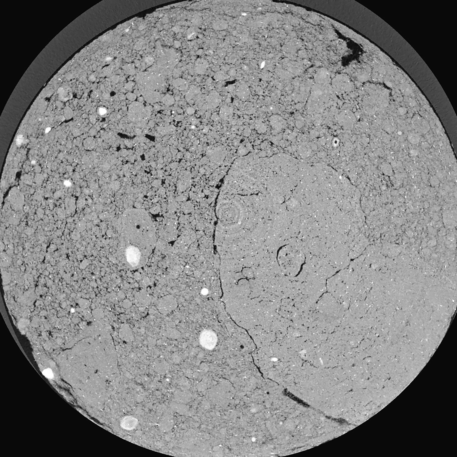
| XY Plane Grey |
|
|---|
|
| Texture | silty clay loam |
|---|
| Sand | 3.5 |
|---|
| Silt | 65.1 |
|---|
| Clay | 31.4 |
|---|
|
|
Results
| Porosity | Surface | Mean Curvature | Euler | MeanPoreSize | Gamma | PoreDist |
| 0.06333 | 2.795 | 6.2 | 25.9875 | 0.0 | 0.2807 | 0.113374322 |
| Opening size | Volume | Surface | MeanCurvature | Euler number |
|---|
| 0.04 | 0.06088 | 2.7635 | 6.1875 | 26.275 |
| 0.05 | 0.05407 | 2.2205 | 4.44 | 20.325 |
| 0.06 | 0.04666 | 1.7385 | 2.9825 | 9.515 |
| 0.07 | 0.04049 | 1.406 | 2.229 | 7.255 |
| 0.08 | 0.0378 | 1.288 | 2.13025 | 9.58 |
| 0.09000000000000001 | 0.02449 | 0.699 | 0.932 | 3.22 |
| 0.1 | 0.02016 | 0.5395 | 0.6875 | 2.45 |
| 0.12000000000000001 | 0.01547 | 0.3772 | 0.458 | 1.67875 |
| 0.13999999999999999 | 0.009373 | 0.1891 | 0.1893 | 0.5934625 |
| 0.16 | 0.007023 | 0.1275 | 0.1147 | 0.32705 |
| 0.18 | 0.004726 | 0.074 | 0.0554 | 0.137625 |
| 0.19999999999999998 | 0.003935 | 0.05785 | 0.040225 | 0.08757625 |
| 0.22 | 0.002828 | 0.03798 | 0.023299 | 0.0457125 |
| 0.24 | 0.002351 | 0.029965 | 0.0175375 | 0.02887125 |
| 0.26 | 0.001795 | 0.021755 | 0.01200725 | 0.01892625 |
| 0.28 | 0.001579 | 0.01858 | 0.0100535 | 0.01379375 |
| 0.30000000000000004 | 0.001186 | 0.013525 | 0.0071215 | 0.009463375 |
| 0.4 | 0.0003064 | 0.0033 | 0.00180925 | 0.0030475 |
| 0.5 | 0.00004318 | 0.000414845 | 0.000208512 | 0.000320787 |
Reference: An open Soil Structure Library based on X-ray CT data
 Soil Structure Library