General Information
Internal Identifier ML_I091
| Soil Type | Regosol |
|---|
| Classification | WRB |
|---|
|
| Location | Garzweiler open-cast mine |
|---|
| Latitude | 51.063893 |
|---|
| Longitude | 6.502039 |
|---|
|
| Landuse | agricultural crop rotation |
|---|
| Tillage | no tillage |
|---|
| Crop | lucerne |
|---|
|
| Sampling Depth | 3.0 |
|---|
| Sample Height | 0.7 |
|---|
| Sampling Date | Nov. 15, 2016 |
|---|
| Voxel size | 0.005 |
|---|
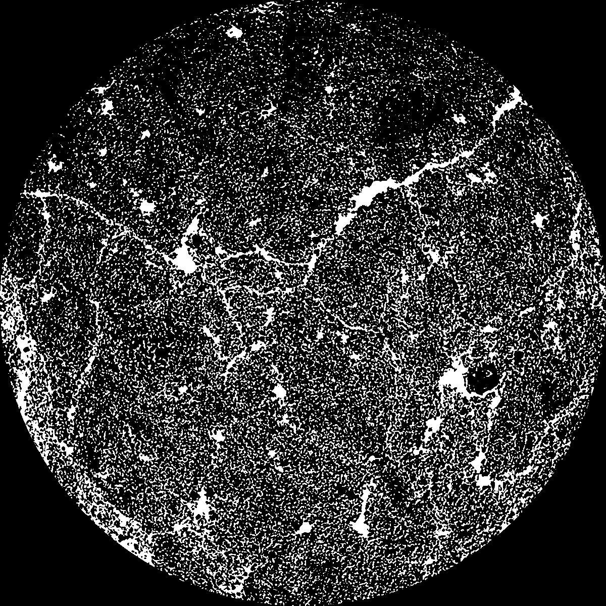
| Pores white? | True |
|---|
|
| XY Plane |
|
|---|
|
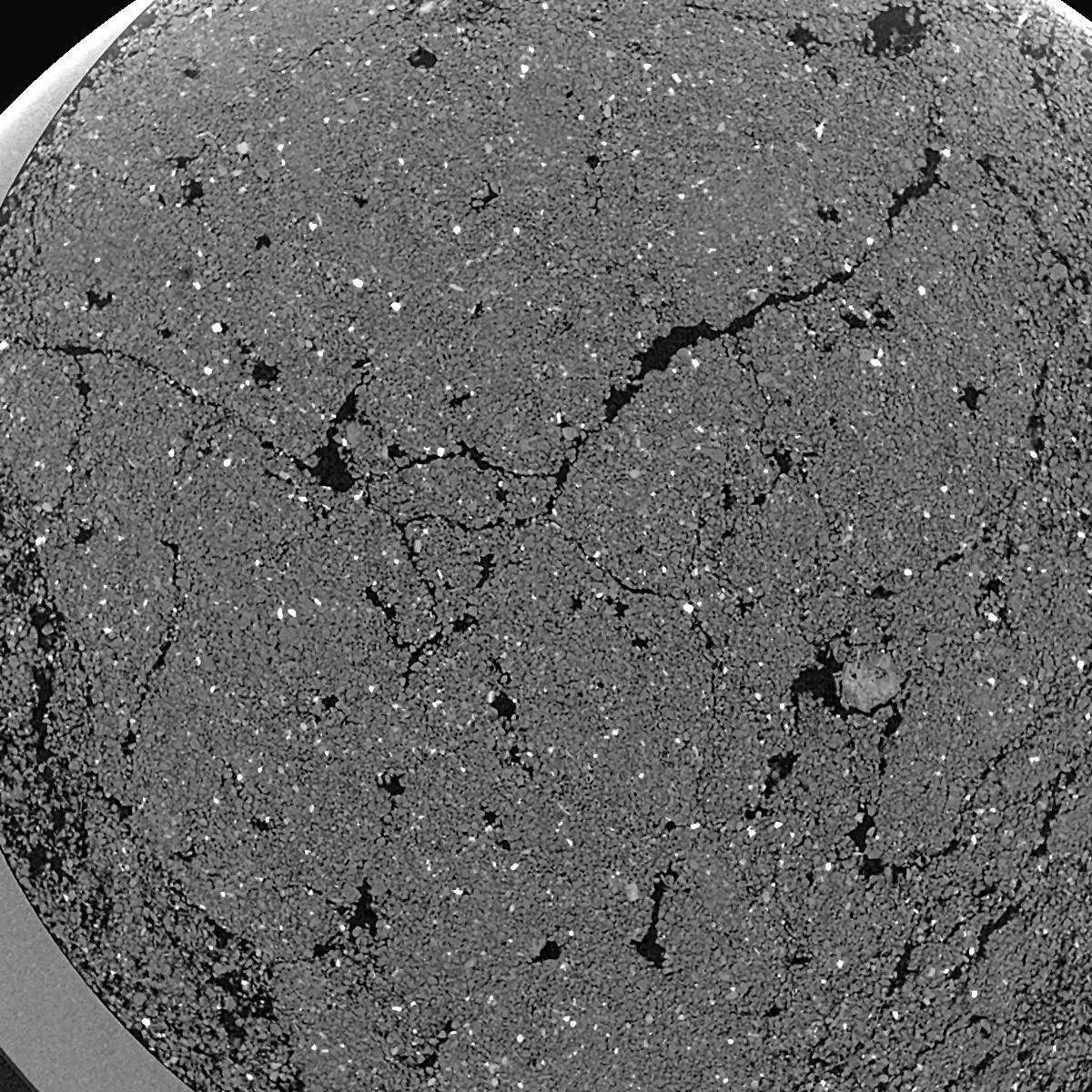
| XY Plane Grey |
|
|---|
|
| Texture | silty clay loam |
|---|
| Sand | 3.5 |
|---|
| Silt | 65.1 |
|---|
| Clay | 31.4 |
|---|
|
|
Results
| Porosity | Surface | Mean Curvature | Euler | MeanPoreSize | Gamma | PoreDist |
| 0.2632 | 53.3 | 364.72 | -12680.0 | 0.0 | 0.9 | 0.007513728 |
| Opening size | Volume | Surface | MeanCurvature | Euler number |
|---|
| 0.01 | 0.2632 | 53.3 | 364.72 | -12680.0 |
| 0.0125 | 0.2307 | 43.1 | 302.08 | -5062.4 |
| 0.015 | 0.1663 | 28.66 | 211.08 | 234.4 |
| 0.0175 | 0.1181 | 18.434 | 133.88 | 1584.0 |
| 0.02 | 0.1013 | 15.43 | 125.44 | 2967.2 |
| 0.022500000000000003 | 0.04829 | 4.888 | 24.436 | 353.36 |
| 0.025 | 0.03915 | 3.496 | 15.132 | 201.2 |
| 0.030000000000000002 | 0.03263 | 2.592 | 9.988 | 130.24 |
| 0.034999999999999996 | 0.02369 | 1.5416 | 4.508 | 40.4128 |
| 0.04 | 0.02007 | 1.2096 | 3.2912 | 26.1048 |
| 0.045 | 0.01571 | 0.8578 | 2.138 | 16.584 |
| 0.049999999999999996 | 0.01385 | 0.7224 | 1.742 | 12.7016 |
| 0.055 | 0.01067 | 0.5118 | 1.1552 | 8.3632 |
| 0.06 | 0.009243 | 0.4212 | 0.9144 | 6.14776 |
| 0.065 | 0.007409 | 0.3162 | 0.6456 | 4.11544 |
| 0.07 | 0.006664 | 0.2744 | 0.5488 | 3.34312 |
| 0.07500000000000001 | 0.005377 | 0.2088 | 0.39432 | 2.33712 |
| 0.1 | 0.002513 | 0.08104 | 0.131744 | 0.650336 |
| 0.125 | 0.001249 | 0.03452 | 0.047404 | 0.203232 |
| 0.15 | 0.0007025 | 0.01836 | 0.0241336 | 0.091456 |
| 0.17500000000000002 | 0.0002967 | 0.007134 | 0.008942 | 0.0304848 |
| 0.225 | 0.00005636 | 0.00122218 | 0.0013718 | 0.00487448 |
Reference: An open Soil Structure Library based on X-ray CT data
 Soil Structure Library