General Information
Internal Identifier ML_J364
| Soil Type | Regosol |
|---|
| Classification | WRB |
|---|
|
| Location | Garzweiler open-cast mine |
|---|
| Latitude | 51.063893 |
|---|
| Longitude | 6.502039 |
|---|
|
| Landuse | agricultural crop rotation |
|---|
| Tillage | conventional tillage |
|---|
| Crop | winter wheat, maize, winter barley, triticale, winter wheat |
|---|
|
| Sampling Depth | 27.0 |
|---|
| Sample Height | 0.7 |
|---|
| Sampling Date | March 15, 2017 |
|---|
| Voxel size | 0.005 |
|---|
| Pores white? | True |
|---|
|
| XY Plane |
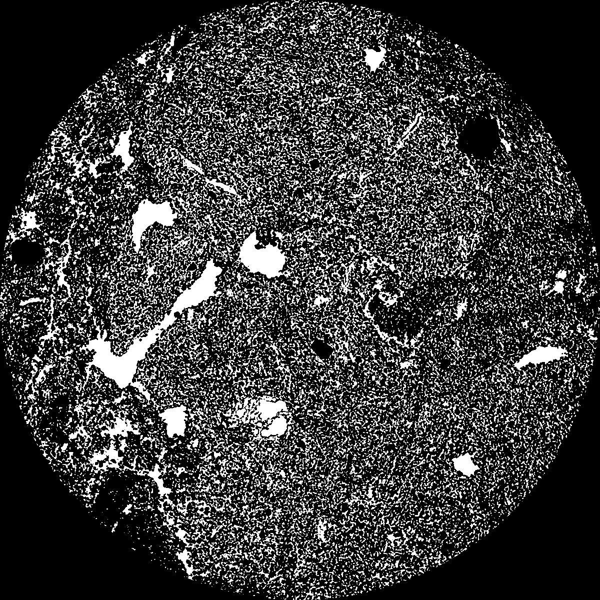
|
|---|
|
| XY Plane Grey |
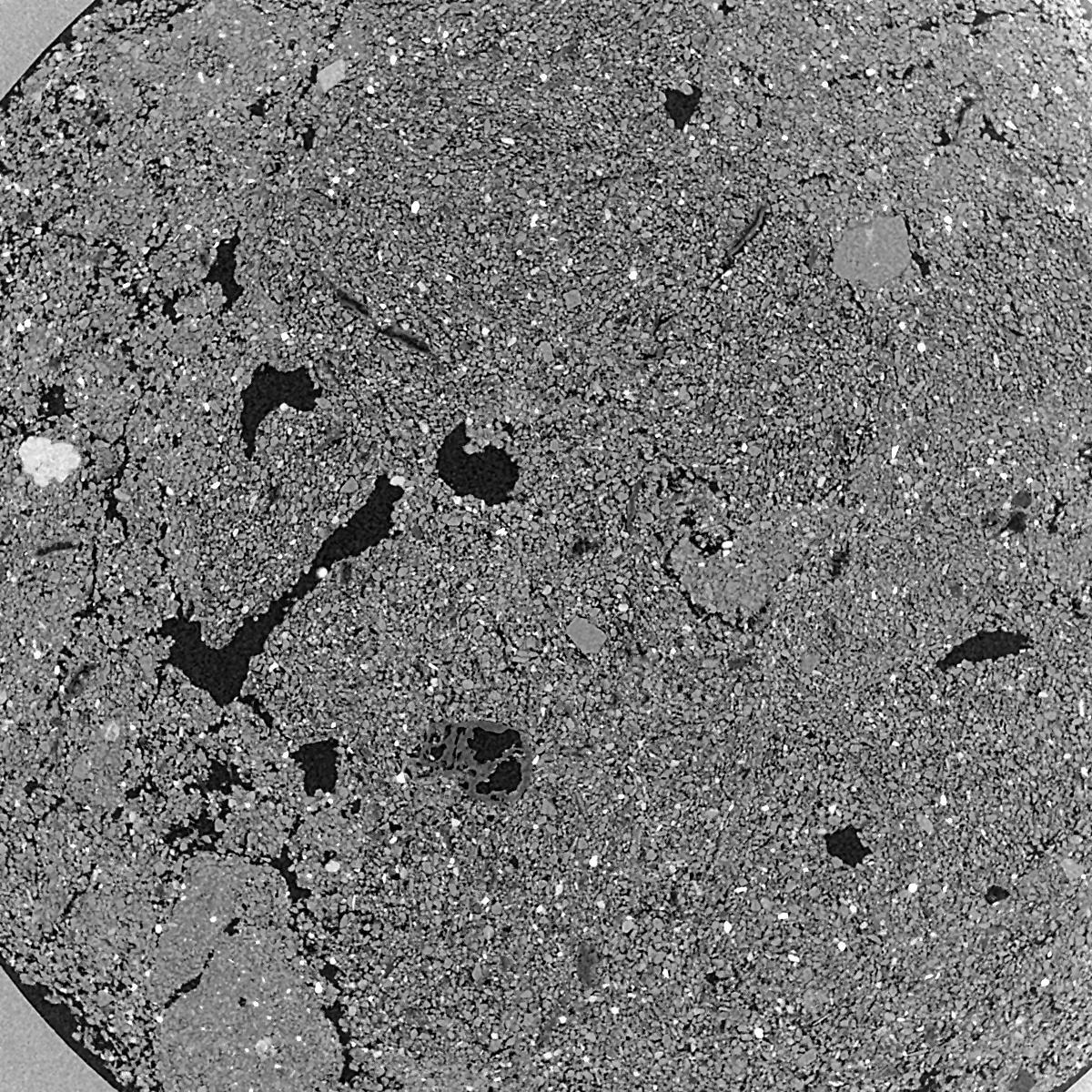
|
|---|
|
| Texture | silty clay loam |
|---|
| Sand | 3.5 |
|---|
| Silt | 65.1 |
|---|
| Clay | 31.4 |
|---|
|
|
Results
| Porosity | Surface | Mean Curvature | Euler | MeanPoreSize | Gamma | PoreDist |
| 0.2761 | 52.2 | 411.2 | -5102.4 | 0.0 | 0.8749 | 0.007618332 |
| Opening size | Volume | Surface | MeanCurvature | Euler number |
|---|
| 0.01 | 0.2761 | 52.2 | 411.2 | -5102.4 |
| 0.0125 | 0.2317 | 37.46 | 287.84 | -880.0 |
| 0.015 | 0.1667 | 21.8 | 155.84 | 1548.0 |
| 0.0175 | 0.1327 | 14.362 | 91.64 | 1446.4 |
| 0.02 | 0.122 | 12.42 | 84.32 | 2046.4 |
| 0.022500000000000003 | 0.08573 | 5.512 | 20.564 | 265.04 |
| 0.025 | 0.07754 | 4.346 | 13.652 | 155.76 |
| 0.030000000000000002 | 0.07105 | 3.498 | 9.592 | 111.36 |
| 0.034999999999999996 | 0.06049 | 2.352 | 4.504 | 35.8192 |
| 0.04 | 0.05575 | 1.9444 | 3.242 | 20.5672 |
| 0.045 | 0.0501 | 1.5258 | 2.1292 | 12.6104 |
| 0.049999999999999996 | 0.04763 | 1.3634 | 1.7844 | 9.3992 |
| 0.055 | 0.04326 | 1.1096 | 1.29 | 7.64152 |
| 0.06 | 0.04123 | 0.991 | 1.0484 | 5.6092 |
| 0.065 | 0.03857 | 0.8612 | 0.8236 | 4.57272 |
| 0.07 | 0.0374 | 0.8032 | 0.7268 | 3.56672 |
| 0.07500000000000001 | 0.03514 | 0.7072 | 0.5756 | 2.78424 |
| 0.1 | 0.02889 | 0.4892 | 0.315464 | 1.19904 |
| 0.125 | 0.0241 | 0.3638 | 0.203636 | 0.599528 |
| 0.15 | 0.02031 | 0.2874 | 0.155116 | 0.223552 |
| 0.17500000000000002 | 0.01658 | 0.2196 | 0.116756 | 0.193072 |
| 0.225 | 0.01064 | 0.12534 | 0.063204 | 0.081296 |
| 0.275 | 0.006921 | 0.07878 | 0.041508 | 0.050808 |
| 0.325 | 0.004246 | 0.04642 | 0.0249468 | 0.0406464 |
| 0.375 | 0.002303 | 0.0244 | 0.0128544 | 0.0203232 |
| 0.425 | 0.0006879 | 0.006668 | 0.00330252 | 0.00487448 |
| 0.475 | 0.0005059 | 0.005298 | 0.00289604 | 0.00487448 |
Reference: An open Soil Structure Library based on X-ray CT data
 Soil Structure Library