General Information
Internal Identifier ML_J412
| Soil Type | Regosol |
|---|
| Classification | WRB |
|---|
|
| Location | Garzweiler open-cast mine |
|---|
| Latitude | 51.063893 |
|---|
| Longitude | 6.502039 |
|---|
|
| Landuse | agricultural crop rotation |
|---|
| Tillage | conventional tillage |
|---|
| Crop | winter wheat, maize, winter barley, triticale, winter wheat |
|---|
|
| Sampling Depth | 43.0 |
|---|
| Sample Height | 0.7 |
|---|
| Sampling Date | March 15, 2017 |
|---|
| Voxel size | 0.005 |
|---|
| Pores white? | True |
|---|
|
| XY Plane |
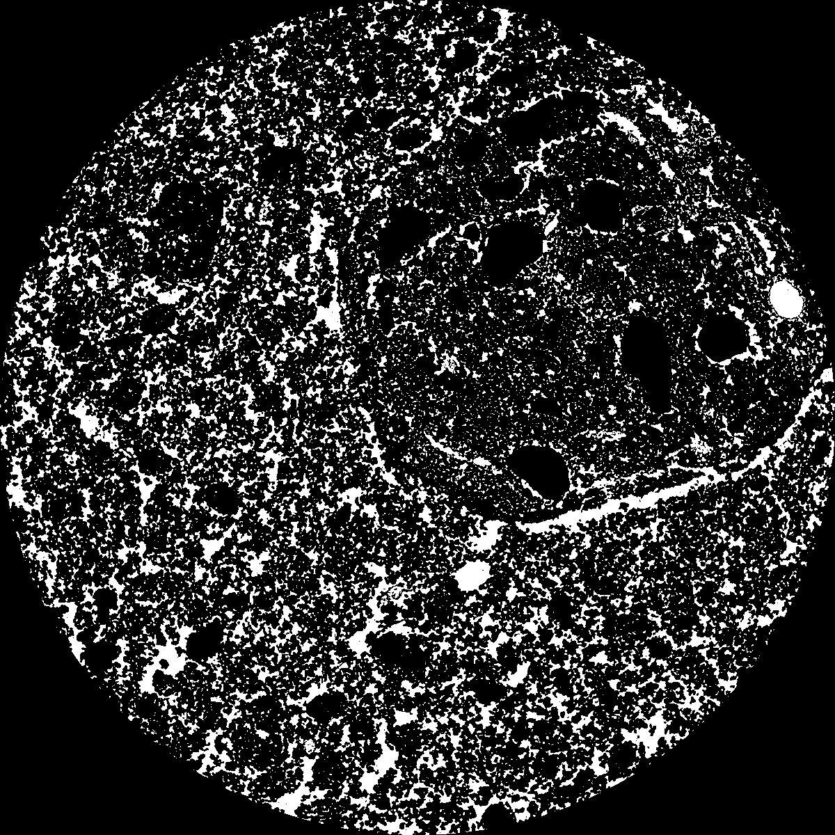
|
|---|
|
| XY Plane Grey |
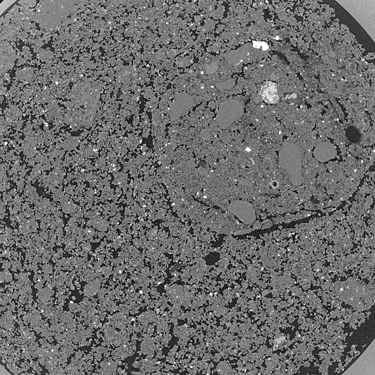
|
|---|
|
| Texture | silty clay loam |
|---|
| Sand | 3.5 |
|---|
| Silt | 65.1 |
|---|
| Clay | 31.4 |
|---|
|
|
Results
| Porosity | Surface | Mean Curvature | Euler | MeanPoreSize | Gamma | PoreDist |
| 0.2405 | 36.74 | 279.72 | 9912.0 | 0.0 | 0.8548 | 0.009995201 |
| Opening size | Volume | Surface | MeanCurvature | Euler number |
|---|
| 0.01 | 0.2405 | 36.74 | 279.72 | 9912.0 |
| 0.0125 | 0.2163 | 27.32 | 134.64 | 216.48 |
| 0.015 | 0.1968 | 22.76 | 91.12 | -727.84 |
| 0.0175 | 0.1815 | 20.04 | 78.52 | -326.96 |
| 0.02 | 0.1731 | 18.684 | 78.36 | 306.88 |
| 0.022500000000000003 | 0.128 | 12.026 | 47.44 | 374.48 |
| 0.025 | 0.1095 | 9.62 | 36.676 | 344.96 |
| 0.030000000000000002 | 0.0922 | 7.464 | 28.02 | 303.76 |
| 0.034999999999999996 | 0.06177 | 4.216 | 13.548 | 135.92 |
| 0.04 | 0.04804 | 3.004 | 8.98 | 81.76 |
| 0.045 | 0.03304 | 1.8162 | 4.752 | 41.208 |
| 0.049999999999999996 | 0.02721 | 1.4106 | 3.5108 | 28.1696 |
| 0.055 | 0.0185 | 0.8604 | 1.9064 | 14.0136 |
| 0.06 | 0.01521 | 0.6598 | 1.3664 | 9.004 |
| 0.065 | 0.01145 | 0.4576 | 0.8548 | 4.7864 |
| 0.07 | 0.01001 | 0.3824 | 0.6836 | 3.58728 |
| 0.07500000000000001 | 0.007649 | 0.2728 | 0.4516 | 2.11376 |
| 0.1 | 0.003298 | 0.0967 | 0.133176 | 0.558928 |
| 0.125 | 0.001484 | 0.0386 | 0.045628 | 0.132112 |
| 0.15 | 0.0007056 | 0.0179 | 0.0215948 | 0.071136 |
| 0.17500000000000002 | 0.0002622 | 0.006768 | 0.0087396 | 0.0304872 |
Reference: An open Soil Structure Library based on X-ray CT data
 Soil Structure Library