General Information
Internal Identifier ML_K414
| Soil Type | Regosol |
|---|
| Classification | WRB |
|---|
|
| Location | Garzweiler open-cast mine |
|---|
| Latitude | 51.063893 |
|---|
| Longitude | 6.502039 |
|---|
|
| Landuse | agricultural crop rotation |
|---|
| Tillage | conventional tillage |
|---|
| Crop | winter wheat, maize, winter barley, triticale, winter wheat |
|---|
|
| Sampling Depth | 55.0 |
|---|
| Sample Height | 0.7 |
|---|
| Sampling Date | March 15, 2017 |
|---|
| Voxel size | 0.005 |
|---|
| Pores white? | True |
|---|
|
| XY Plane |
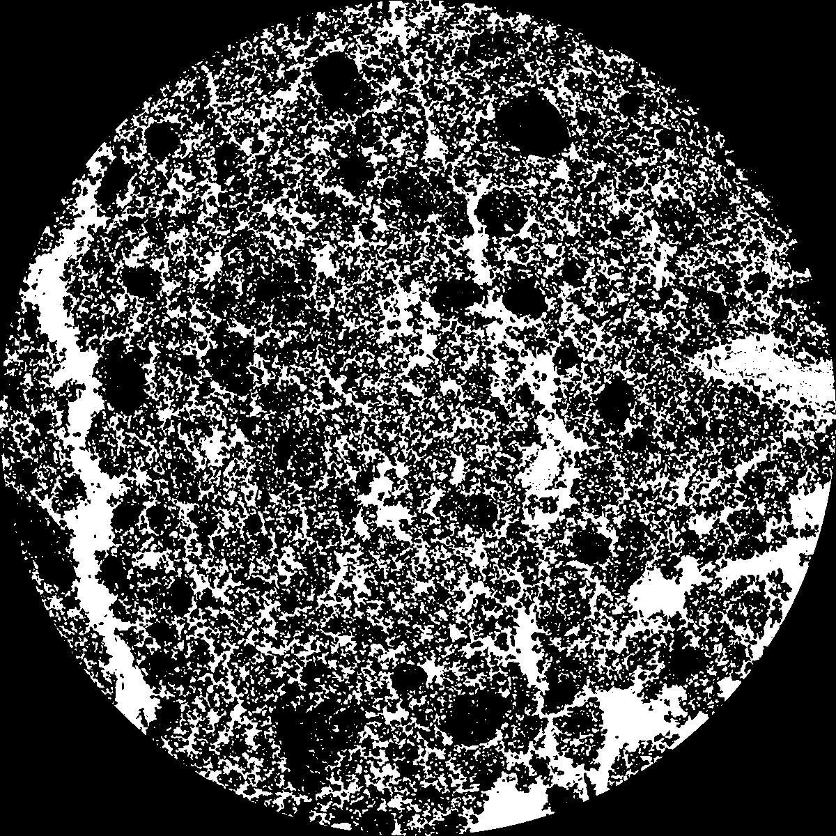
|
|---|
|
| XY Plane Grey |
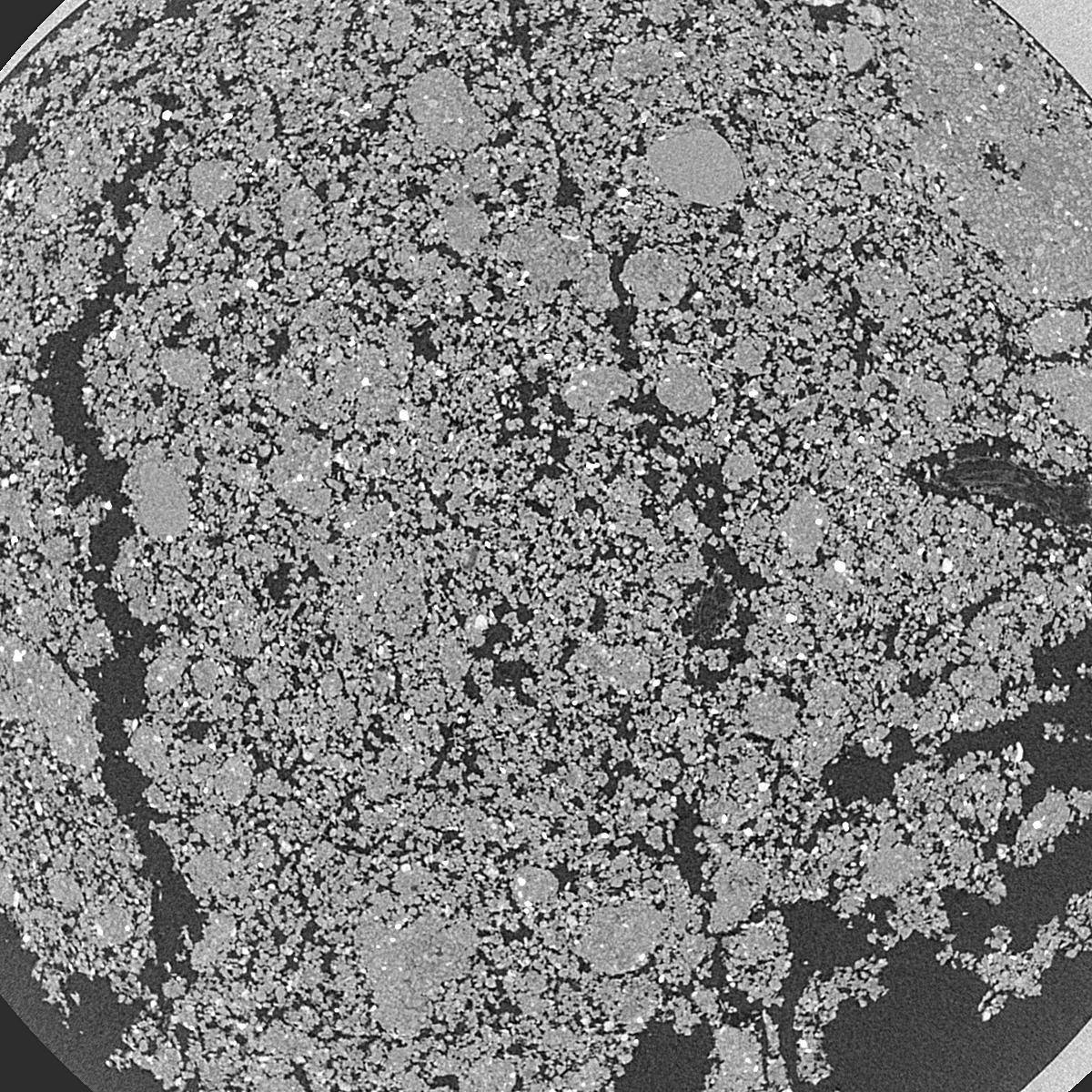
|
|---|
|
| Texture | silty clay loam |
|---|
| Sand | 3.5 |
|---|
| Silt | 65.1 |
|---|
| Clay | 31.4 |
|---|
|
|
Results
| Porosity | Surface | Mean Curvature | Euler | MeanPoreSize | Gamma | PoreDist |
| 0.3562 | 48.76 | 217.88 | -5653.6 | 0.0 | 0.9592 | 0.008511743 |
| Opening size | Volume | Surface | MeanCurvature | Euler number |
|---|
| 0.01 | 0.3562 | 48.76 | 217.88 | -5653.6 |
| 0.0125 | 0.3355 | 40.58 | 135.84 | -6508.8 |
| 0.015 | 0.3041 | 34.52 | 119.12 | -3673.6 |
| 0.0175 | 0.2739 | 29.3 | 104.84 | -1423.2 |
| 0.02 | 0.2586 | 26.8 | 105.8 | 16.0672 |
| 0.022500000000000003 | 0.1889 | 16.414 | 59.04 | 274.32 |
| 0.025 | 0.1635 | 13.12 | 45.36 | 303.2 |
| 0.030000000000000002 | 0.1416 | 10.396 | 35.108 | 319.52 |
| 0.034999999999999996 | 0.1032 | 6.212 | 17.536 | 149.04 |
| 0.04 | 0.08637 | 4.684 | 12.136 | 95.36 |
| 0.045 | 0.06753 | 3.15 | 6.988 | 51.3416 |
| 0.049999999999999996 | 0.06014 | 2.622 | 5.488 | 36.5856 |
| 0.055 | 0.04797 | 1.8422 | 3.4076 | 20.8536 |
| 0.06 | 0.04291 | 1.5348 | 2.6584 | 15.0304 |
| 0.065 | 0.03648 | 1.1922 | 1.8964 | 10.02 |
| 0.07 | 0.03385 | 1.0564 | 1.6192 | 7.93696 |
| 0.07500000000000001 | 0.02887 | 0.821 | 1.1332 | 5.12192 |
| 0.1 | 0.01779 | 0.3834 | 0.395832 | 1.22968 |
| 0.125 | 0.01184 | 0.2032 | 0.158536 | 0.396344 |
| 0.15 | 0.008597 | 0.12982 | 0.091412 | 0.243904 |
| 0.17500000000000002 | 0.006347 | 0.0833 | 0.044816 | 0.0711384 |
| 0.225 | 0.004088 | 0.04814 | 0.0228148 | 0.0203248 |
| 0.275 | 0.002655 | 0.02988 | 0.0146848 | 0.0203248 |
| 0.325 | 0.00145 | 0.01709 | 0.0093496 | 0.0101624 |
| 0.375 | 0.0005034 | 0.006414 | 0.0042176 | 0.0083208 |
Reference: An open Soil Structure Library based on X-ray CT data
 Soil Structure Library