General Information
Internal Identifier ML_K539
| Soil Type | Regosol |
|---|
| Classification | WRB |
|---|
|
| Location | Garzweiler open-cast mine |
|---|
| Latitude | 51.063893 |
|---|
| Longitude | 6.502039 |
|---|
|
| Landuse | agricultural crop rotation |
|---|
| Tillage | conventional tillage |
|---|
| Crop | winter wheat, maize, winter barley, triticale, winter wheat |
|---|
|
| Sampling Depth | 55.0 |
|---|
| Sample Height | 0.7 |
|---|
| Sampling Date | Nov. 21, 2016 |
|---|
| Voxel size | 0.005 |
|---|
| Pores white? | True |
|---|
|
| XY Plane |
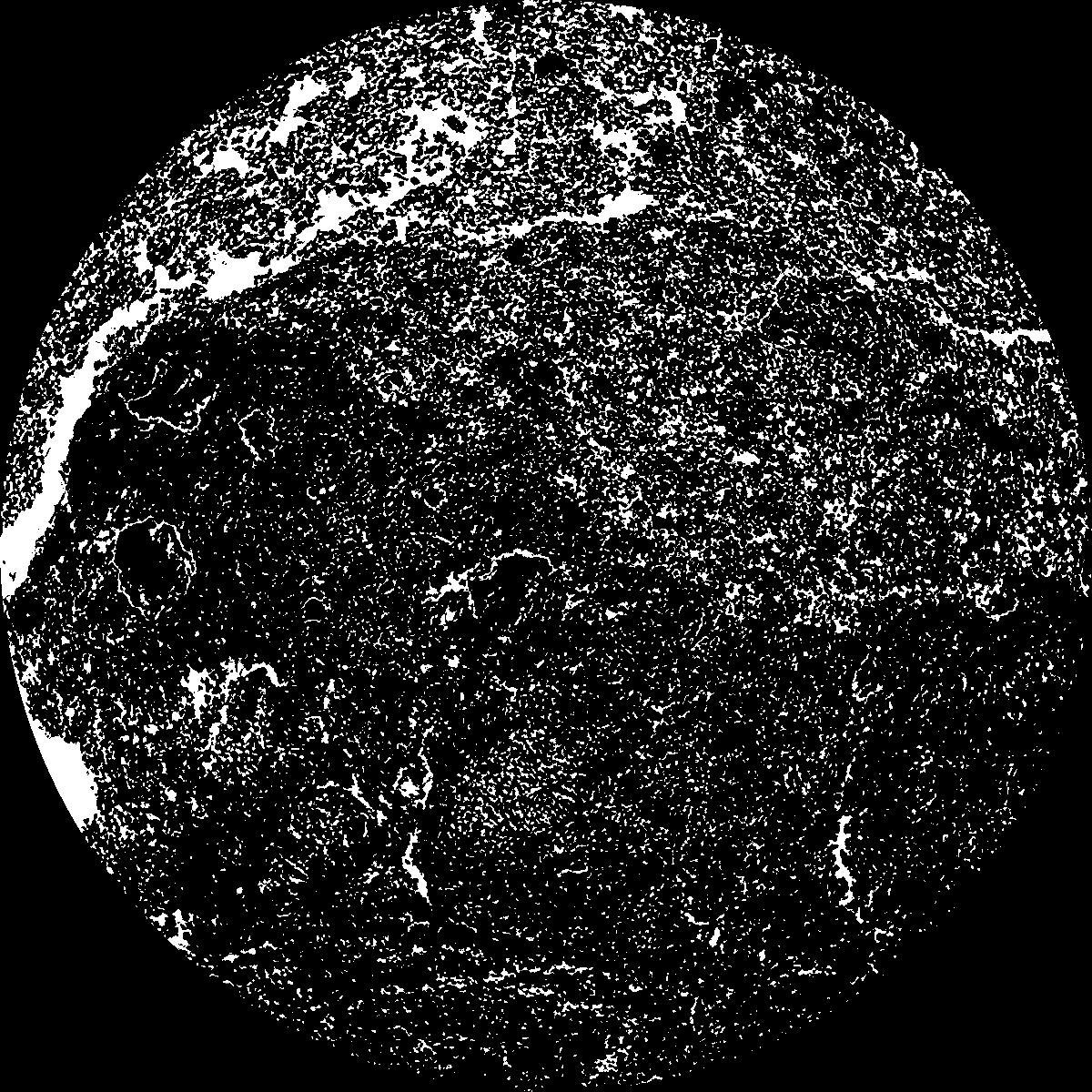
|
|---|
|
| XY Plane Grey |
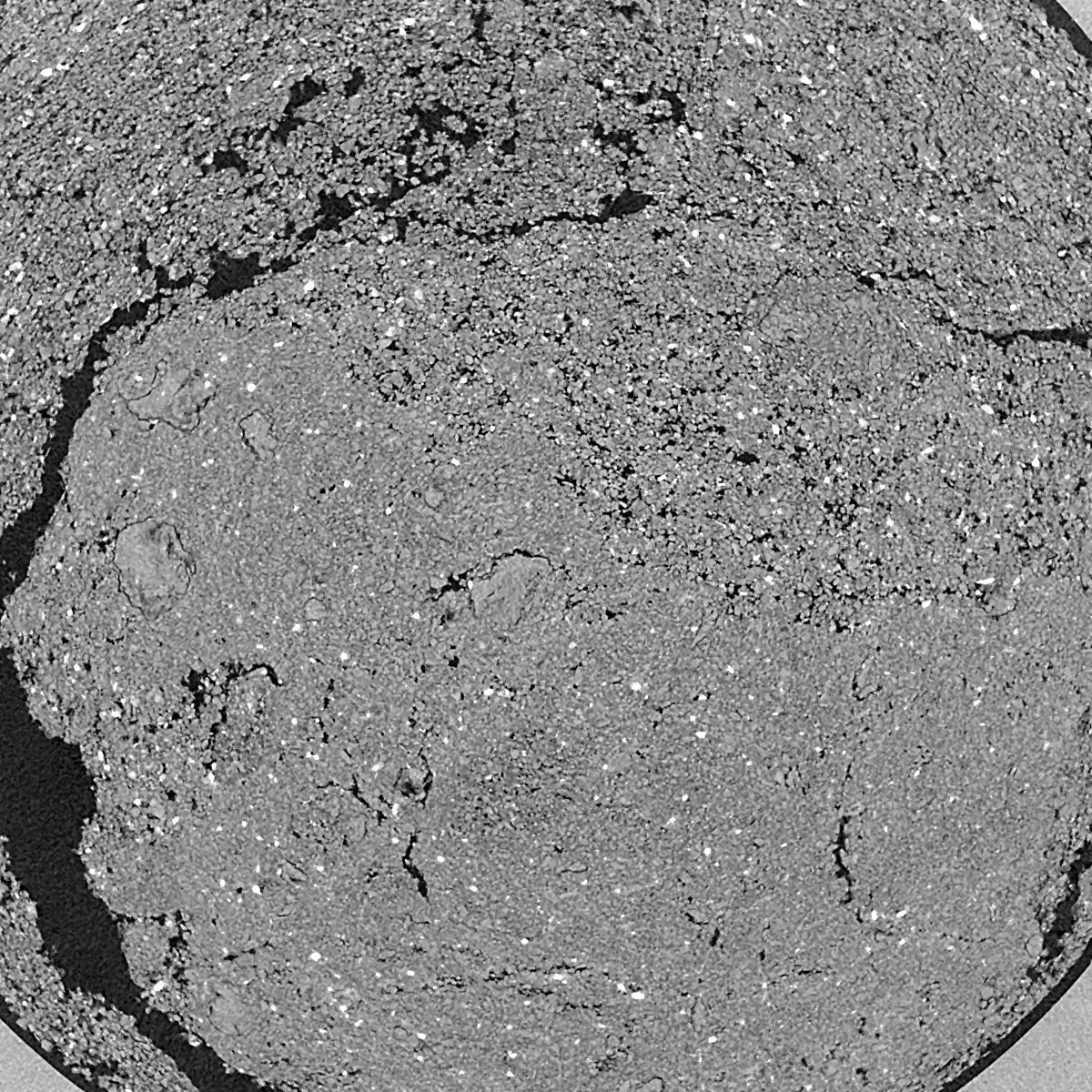
|
|---|
|
| Texture | silty clay loam |
|---|
| Sand | 3.5 |
|---|
| Silt | 65.1 |
|---|
| Clay | 31.4 |
|---|
|
|
Results
| Porosity | Surface | Mean Curvature | Euler | MeanPoreSize | Gamma | PoreDist |
| 0.2263 | 39.46 | 290.44 | -2821.6 | 0.0 | 0.7896 | 0.010500959 |
| Opening size | Volume | Surface | MeanCurvature | Euler number |
|---|
| 0.01 | 0.2263 | 39.46 | 290.44 | -2821.6 |
| 0.0125 | 0.1957 | 28.84 | 191.0 | -1084.8 |
| 0.015 | 0.1567 | 19.83 | 120.6 | 57.7784 |
| 0.0175 | 0.1326 | 14.934 | 87.12 | 720.4 |
| 0.02 | 0.1228 | 13.226 | 82.88 | 1406.4 |
| 0.022500000000000003 | 0.08373 | 6.296 | 28.652 | 400.56 |
| 0.025 | 0.07303 | 4.726 | 18.964 | 262.4 |
| 0.030000000000000002 | 0.0645 | 3.558 | 12.536 | 178.64 |
| 0.034999999999999996 | 0.05228 | 2.1 | 4.68 | 46.408 |
| 0.04 | 0.04768 | 1.6706 | 3.0124 | 24.1136 |
| 0.045 | 0.04262 | 1.2682 | 1.6972 | 11.0968 |
| 0.049999999999999996 | 0.04056 | 1.1274 | 1.3372 | 6.62536 |
| 0.055 | 0.03709 | 0.9252 | 0.9212 | 4.278 |
| 0.06 | 0.03549 | 0.8348 | 0.7476 | 2.7436 |
| 0.065 | 0.03331 | 0.734 | 0.6004 | 2.04248 |
| 0.07 | 0.03232 | 0.6872 | 0.5308 | 1.27016 |
| 0.07500000000000001 | 0.03037 | 0.6076 | 0.426 | 1.09744 |
| 0.1 | 0.02477 | 0.422 | 0.249976 | 0.406464 |
| 0.125 | 0.02015 | 0.3032 | 0.165736 | 0.335328 |
| 0.15 | 0.01646 | 0.2242 | 0.11264 | 0.152424 |
| 0.17500000000000002 | 0.01344 | 0.1696 | 0.080988 | 0.081296 |
| 0.225 | 0.008504 | 0.09306 | 0.0387156 | 0.0203232 |
| 0.275 | 0.005366 | 0.05522 | 0.0239304 | 0.0203232 |
| 0.325 | 0.003142 | 0.03022 | 0.0131592 | 0.0203232 |
| 0.375 | 0.001667 | 0.015542 | 0.0063508 | 0.00487448 |
| 0.425 | 0.0006668 | 0.00657 | 0.00330252 | 0.00487448 |
| 0.475 | 0.0004575 | 0.00494 | 0.00279444 | 0.00487448 |
Reference: An open Soil Structure Library based on X-ray CT data
 Soil Structure Library