General Information
Internal Identifier CG_P3_U_b_3cm_b
| Soil Type | Chernozem |
|---|
| Classification | WRB |
|---|
|
| Location | Bernburg (Westerfeld) |
|---|
| Latitude | 51.82 |
|---|
| Longitude | 11.7 |
|---|
|
| Landuse | agricultural crop rotation |
|---|
| Tillage | conventional tillage |
|---|
| Crop | winter wheat, maize, winter wheat, winter rape, winter barley |
|---|
|
| Sampling Depth | 31.0 |
|---|
| Sample Height | 3.0 |
|---|
| Sampling Date | March 28, 2017 |
|---|
| Voxel size | 0.02 |
|---|
| Pores white? | True |
|---|
|
| XY Plane |
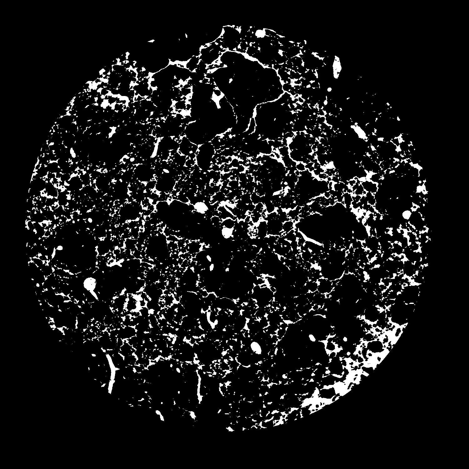
|
|---|
|
| XY Plane Grey |
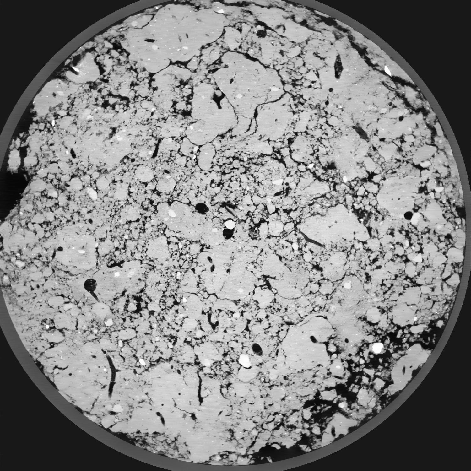
|
|---|
|
| Texture | silt loam |
|---|
| Sand | 8.0 |
|---|
| Silt | 79.0 |
|---|
| Clay | 13.0 |
|---|
|
|
Results
| Porosity | Surface | Mean Curvature | Euler | MeanPoreSize | Gamma | PoreDist |
| 0.1313 | 3.754 | 4.715 | 6.405 | 0.0 | 0.8737 | 0.117694138 |
| Opening size | Volume | Surface | MeanCurvature | Euler number |
|---|
| 0.04 | 0.1313 | 3.754 | 4.715 | 6.405 |
| 0.05 | 0.1251 | 3.185 | 3.195 | -2.50875 |
| 0.06 | 0.1193 | 2.88 | 2.7 | -2.3175 |
| 0.07 | 0.1145 | 2.6615 | 2.42625 | -0.2899625 |
| 0.08 | 0.1117 | 2.544 | 2.3815 | 2.3625 |
| 0.09000000000000001 | 0.09587 | 1.978 | 1.718 | 2.05 |
| 0.1 | 0.08875 | 1.7555 | 1.498 | 2.2225 |
| 0.12000000000000001 | 0.07966 | 1.4775 | 1.2395 | 2.305 |
| 0.13999999999999999 | 0.06271 | 1.027 | 0.7805 | 1.515 |
| 0.16 | 0.05362 | 0.815 | 0.58425 | 1.091475 |
| 0.18 | 0.04207 | 0.572 | 0.3655 | 0.659275 |
| 0.19999999999999998 | 0.03709 | 0.4786 | 0.2935 | 0.4906625 |
| 0.22 | 0.02894 | 0.34005 | 0.19145 | 0.348 |
| 0.24 | 0.02507 | 0.27555 | 0.146225 | 0.2350875 |
| 0.26 | 0.02032 | 0.2046 | 0.097575 | 0.1437125 |
| 0.28 | 0.01836 | 0.1761 | 0.079925 | 0.10509625 |
| 0.30000000000000004 | 0.01496 | 0.1312 | 0.052075 | 0.05676875 |
| 0.4 | 0.008583 | 0.0636 | 0.020939 | 0.02047 |
| 0.5 | 0.00487 | 0.034 | 0.01061925 | 0.008230375 |
| 0.6 | 0.00186 | 0.01294 | 0.0043515 | 0.003587625 |
| 0.7000000000000001 | 0.000229 | 0.0016655 | 0.000637325 | 0.000844137 |
Reference: An open Soil Structure Library based on X-ray CT data
 Soil Structure Library