General Information
Internal Identifier Frederic Leuther
| Soil Type | Haplic Chernozem |
|---|
| Classification | FAO |
|---|
|
| Location | Bad Lauchtädt |
|---|
| Latitude | 51.39178 |
|---|
| Longitude | 11.87701 |
|---|
|
| Landuse | Cropland |
|---|
| Tillage | Conventional |
|---|
| Crop | silage maize, sugar beet, potato |
|---|
|
| Sampling Depth | 40.0 |
|---|
| Sample Height | 3.0 |
|---|
| Sampling Date | March 10, 2020 |
|---|
| Voxel size | 0.019 |
|---|
| Pores white? | True |
|---|
|
| XY Plane |
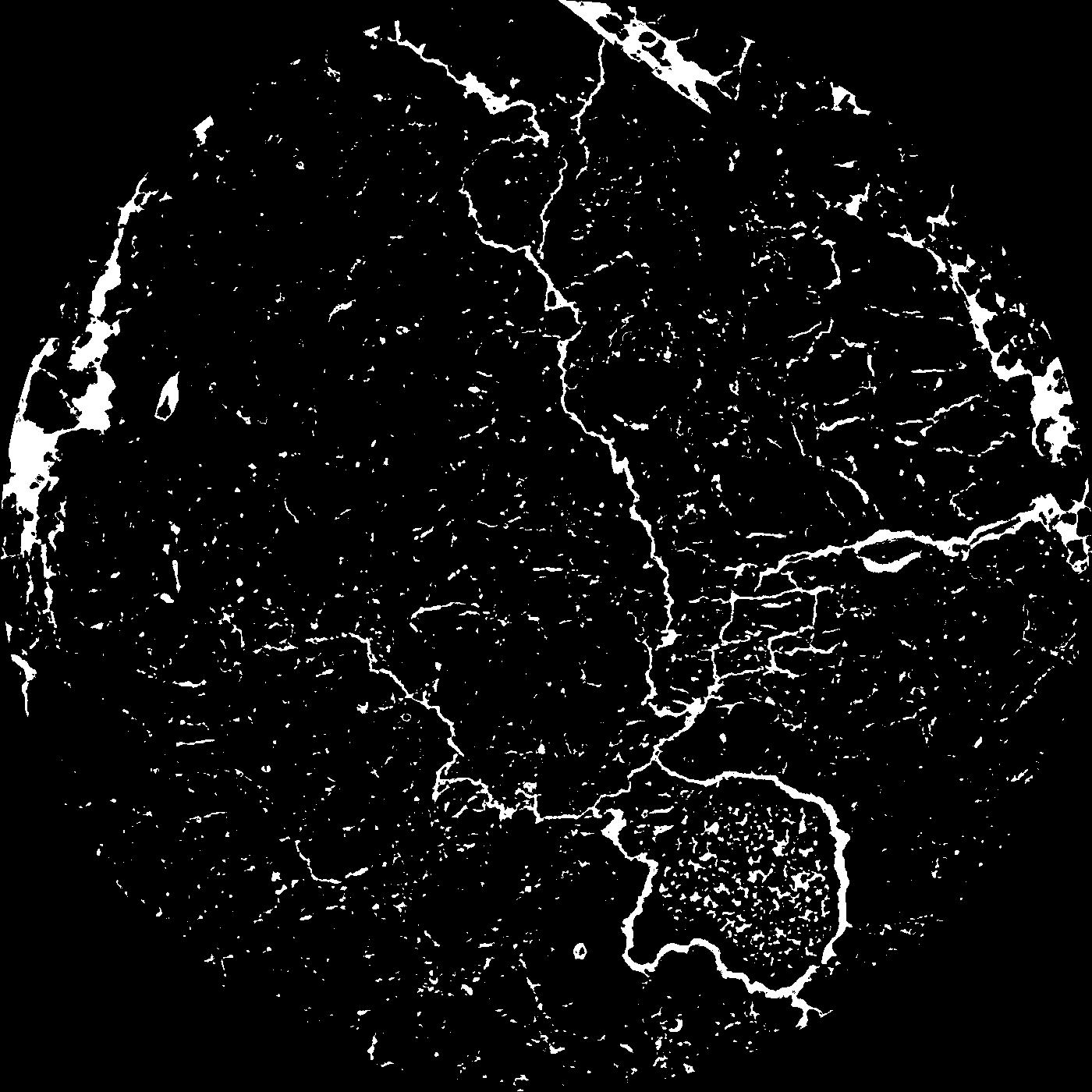
|
|---|
|
| XY Plane Grey |
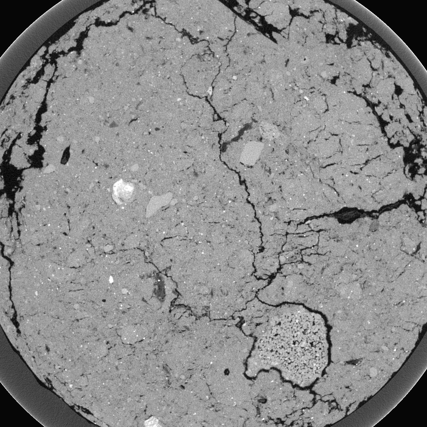
|
|---|
|
| Texture | silt loam |
|---|
| Sand | 9.0 |
|---|
| Silt | 70.0 |
|---|
| Clay | 21.0 |
|---|
|
|
Results
| Porosity | Surface | Mean Curvature | Euler | MeanPoreSize | Gamma | PoreDist |
| 0.04695 | 1.479473684 | 2.176454294 | 16.095640764 | 0.0 | 0.615 | 0.167249558 |
| Opening size | Volume | Surface | MeanCurvature | Euler number |
|---|
| 0.038 | 0.04695 | 1.479473684 | 2.176454294 | 16.095640764 |
| 0.0475 | 0.04404 | 1.211578947 | 1.402770083 | 6.576760461 |
| 0.056999999999999995 | 0.03989 | 0.978421053 | 0.936288089 | 2.558682024 |
| 0.0665 | 0.03673 | 0.829473684 | 0.699168975 | 1.666423677 |
| 0.076 | 0.03546 | 0.776315789 | 0.677562327 | 2.379355591 |
| 0.0855 | 0.02899 | 0.532105263 | 0.335734072 | 0.277985129 |
| 0.095 | 0.0268 | 0.466368421 | 0.280886427 | 0.210934539 |
| 0.114 | 0.02455 | 0.401263158 | 0.23634349 | 0.254279049 |
| 0.133 | 0.02016 | 0.293315789 | 0.152880886 | 0.127601691 |
| 0.152 | 0.01782 | 0.245210526 | 0.123933518 | 0.09204403 |
| 0.17099999999999999 | 0.01459 | 0.187315789 | 0.092603878 | 0.088524566 |
| 0.19 | 0.01298 | 0.160578947 | 0.078587258 | 0.070559848 |
| 0.209 | 0.01032 | 0.121 | 0.059085873 | 0.066856685 |
| 0.22799999999999998 | 0.008991 | 0.101368421 | 0.04933518 | 0.053337221 |
| 0.247 | 0.007274 | 0.078578947 | 0.038144044 | 0.04648491 |
| 0.266 | 0.006494 | 0.068105263 | 0.033157895 | 0.039817758 |
| 0.28500000000000003 | 0.005078 | 0.050263158 | 0.023755125 | 0.032224814 |
| 0.38 | 0.002283 | 0.017673684 | 0.006780609 | 0.008333868 |
| 0.47500000000000003 | 0.001248 | 0.008236842 | 0.002681302 | 0.002777956 |
| 0.5700000000000001 | 0.0006825 | 0.003926842 | 0.001115457 | 0.001296384 |
| 0.665 | 0.00037 | 0.001923684 | 0.000520776 | 0.000555591 |
| 0.855 | 0.0001735 | 0.000774211 | 0.000158343 | 0.000086099 |
Reference: An open Soil Structure Library based on X-ray CT data
 Soil Structure Library