General Information
Internal Identifier 2_B_CT_Flakkebjerg_2019
| Soil Type | Glossic phaeozem |
|---|
| Classification | WRB |
|---|
|
| Location | Denmark |
|---|
| Latitude | 55.316666666 |
|---|
| Longitude | 11.3888889 |
|---|
|
| Landuse | Cropland |
|---|
| Tillage | Conventional Inversion Tillage |
|---|
| Crop | Spring Barley, Winter wheat, Oats, Broad Beans |
|---|
|
| Sample Height | 10.0 |
|---|
| Sampling Date | Dec. 2, 2019 |
|---|
| Voxel size | 0.06 |
|---|
| Pores white? | True |
|---|
|
| XY Plane |
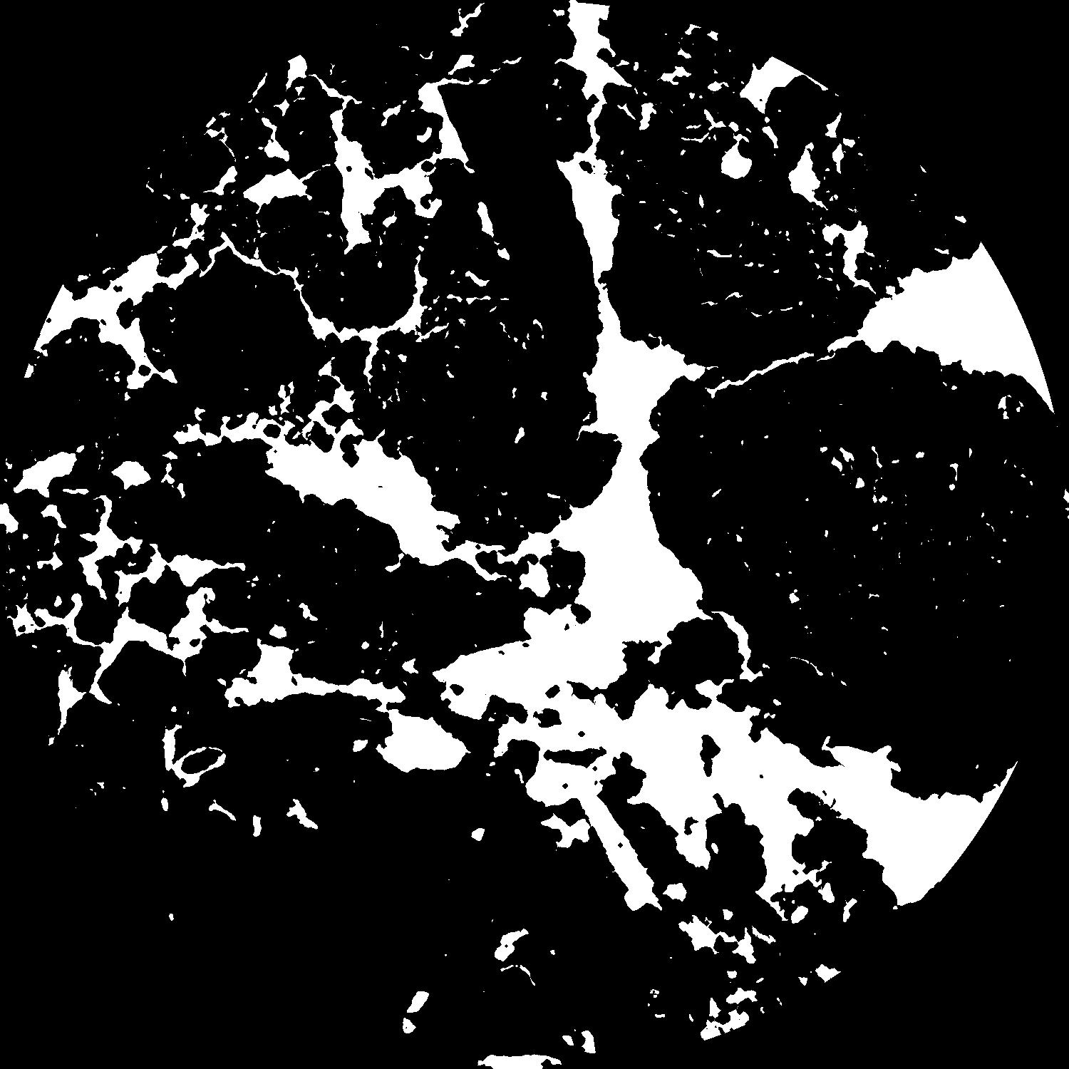
|
|---|
|
| XY Plane Grey |
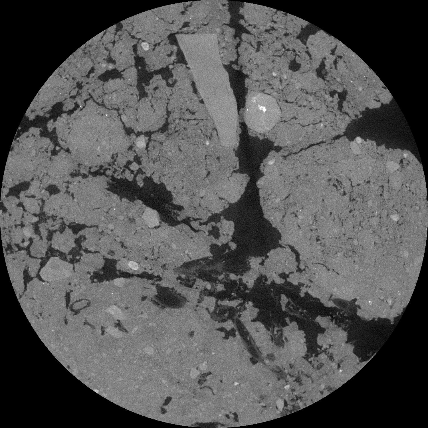
|
|---|
|
| Texture | Sandy loam |
|---|
| Sand | 69.6 |
|---|
| Silt | 13.7 |
|---|
| Clay | 14.7 |
|---|
|
|
Results
| Porosity | Surface | Mean Curvature | Euler | MeanPoreSize | Gamma | PoreDist |
| 0.224147248 | 0.405690744 | 0.081473722 | 0.099822292 | 2.18904599179 | 0.965378059775 | 2.17431479 |
| Opening size | Volume | Surface | MeanCurvature | Euler number |
|---|
| 0.12 | 0.224147248 | 0.405690744 | 0.081473722 | 0.099822292 |
| 0.15 | 0.222631337 | 0.372330675 | 0.057230797 | 0.020956559 |
| 0.18 | 0.2213737 | 0.357734579 | 0.048321491 | 0.007474987 |
| 0.21 | 0.220335636 | 0.34783388 | 0.043653372 | 0.007523139 |
| 0.24 | 0.219744172 | 0.342730636 | 0.042825473 | 0.014871342 |
| 0.27 | 0.21674108 | 0.320730686 | 0.033947015 | 0.00377173 |
| 0.3 | 0.214900564 | 0.309827196 | 0.031184543 | 0.003137365 |
| 0.36 | 0.212065581 | 0.29357202 | 0.02792886 | 0.004032809 |
| 0.42 | 0.206856625 | 0.269352954 | 0.022776492 | 0.002407139 |
| 0.48 | 0.203081142 | 0.253922849 | 0.020290331 | 0.001868195 |
| 0.54 | 0.197000059 | 0.233457344 | 0.017068805 | 0.002831227 |
| 0.6 | 0.193734775 | 0.222732727 | 0.015708693 | 0.001535993 |
| 0.66 | 0.187267481 | 0.205951159 | 0.01379851 | 0.003629484 |
| 0.72 | 0.183313066 | 0.1949978 | 0.012585748 | 0.001657476 |
| 0.78 | 0.177553802 | 0.182230896 | 0.011257045 | 0.002599304 |
| 0.84 | 0.174595557 | 0.174862676 | 0.010513786 | 0.000872914 |
| 0.9 | 0.16908883 | 0.164036057 | 0.009518531 | 0.001261661 |
| 1.2 | 0.147504331 | 0.127086111 | 0.006779448 | 0.001319531 |
| 1.5 | 0.127767004 | 0.099659331 | 0.004917939 | 0.000838015 |
| 1.8 | 0.110740633 | 0.080090681 | 0.003808161 | 0.000601233 |
| 2.1 | 0.094182618 | 0.063220893 | 0.002860982 | 0.000530551 |
| 2.7 | 0.068467783 | 0.040810495 | 0.001696802 | 0.00021602 |
| 3.3 | 0.049326203 | 0.02681098 | 0.001058291 | 0.000163009 |
| 3.9 | 0.035412251 | 0.017642148 | 0.000637771 | 0.000094978 |
| 4.5 | 0.02535962 | 0.012169904 | 0.000428694 | 0.0000402 |
| 5.1 | 0.016130912 | 0.007700477 | 0.000279458 | 0.000031807 |
| 5.7 | 0.008923706 | 0.004138442 | 0.000148466 | 0.00001502 |
| 6.3 | 0.003646937 | 0.001561468 | 0.00005242 | 0.000004418 |
| 6.9 | 0.002431 | 0.001020067 | 0.000034567 | 0.000003534 |
| 7.5 | 0.000912471 | 0.000405672 | 0.000013992 | 0.000000884 |
Reference: An open Soil Structure Library based on X-ray CT data
 Soil Structure Library