General Information
Internal Identifier CG_G1_O_a
| Soil Type | Chernozem |
|---|
| Classification | WRB |
|---|
|
| Location | Bernburg (Westerfeld) |
|---|
| Latitude | 51.820 |
|---|
| Longitude | 11.700 |
|---|
|
| Landuse | agricultural crop rotation |
|---|
| Tillage | reduced tillage |
|---|
| Crop | winter wheat, maize, winter wheat, winter rape, winter barley |
|---|
|
| Sampling Depth | 13.0 |
|---|
| Sample Height | 10.0 |
|---|
| Sampling Date | March 28, 2017 |
|---|
| Voxel size | 0.06 |
|---|
| Pores white? | True |
|---|
|
| XY Plane |
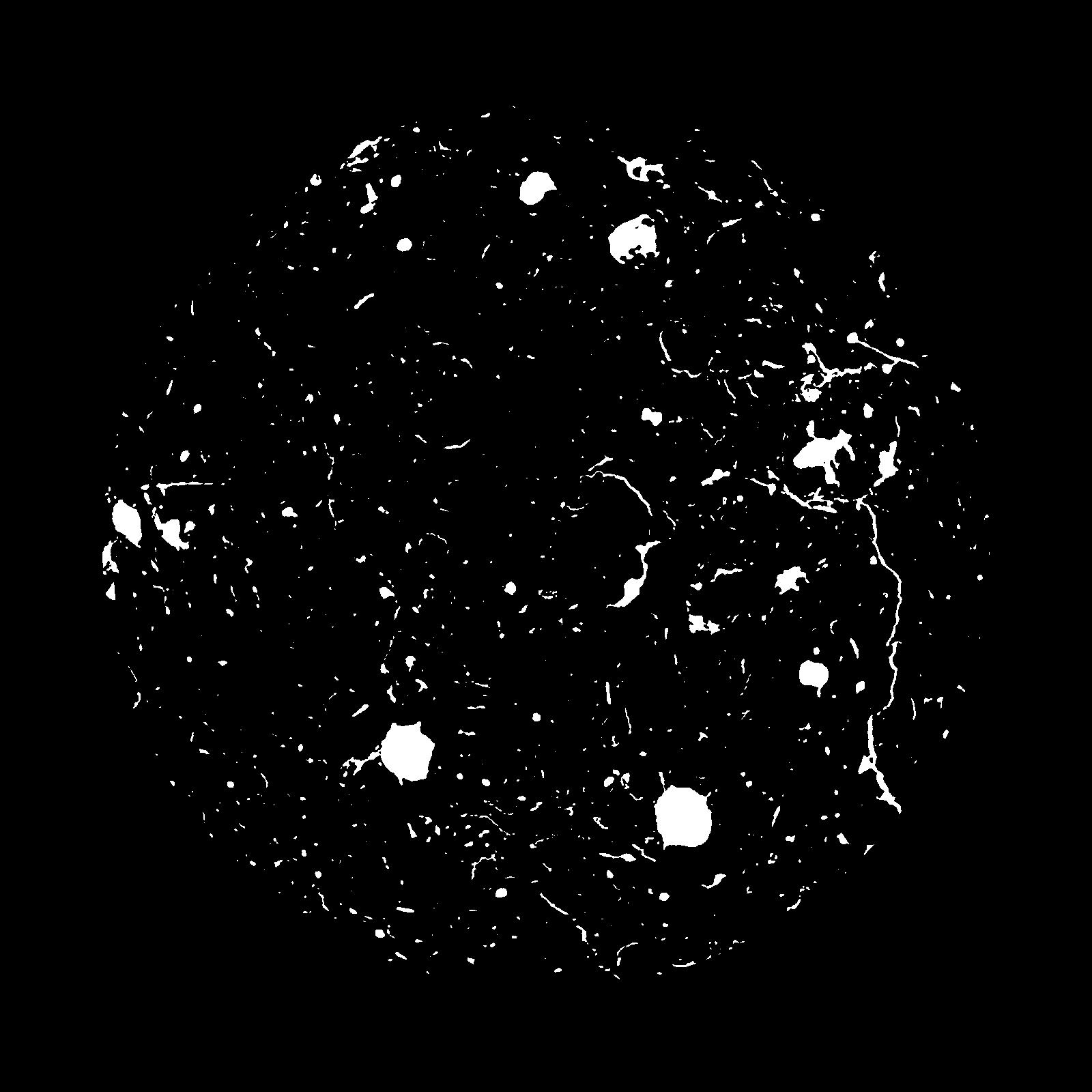
|
|---|
|
| XY Plane Grey |
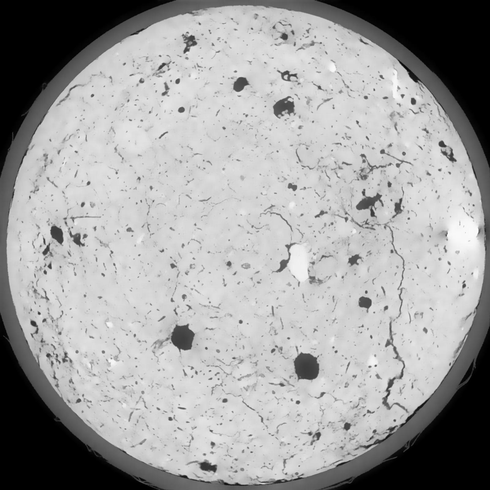
|
|---|
|
| Texture | silt loam |
|---|
| Sand | 8.0 |
|---|
| Silt | 79.0 |
|---|
| Clay | 13.0 |
|---|
|
|
Results
| Porosity | Surface | Mean Curvature | Euler | MeanPoreSize | Gamma | PoreDist |
| 0.0695 | 0.5615 | 0.286111111 | 0.501388889 | 0.0 | 0.6496 | 0.43241715 |
| Opening size | Volume | Surface | MeanCurvature | Euler number |
|---|
| 0.12 | 0.0695 | 0.5615 | 0.286111111 | 0.501388889 |
| 0.15 | 0.06635 | 0.471333333 | 0.188 | 0.192175926 |
| 0.18 | 0.06341 | 0.4135 | 0.142111111 | 0.099074074 |
| 0.21 | 0.06097 | 0.373666667 | 0.117611111 | 0.083101852 |
| 0.24 | 0.05983 | 0.357666667 | 0.113916667 | 0.114490741 |
| 0.27 | 0.05312 | 0.271833333 | 0.069194444 | 0.043933796 |
| 0.3 | 0.05031 | 0.241833333 | 0.057583333 | 0.036341204 |
| 0.36 | 0.04675 | 0.2055 | 0.045527778 | 0.030593519 |
| 0.42 | 0.04044 | 0.152366667 | 0.028805556 | 0.014811111 |
| 0.48 | 0.03699 | 0.127483333 | 0.022466667 | 0.010319444 |
| 0.54 | 0.0324 | 0.098233333 | 0.015391667 | 0.006959722 |
| 0.6000000000000001 | 0.03033 | 0.0861 | 0.012827778 | 0.005275463 |
| 0.6599999999999999 | 0.02695 | 0.068516667 | 0.009305556 | 0.004633796 |
| 0.72 | 0.02543 | 0.060683333 | 0.007761111 | 0.003270556 |
| 0.78 | 0.02348 | 0.0521 | 0.006219444 | 0.002798241 |
| 0.8400000000000001 | 0.02257 | 0.047966667 | 0.005477778 | 0.002031852 |
| 0.8999999999999999 | 0.02092 | 0.0414 | 0.004363889 | 0.001630833 |
| 1.2 | 0.01643 | 0.025966667 | 0.002087972 | 0.000828796 |
| 1.5 | 0.01356 | 0.01825 | 0.001153333 | 0.000320815 |
| 1.8 | 0.01172 | 0.014426667 | 0.00082075 | 0.000187144 |
| 2.1 | 0.009954 | 0.011121667 | 0.00054325 | 0.000151495 |
| 2.7 | 0.007847 | 0.008081667 | 0.000351306 | 0.00006238 |
| 3.3000000000000003 | 0.005869 | 0.005753333 | 0.000245958 | 0.000035646 |
| 3.9 | 0.00456 | 0.004616667 | 0.000214411 | 0.000017823 |
| 4.5 | 0.001169 | 0.001135333 | 0.000055072 | 0.000007267 |
Reference: An open Soil Structure Library based on X-ray CT data
 Soil Structure Library