 Soil Structure Library
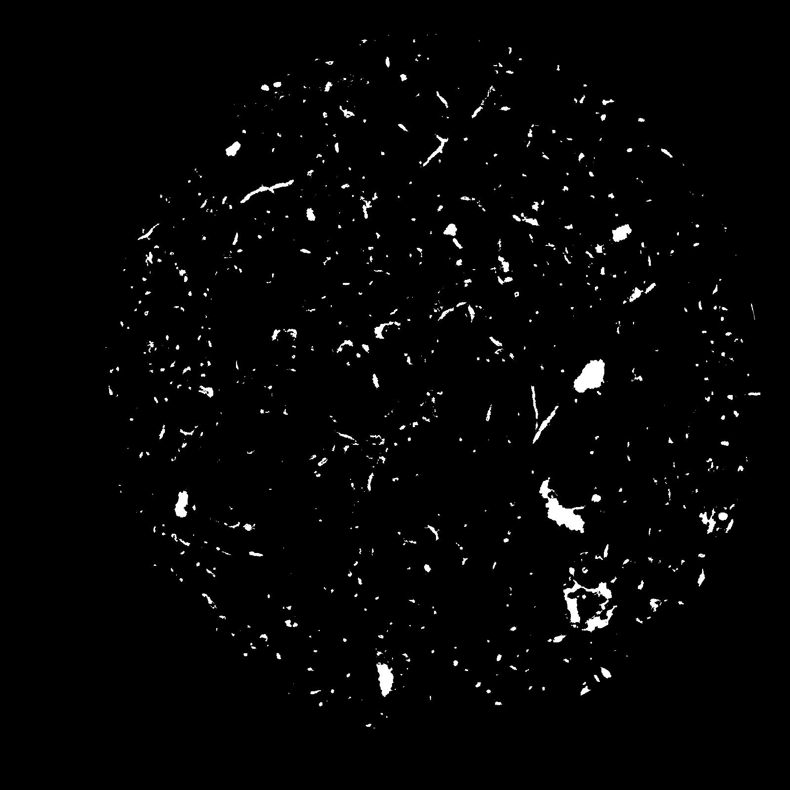
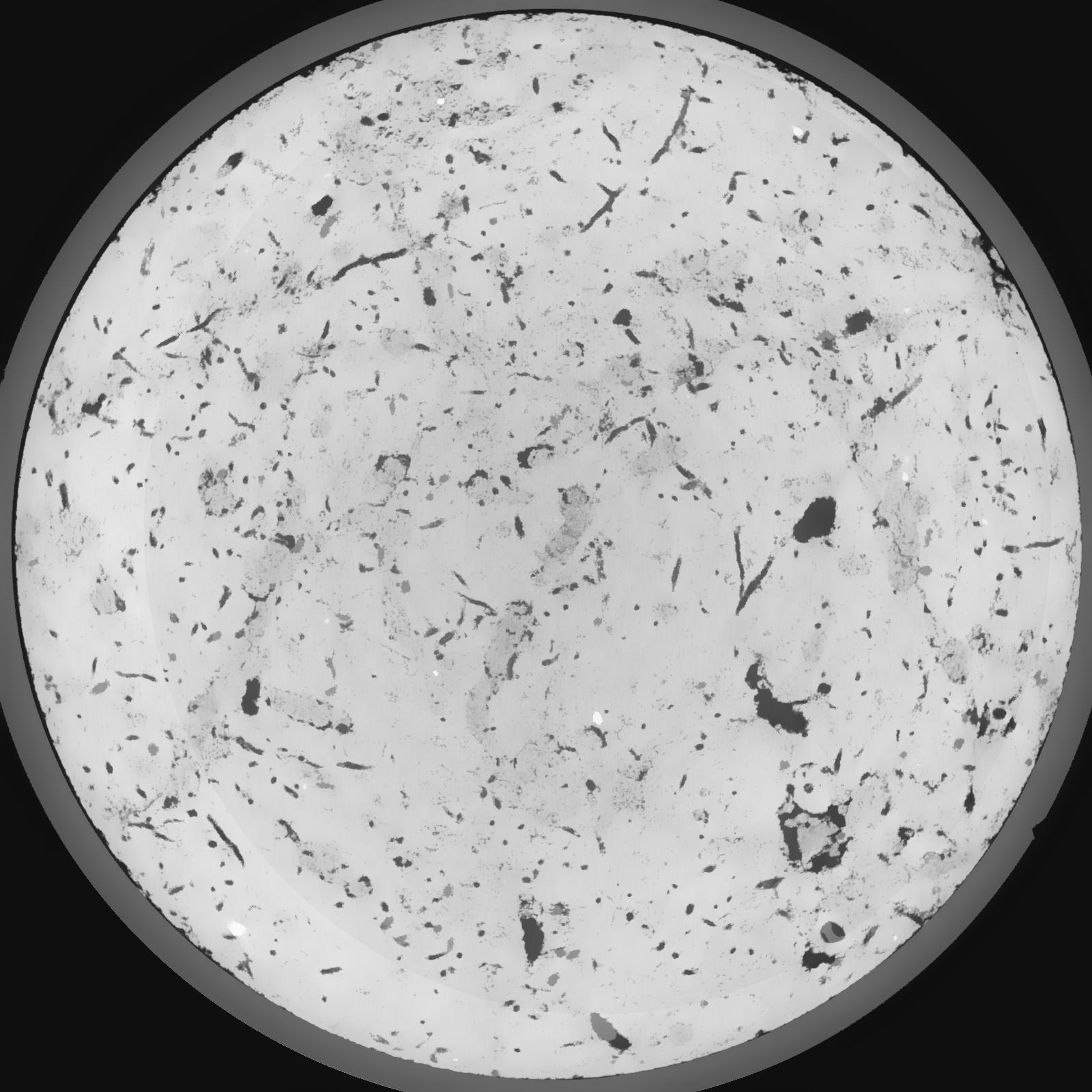
General Information
|
|
||||||||||||||||
|
|
||||||||||||||||
|
|
||||||||||||||||
|
|
Results
| Porosity | Surface | Mean Curvature | Euler | MeanPoreSize | Gamma | PoreDist |
|---|---|---|---|---|---|---|
| 0.04929 | 0.4515 | 0.2415 | 0.526388889 | 0.0 | 0.4288 | 0.562671202 |
| Opening size | Volume | Surface | MeanCurvature | Euler number |
|---|---|---|---|---|
| 0.12 | 0.04929 | 0.4515 | 0.2415 | 0.526388889 |
| 0.15 | 0.04714 | 0.388166667 | 0.169611111 | 0.12962963 |
| 0.18 | 0.0455 | 0.355833333 | 0.143333333 | 0.084722222 |
| 0.21 | 0.04407 | 0.332333333 | 0.128611111 | 0.080972222 |
| 0.24 | 0.04326 | 0.3205 | 0.125361111 | 0.102592593 |
| 0.27 | 0.0377 | 0.246 | 0.083944444 | 0.063935185 |
| 0.3 | 0.03512 | 0.216166667 | 0.070388889 | 0.057592593 |
| 0.36 | 0.03158 | 0.176833333 | 0.053833333 | 0.04498287 |
| 0.42 | 0.02579 | 0.119766667 | 0.029277778 | 0.021677315 |
| 0.48 | 0.02303 | 0.09655 | 0.020913889 | 0.013745833 |
| 0.54 | 0.01994 | 0.073983333 | 0.013538889 | 0.008797685 |
| 0.6000000000000001 | 0.01869 | 0.065883333 | 0.011347222 | 0.006103241 |
| 0.6599999999999999 | 0.01661 | 0.054183333 | 0.008444444 | 0.005212963 |
| 0.72 | 0.01559 | 0.048566667 | 0.007177778 | 0.003408426 |
| 0.78 | 0.01424 | 0.042466667 | 0.006 | 0.0030475 |
| 0.8400000000000001 | 0.01356 | 0.03925 | 0.005402778 | 0.002101204 |
| 0.8999999999999999 | 0.01225 | 0.033833333 | 0.004430556 | 0.001900694 |
| 1.2 | 0.008382 | 0.019783333 | 0.002212028 | 0.000858102 |
| 1.5 | 0.005617 | 0.01188 | 0.001207778 | 0.000409009 |
| 1.8 | 0.00346 | 0.006615 | 0.000616389 | 0.000184454 |
| 2.1 | 0.00202 | 0.003635 | 0.000332028 | 0.000096236 |
| 2.7 | 0.0004671 | 0.000617667 | 0.000038975 | 0.000006726 |
| 3.3000000000000003 | 0.0001153 | 0.000163845 | 0.000011549 | 0.000002242 |