 Soil Structure Library
General Information
|
|
|||||||||||||||
|
|
|||||||||||||||
|
|
|||||||||||||||
|
|
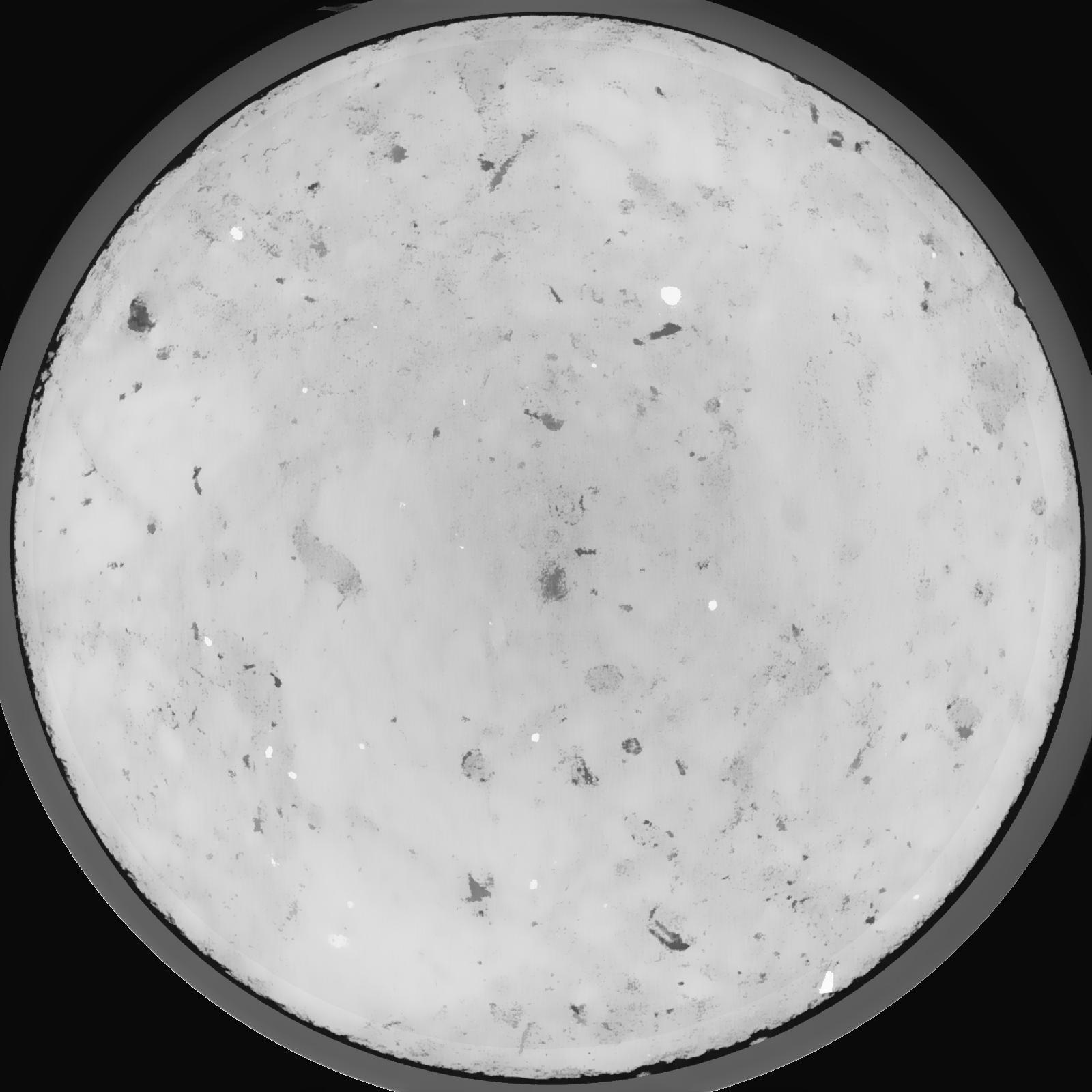
Results
| Porosity | Surface | Mean Curvature | Euler | MeanPoreSize | Gamma | PoreDist |
|---|---|---|---|---|---|---|
| 0.00202 | 0.026083333 | 0.019458333 | 0.068148148 | 0.0 | 0.01497 | 2.625870149 |
| Opening size | Volume | Surface | MeanCurvature | Euler number |
|---|---|---|---|---|
| 0.12 | 0.00202 | 0.026083333 | 0.019458333 | 0.068148148 |
| 0.15 | 0.001782 | 0.018883333 | 0.010166667 | 0.013191667 |
| 0.18 | 0.001591 | 0.01517 | 0.007347222 | 0.008024537 |
| 0.21 | 0.001462 | 0.013015 | 0.00595 | 0.007247685 |
| 0.24 | 0.001402 | 0.012138333 | 0.005683333 | 0.008436574 |
| 0.27 | 0.001104 | 0.007791667 | 0.002753611 | 0.003010324 |
| 0.3 | 0.00101 | 0.00667 | 0.002172056 | 0.002252963 |
| 0.36 | 0.0009095 | 0.005555 | 0.001696333 | 0.001610648 |
| 0.42 | 0.0007265 | 0.003835 | 0.000996861 | 0.000814907 |
| 0.48 | 0.0006312 | 0.00305 | 0.000711556 | 0.000517685 |
| 0.54 | 0.0005201 | 0.002285 | 0.00048375 | 0.000373898 |
| 0.6000000000000001 | 0.0004707 | 0.001971667 | 0.000402083 | 0.00026844 |
| 0.6599999999999999 | 0.0003954 | 0.001553 | 0.000294528 | 0.000210917 |
| 0.72 | 0.0003534 | 0.001323833 | 0.000243894 | 0.000153394 |
| 0.78 | 0.0002945 | 0.001019 | 0.000169692 | 0.000105458 |
| 0.8400000000000001 | 0.0002729 | 0.000919333 | 0.000153008 | 0.000086282 |
| 0.8999999999999999 | 0.0002351 | 0.0007525 | 0.000117922 | 0.000067111 |
| 1.2 | 0.0001423 | 0.000408167 | 0.000057522 | 0.000028761 |
| 1.5 | 0.00007141 | 0.000195833 | 0.000027036 | 0.000009587 |
| 1.8 | 0.000009801 | 0.000031097 | 0.000005177 | 0.000002681 |