General Information
Internal Identifier Ad_1_A_2_u
| Soil Type | Haplic Luvisol |
|---|
| Classification | WRB |
|---|
|
| Location | Adenstedt |
|---|
| Latitude | 52.00772222 |
|---|
| Longitude | 9.939417 |
|---|
|
| Landuse | Cropland |
|---|
| Tillage | tillage |
|---|
| Crop | winter wheat, sugarbeets, winter wheat, silage mais |
|---|
|
| Sampling Depth | 10.0 |
|---|
| Sampling Date | March 24, 2021 |
|---|
| Voxel size | 0.06 |
|---|
| Pores white? | True |
|---|
|
| XY Plane |
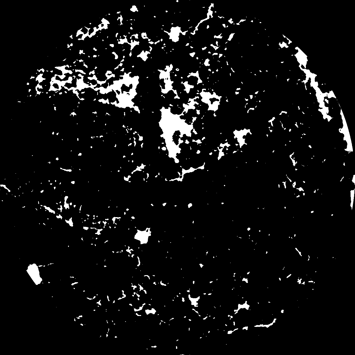
|
|---|
|
| XY Plane Grey |
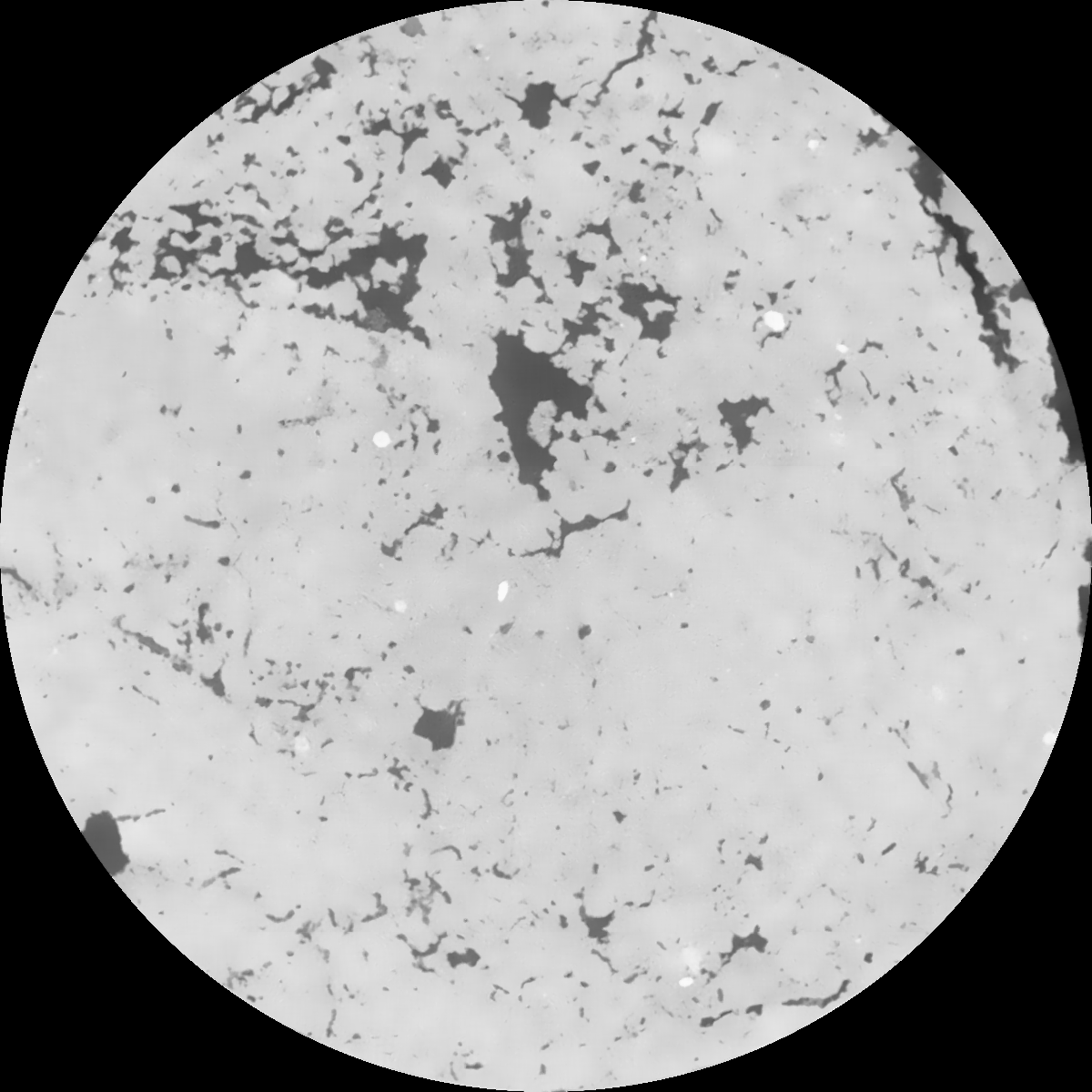
|
|---|
|
| Texture | clayey silt |
|---|
| Sand | 8.3 |
|---|
| Silt | 71.9 |
|---|
| Clay | 19.8 |
|---|
|
|
Results
| Porosity | Surface | Mean Curvature | Euler | MeanPoreSize | Gamma | PoreDist |
| 0.066581365 | 0.422706175 | 0.174379803 | 0.294415671 | 0.953324170875 | 0.738019290299 | 0.621944339 |
| Opening size | Volume | Surface | MeanCurvature | Euler number |
|---|
| 0.12 | 0.066581365 | 0.422706175 | 0.174379803 | 0.294415671 |
| 0.15 | 0.065007602 | 0.379449916 | 0.125619519 | 0.115909458 |
| 0.18 | 0.063674327 | 0.35311989 | 0.103928926 | 0.068016212 |
| 0.21 | 0.062395074 | 0.332267653 | 0.090975878 | 0.058182572 |
| 0.24 | 0.061717015 | 0.322594728 | 0.088416461 | 0.072415345 |
| 0.27 | 0.057432612 | 0.269087065 | 0.06146529 | 0.036477652 |
| 0.3 | 0.055426976 | 0.247938518 | 0.053611964 | 0.032575739 |
| 0.36 | 0.052513019 | 0.218587729 | 0.044070038 | 0.02652061 |
| 0.42 | 0.047257167 | 0.174611525 | 0.030109505 | 0.015265137 |
| 0.48 | 0.044051052 | 0.151441499 | 0.024094882 | 0.011275338 |
| 0.54 | 0.039548957 | 0.123105007 | 0.01707128 | 0.007954919 |
| 0.6 | 0.037389069 | 0.110768275 | 0.014508707 | 0.005631348 |
| 0.66 | 0.03371387 | 0.09289088 | 0.011199513 | 0.00473563 |
| 0.72 | 0.031752066 | 0.083433624 | 0.009575931 | 0.00310913 |
| 0.78 | 0.029131672 | 0.072650243 | 0.007895066 | 0.002672708 |
| 0.84 | 0.027895704 | 0.067462226 | 0.007146142 | 0.001939519 |
| 0.9 | 0.025526142 | 0.059007105 | 0.006012776 | 0.001719202 |
| 1.2 | 0.018074247 | 0.035393718 | 0.003106905 | 0.000826493 |
| 1.5 | 0.012825837 | 0.022106871 | 0.00172608 | 0.000443645 |
| 1.8 | 0.008982138 | 0.013965316 | 0.000990306 | 0.00019323 |
| 2.1 | 0.006153666 | 0.008788506 | 0.000593159 | 0.000137849 |
| 2.7 | 0.002735178 | 0.003372624 | 0.000208717 | 0.000057788 |
| 3.3 | 0.001292306 | 0.001404898 | 0.000074681 | 0.000015651 |
| 3.9 | 0.000669296 | 0.000693371 | 0.000037235 | 0.000020467 |
| 4.5 | 0.000375435 | 0.000391802 | 0.000021513 | 0.00000602 |
| 5.1 | 0.000105172 | 0.000113826 | 0.000006587 | 0.000001204 |
| 5.7 | 0.0 | 0.0 | 0.0 | 0.0 |
| 6.3 | 0.0 | 0.0 | 0.0 | 0.0 |
| 6.9 | 0.0 | 0.0 | 0.0 | 0.0 |
| 7.5 | 0.0 | 0.0 | 0.0 | 0.0 |
| 8.1 | 0.0 | 0.0 | 0.0 | 0.0 |
| 8.7 | 0.0 | 0.0 | 0.0 | 0.0 |
| 9.3 | 0.0 | 0.0 | 0.0 | 0.0 |
| 9.9 | 0.0 | 0.0 | 0.0 | 0.0 |
Reference: An open Soil Structure Library based on X-ray CT data
 Soil Structure Library