General Information
Internal Identifier Ad_1_B_2_u
| Soil Type | Haplic Luvisol |
|---|
| Classification | WRB |
|---|
|
| Location | Adenstedt |
|---|
| Latitude | 52.00772222 |
|---|
| Longitude | 9.939417 |
|---|
|
| Landuse | Cropland |
|---|
| Tillage | tillage |
|---|
| Crop | winter wheat, sugarbeets, winter wheat, silage mais |
|---|
|
| Sampling Depth | 25.0 |
|---|
| Sampling Date | March 24, 2021 |
|---|
| Voxel size | 0.06 |
|---|
| Pores white? | True |
|---|
|
| XY Plane |
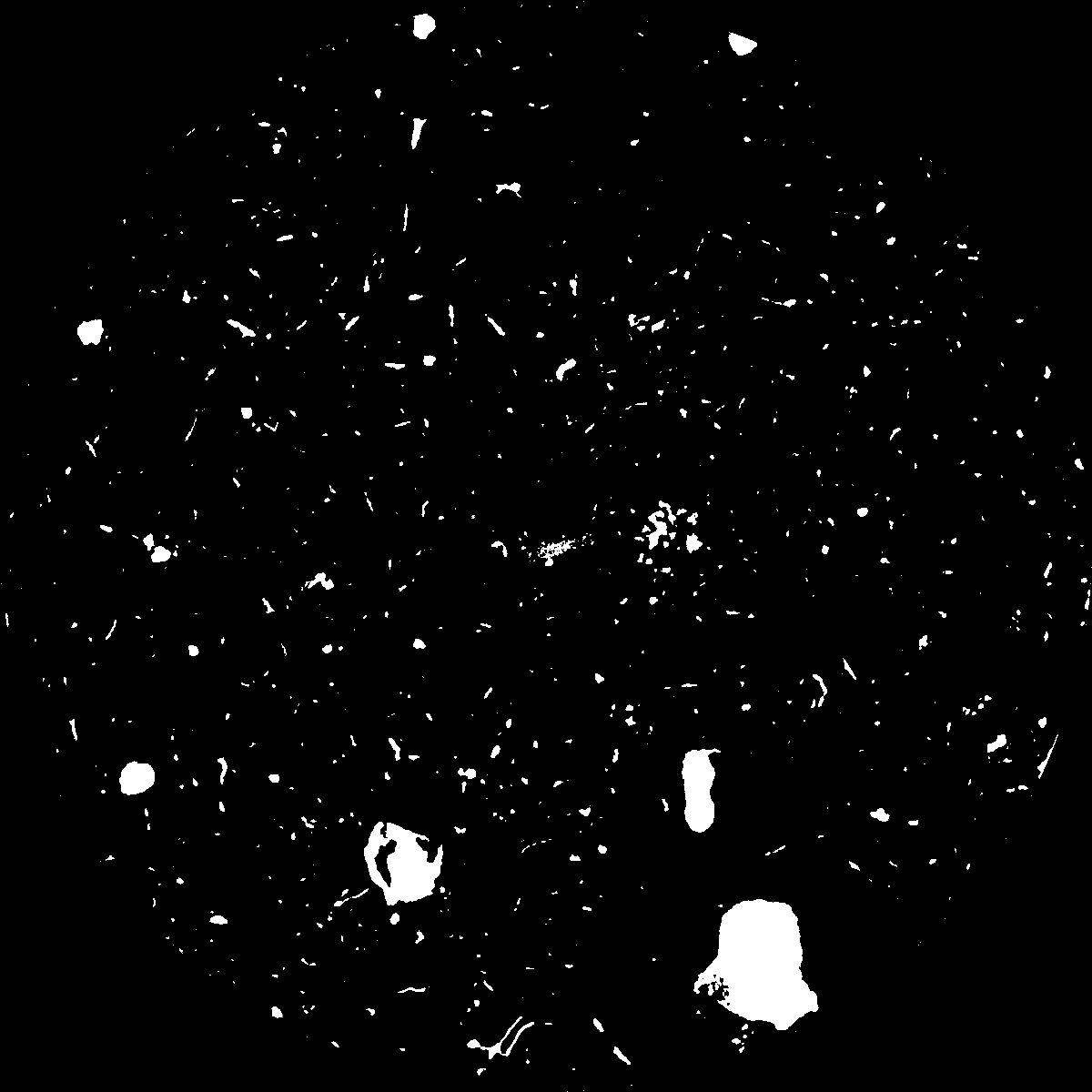
|
|---|
|
| XY Plane Grey |
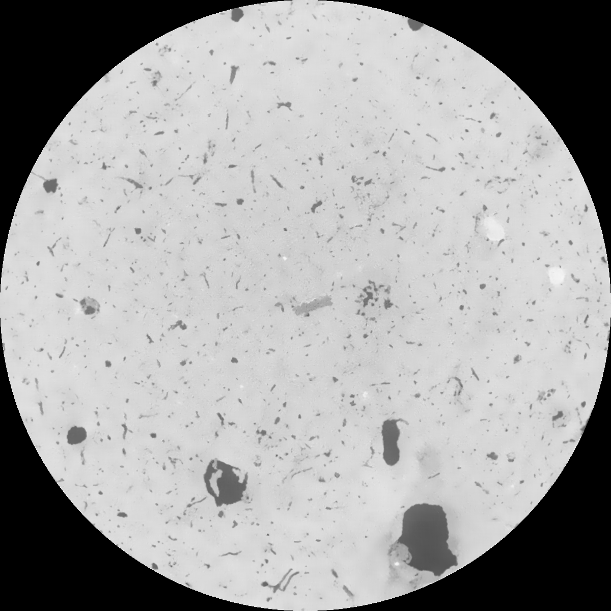
|
|---|
|
| Texture | clayey silt |
|---|
| Sand | 8.3 |
|---|
| Silt | 71.9 |
|---|
| Clay | 19.8 |
|---|
|
|
Results
| Porosity | Surface | Mean Curvature | Euler | MeanPoreSize | Gamma | PoreDist |
| 0.051756752 | 0.337313735 | 0.231032614 | 0.558804307 | 2.41448532256 | 0.612731030898 | 0.543231387 |
| Opening size | Volume | Surface | MeanCurvature | Euler number |
|---|
| 0.12 | 0.051756752 | 0.337313735 | 0.231032614 | 0.558804307 |
| 0.15 | 0.049686626 | 0.279626489 | 0.151827658 | 0.216023452 |
| 0.18 | 0.048182288 | 0.245600824 | 0.114754724 | 0.12895697 |
| 0.21 | 0.046825668 | 0.220331327 | 0.093606067 | 0.101252302 |
| 0.24 | 0.046227666 | 0.211006807 | 0.089596061 | 0.116509614 |
| 0.27 | 0.042539355 | 0.155764228 | 0.050497134 | 0.051529093 |
| 0.3 | 0.041112562 | 0.137935416 | 0.040747457 | 0.041658131 |
| 0.36 | 0.039156192 | 0.115323388 | 0.030008248 | 0.029148171 |
| 0.42 | 0.036220842 | 0.086042675 | 0.01655535 | 0.013260004 |
| 0.48 | 0.034719642 | 0.073439054 | 0.011904124 | 0.008417827 |
| 0.54 | 0.03289346 | 0.060355192 | 0.007572904 | 0.00482171 |
| 0.6 | 0.032068824 | 0.055100725 | 0.006152534 | 0.003097693 |
| 0.66 | 0.030825043 | 0.048586774 | 0.004631806 | 0.002409049 |
| 0.72 | 0.030205433 | 0.045456374 | 0.004032426 | 0.001474805 |
| 0.78 | 0.029363336 | 0.042069441 | 0.003505803 | 0.001443503 |
| 0.84 | 0.028953559 | 0.040329332 | 0.003245388 | 0.000880067 |
| 0.9 | 0.028144549 | 0.037520654 | 0.002890611 | 0.000875252 |
| 1.2 | 0.025342017 | 0.028875245 | 0.001891222 | 0.000650118 |
| 1.5 | 0.022776334 | 0.022400969 | 0.001222519 | 0.000446655 |
| 1.8 | 0.020808089 | 0.018128703 | 0.000806496 | 0.000195035 |
| 2.1 | 0.019401122 | 0.015689074 | 0.000616816 | 0.000163733 |
| 2.7 | 0.016933481 | 0.012273771 | 0.000432657 | 0.000073439 |
| 3.3 | 0.014897005 | 0.00989642 | 0.00031404 | 0.000058992 |
| 3.9 | 0.012953573 | 0.007875331 | 0.000217658 | 0.000036118 |
| 4.5 | 0.011638995 | 0.006462025 | 0.000138749 | 0.000014447 |
| 5.1 | 0.010790991 | 0.005898168 | 0.000124818 | 0.000001204 |
| 5.7 | 0.009787564 | 0.005442867 | 0.000121759 | 0.000008427 |
| 6.3 | 0.007898233 | 0.004524219 | 0.000112679 | 0.000008427 |
| 6.9 | 0.006273068 | 0.003691125 | 0.000096547 | 0.000003612 |
| 7.5 | 0.002715873 | 0.001678782 | 0.000050752 | 0.000003612 |
| 8.1 | 0.000921022 | 0.000617498 | 0.000021863 | 0.000002408 |
| 8.7 | 0.0 | 0.0 | 0.0 | 0.0 |
| 9.3 | 0.0 | 0.0 | 0.0 | 0.0 |
| 9.9 | 0.0 | 0.0 | 0.0 | 0.0 |
Reference: An open Soil Structure Library based on X-ray CT data
 Soil Structure Library