General Information
Internal Identifier Ad_1_B_3_u
| Soil Type | Haplic Luvisol |
|---|
| Classification | WRB |
|---|
|
| Location | Adenstedt |
|---|
| Latitude | 52.00772222 |
|---|
| Longitude | 9.939417 |
|---|
|
| Landuse | Cropland |
|---|
| Tillage | tillage |
|---|
| Crop | winter wheat, sugarbeets, winter wheat, silage mais |
|---|
|
| Sampling Depth | 25.0 |
|---|
| Sampling Date | March 24, 2021 |
|---|
| Voxel size | 0.06 |
|---|
| Pores white? | True |
|---|
|
| XY Plane |
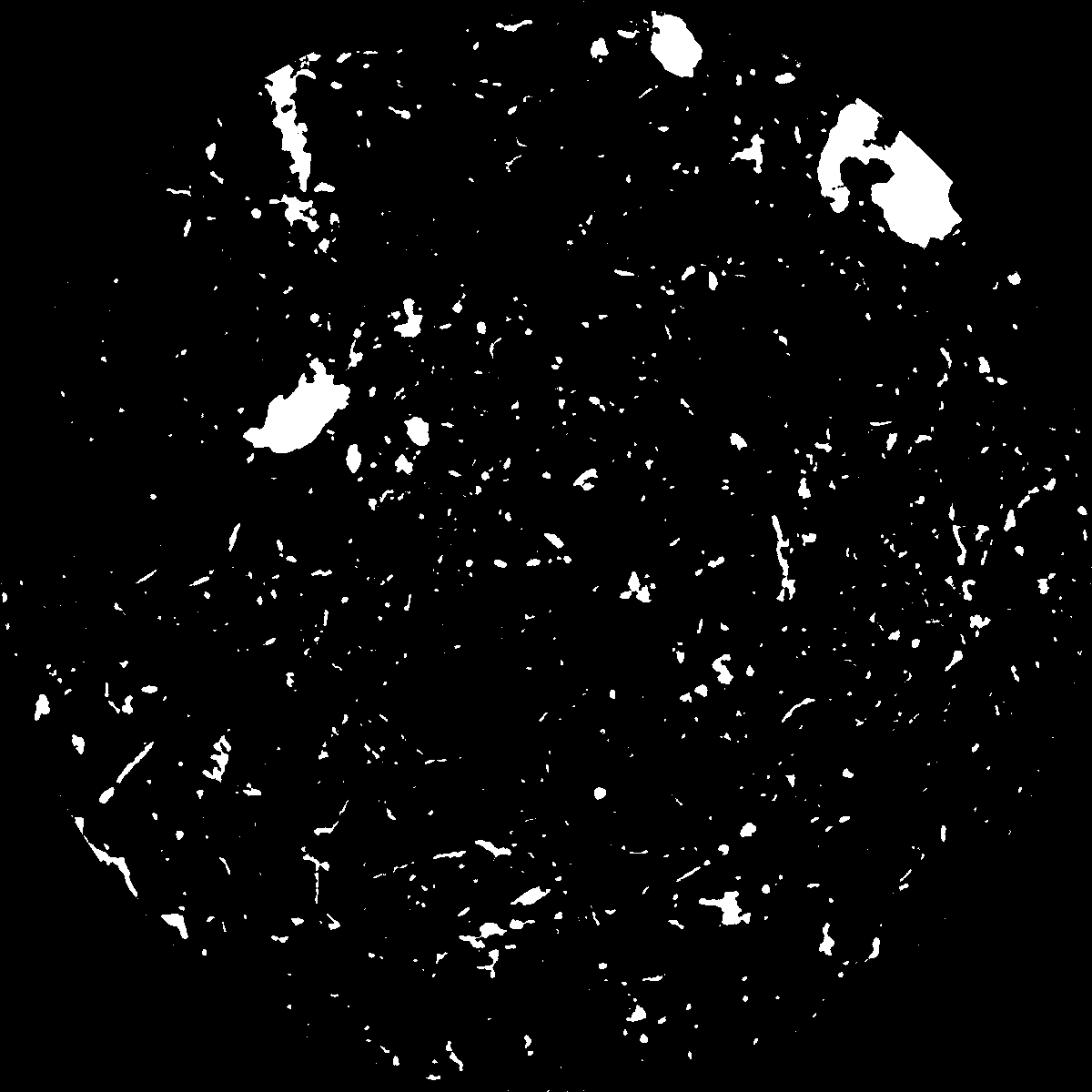
|
|---|
|
| XY Plane Grey |
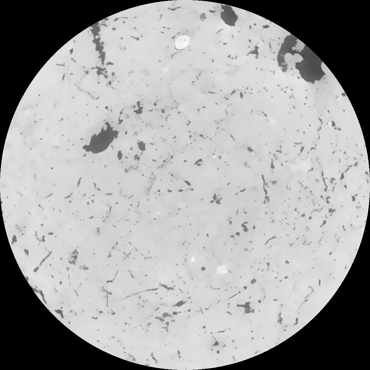
|
|---|
|
| Texture | clayey silt |
|---|
| Sand | 8.3 |
|---|
| Silt | 71.9 |
|---|
| Clay | 19.8 |
|---|
|
|
Results
| Porosity | Surface | Mean Curvature | Euler | MeanPoreSize | Gamma | PoreDist |
| 0.048466897 | 0.388771749 | 0.255398387 | 0.526489217 | 1.27457612168 | 0.571293501245 | 0.532593561 |
| Opening size | Volume | Surface | MeanCurvature | Euler number |
|---|
| 0.12 | 0.048466897 | 0.388771749 | 0.255398387 | 0.526489217 |
| 0.15 | 0.046283825 | 0.329871271 | 0.177694489 | 0.221956383 |
| 0.18 | 0.044686864 | 0.294015276 | 0.139335919 | 0.137999633 |
| 0.21 | 0.04315634 | 0.265715481 | 0.116123072 | 0.112046673 |
| 0.24 | 0.042453805 | 0.254807713 | 0.111564846 | 0.131843977 |
| 0.27 | 0.037959063 | 0.187961299 | 0.065287254 | 0.062093514 |
| 0.3 | 0.03618886 | 0.16587235 | 0.053365391 | 0.051537521 |
| 0.36 | 0.033688512 | 0.137012043 | 0.039750157 | 0.037437179 |
| 0.42 | 0.029925632 | 0.099026274 | 0.022102105 | 0.017154694 |
| 0.48 | 0.028036835 | 0.0828319 | 0.015927313 | 0.010770292 |
| 0.54 | 0.025753514 | 0.066043199 | 0.010199916 | 0.006309759 |
| 0.6 | 0.024709922 | 0.059223401 | 0.008305079 | 0.004169184 |
| 0.66 | 0.023073176 | 0.049982736 | 0.005941359 | 0.003259019 |
| 0.72 | 0.022270962 | 0.045569925 | 0.004941591 | 0.002018978 |
| 0.78 | 0.021289939 | 0.041138189 | 0.004062337 | 0.001624092 |
| 0.84 | 0.020802891 | 0.038866886 | 0.003649274 | 0.001067879 |
| 0.9 | 0.01992579 | 0.035502177 | 0.003089468 | 0.000936652 |
| 1.2 | 0.016987421 | 0.025815203 | 0.001786559 | 0.000534542 |
| 1.5 | 0.014854507 | 0.020554184 | 0.001267812 | 0.00033469 |
| 1.8 | 0.013065907 | 0.016948328 | 0.00097633 | 0.000168549 |
| 2.1 | 0.011183715 | 0.013811211 | 0.000782423 | 0.0001842 |
| 2.7 | 0.007354898 | 0.008036993 | 0.000420703 | 0.000066216 |
| 3.3 | 0.004387324 | 0.004122517 | 0.000187041 | 0.000030098 |
| 3.9 | 0.003008978 | 0.002636083 | 0.00011319 | 0.000022875 |
| 4.5 | 0.002038633 | 0.001694294 | 0.000070527 | 0.000010835 |
| 5.1 | 0.001261731 | 0.001005673 | 0.000040432 | 0.000004816 |
| 5.7 | 0.000847535 | 0.000737326 | 0.000033718 | 0.000004816 |
| 6.3 | 0.000318636 | 0.000302885 | 0.000015234 | 0.000002408 |
| 6.9 | 0.0 | 0.0 | 0.0 | 0.0 |
| 7.5 | 0.0 | 0.0 | 0.0 | 0.0 |
| 8.1 | 0.0 | 0.0 | 0.0 | 0.0 |
| 8.7 | 0.0 | 0.0 | 0.0 | 0.0 |
| 9.3 | 0.0 | 0.0 | 0.0 | 0.0 |
| 9.9 | 0.0 | 0.0 | 0.0 | 0.0 |
Reference: An open Soil Structure Library based on X-ray CT data
 Soil Structure Library