General Information
Internal Identifier Ad_2_B_1_o
| Soil Type | Haplic Luvisol |
|---|
| Classification | WRB |
|---|
|
| Location | Adenstedt |
|---|
| Latitude | 52.00772222 |
|---|
| Longitude | 9.939417 |
|---|
|
| Landuse | Cropland |
|---|
| Tillage | tillage |
|---|
| Crop | winter wheat, sugarbeets, winter wheat, silage mais |
|---|
|
| Sampling Depth | 15.0 |
|---|
| Sampling Date | March 24, 2021 |
|---|
| Voxel size | 0.06 |
|---|
| Pores white? | True |
|---|
|
| XY Plane |
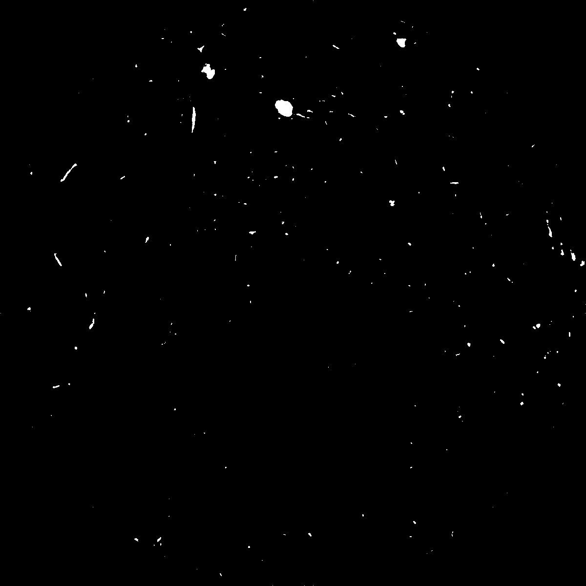
|
|---|
|
| XY Plane Grey |
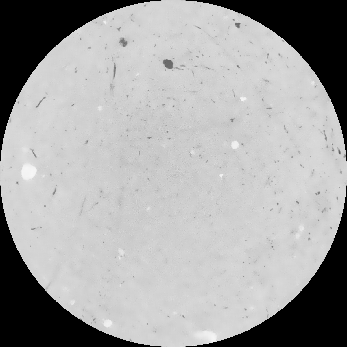
|
|---|
|
| Texture | clayey silt |
|---|
| Sand | 8.3 |
|---|
| Silt | 71.9 |
|---|
| Clay | 19.8 |
|---|
|
|
Results
| Porosity | Surface | Mean Curvature | Euler | MeanPoreSize | Gamma | PoreDist |
| 0.008278486 | 0.093168538 | 0.077681432 | 0.238039946 | 0.81554927388 | 0.065807397705 | 1.132959754 |
| Opening size | Volume | Surface | MeanCurvature | Euler number |
|---|
| 0.12 | 0.008278486 | 0.093168538 | 0.077681432 | 0.238039946 |
| 0.15 | 0.007523639 | 0.071345307 | 0.04478229 | 0.080630557 |
| 0.18 | 0.007023738 | 0.060077556 | 0.032386783 | 0.045720861 |
| 0.21 | 0.006605211 | 0.052299317 | 0.025816146 | 0.034744786 |
| 0.24 | 0.006417461 | 0.049417458 | 0.024583491 | 0.038351065 |
| 0.27 | 0.005310877 | 0.032732869 | 0.012487508 | 0.014917286 |
| 0.3 | 0.004928002 | 0.027983596 | 0.009888281 | 0.011731591 |
| 0.36 | 0.004429621 | 0.022226384 | 0.0071206 | 0.007767369 |
| 0.42 | 0.003702935 | 0.014856944 | 0.003638638 | 0.00322916 |
| 0.48 | 0.003373675 | 0.012023762 | 0.00252189 | 0.001888151 |
| 0.54 | 0.00299818 | 0.009282802 | 0.001584668 | 0.001062324 |
| 0.6 | 0.002841933 | 0.008294887 | 0.001320505 | 0.000690319 |
| 0.66 | 0.002583024 | 0.006885803 | 0.000984733 | 0.000572709 |
| 0.72 | 0.002447436 | 0.006143366 | 0.000816222 | 0.000361778 |
| 0.78 | 0.002284112 | 0.00543409 | 0.000691665 | 0.000327262 |
| 0.84 | 0.002202158 | 0.005058446 | 0.000625212 | 0.000221158 |
| 0.9 | 0.002039769 | 0.004406589 | 0.000513137 | 0.000216044 |
| 1.2 | 0.001544205 | 0.00260508 | 0.000221975 | 0.00007798 |
| 1.5 | 0.001240117 | 0.001793934 | 0.000129939 | 0.000053691 |
| 1.8 | 0.00105062 | 0.001339505 | 0.000079324 | 0.000025567 |
| 2.1 | 0.000929601 | 0.001104137 | 0.000056828 | 0.000012784 |
| 2.7 | 0.000764286 | 0.000912517 | 0.000051135 | 0.00000767 |
| 3.3 | 0.000523422 | 0.000647189 | 0.000040659 | 0.00000767 |
| 3.9 | 0.000213624 | 0.000298997 | 0.000022165 | 0.000005113 |
| 4.5 | 0.0 | 0.0 | 0.0 | 0.0 |
| 5.1 | 0.0 | 0.0 | 0.0 | 0.0 |
| 5.7 | 0.0 | 0.0 | 0.0 | 0.0 |
| 6.3 | 0.0 | 0.0 | 0.0 | 0.0 |
| 6.9 | 0.0 | 0.0 | 0.0 | 0.0 |
| 7.5 | 0.0 | 0.0 | 0.0 | 0.0 |
| 8.1 | 0.0 | 0.0 | 0.0 | 0.0 |
| 8.7 | 0.0 | 0.0 | 0.0 | 0.0 |
| 9.3 | 0.0 | 0.0 | 0.0 | 0.0 |
| 9.9 | 0.0 | 0.0 | 0.0 | 0.0 |
Reference: An open Soil Structure Library based on X-ray CT data
 Soil Structure Library