General Information
Internal Identifier Ad_2_B_2_o
| Soil Type | Haplic Luvisol |
|---|
| Classification | WRB |
|---|
|
| Location | Adenstedt |
|---|
| Latitude | 52.00772222 |
|---|
| Longitude | 9.939417 |
|---|
|
| Landuse | Cropland |
|---|
| Tillage | tillage |
|---|
| Crop | winter wheat, sugarbeets, winter wheat, silage mais |
|---|
|
| Sampling Depth | 15.0 |
|---|
| Sampling Date | March 24, 2021 |
|---|
| Voxel size | 0.06 |
|---|
| Pores white? | True |
|---|
|
| XY Plane |
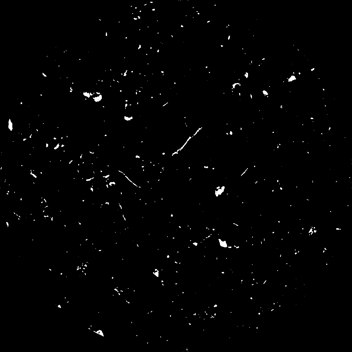
|
|---|
|
| XY Plane Grey |
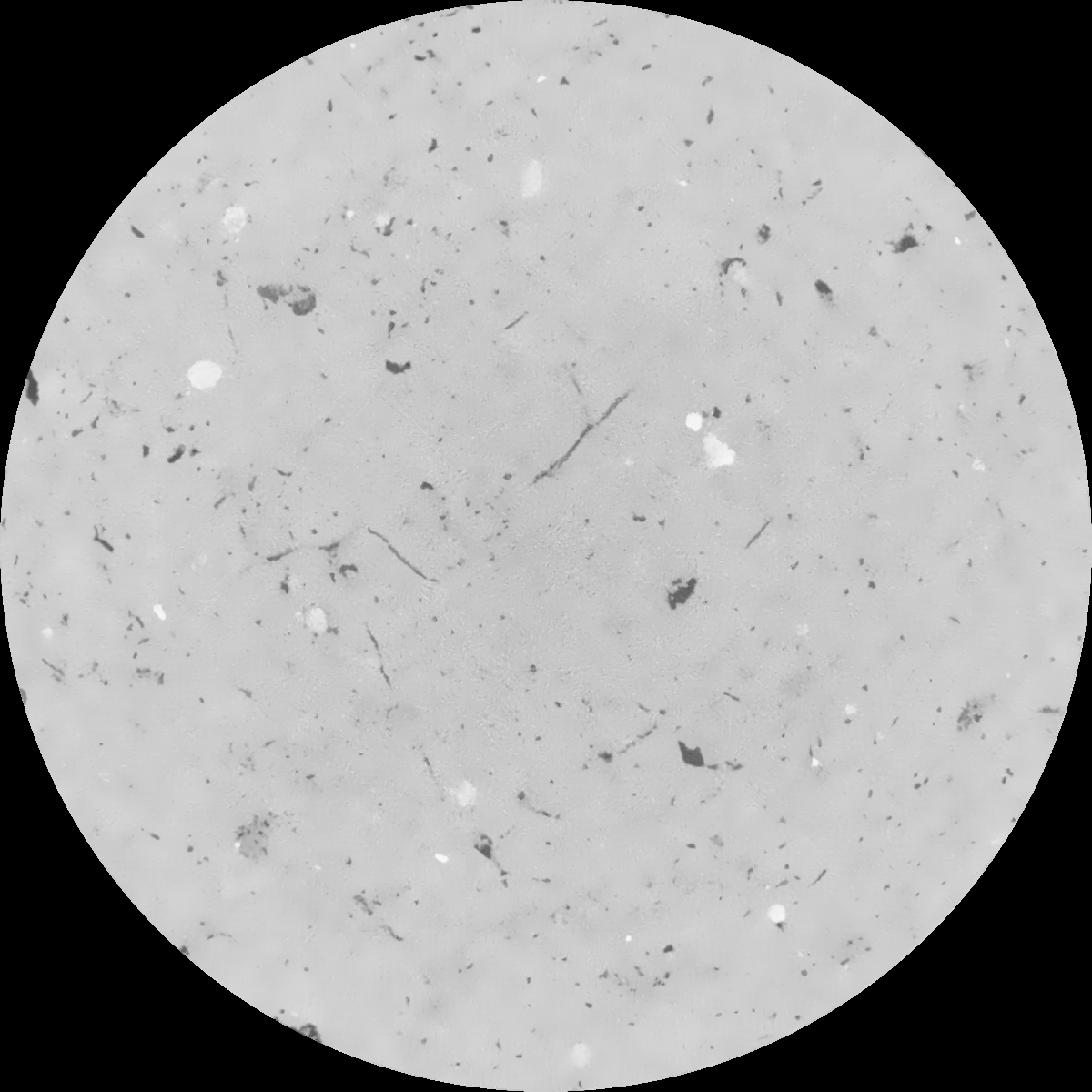
|
|---|
|
| Texture | clayey silt |
|---|
| Sand | 8.3 |
|---|
| Silt | 71.9 |
|---|
| Clay | 19.8 |
|---|
|
|
Results
| Porosity | Surface | Mean Curvature | Euler | MeanPoreSize | Gamma | PoreDist |
| 0.019859659 | 0.182297014 | 0.127041716 | 0.307277041 | 1.05779728528 | 0.241840310937 | 1.079207619 |
| Opening size | Volume | Surface | MeanCurvature | Euler number |
|---|
| 0.12 | 0.019859659 | 0.182297014 | 0.127041716 | 0.307277041 |
| 0.15 | 0.018720922 | 0.150410016 | 0.083102245 | 0.121239221 |
| 0.18 | 0.0178854 | 0.131669418 | 0.062887692 | 0.072083383 |
| 0.21 | 0.017123332 | 0.117546129 | 0.051114783 | 0.055600095 |
| 0.24 | 0.016784073 | 0.112307944 | 0.048927636 | 0.063742027 |
| 0.27 | 0.014718174 | 0.081779023 | 0.027703272 | 0.027732933 |
| 0.3 | 0.013912012 | 0.071886227 | 0.022433559 | 0.022032687 |
| 0.36 | 0.012833238 | 0.059622444 | 0.016849076 | 0.015435025 |
| 0.42 | 0.01116925 | 0.043514425 | 0.009813214 | 0.007153752 |
| 0.48 | 0.01030061 | 0.036429226 | 0.00735107 | 0.004735078 |
| 0.54 | 0.009201071 | 0.028770772 | 0.004993332 | 0.003174829 |
| 0.6 | 0.008687831 | 0.02556756 | 0.00418187 | 0.002269744 |
| 0.66 | 0.007834868 | 0.02090448 | 0.003065887 | 0.001836377 |
| 0.72 | 0.00739732 | 0.018537562 | 0.002541606 | 0.001193357 |
| 0.78 | 0.006837602 | 0.015996433 | 0.002044429 | 0.000953663 |
| 0.84 | 0.006568354 | 0.014748517 | 0.001821396 | 0.000723557 |
| 0.9 | 0.00607361 | 0.012716798 | 0.001441989 | 0.000524131 |
| 1.2 | 0.004704285 | 0.007945541 | 0.000727432 | 0.000248004 |
| 1.5 | 0.003789586 | 0.005454873 | 0.000422028 | 0.000126559 |
| 1.8 | 0.003129873 | 0.003933729 | 0.000270955 | 0.000092043 |
| 2.1 | 0.00260406 | 0.002836083 | 0.000158252 | 0.000048578 |
| 2.7 | 0.001952233 | 0.00171436 | 0.000065034 | 0.00000767 |
| 3.3 | 0.001749642 | 0.0014397 | 0.000048423 | 0.000017897 |
| 3.9 | 0.001634883 | 0.001351602 | 0.000047487 | 0.000002557 |
| 4.5 | 0.001430844 | 0.001210964 | 0.000045312 | 0.000002557 |
| 5.1 | 0.00095977 | 0.00094172 | 0.000045682 | 0.000005113 |
| 5.7 | 0.0 | 0.0 | 0.0 | 0.0 |
| 6.3 | 0.0 | 0.0 | 0.0 | 0.0 |
| 6.9 | 0.0 | 0.0 | 0.0 | 0.0 |
| 7.5 | 0.0 | 0.0 | 0.0 | 0.0 |
| 8.1 | 0.0 | 0.0 | 0.0 | 0.0 |
| 8.7 | 0.0 | 0.0 | 0.0 | 0.0 |
| 9.3 | 0.0 | 0.0 | 0.0 | 0.0 |
| 9.9 | 0.0 | 0.0 | 0.0 | 0.0 |
Reference: An open Soil Structure Library based on X-ray CT data
 Soil Structure Library