General Information
Internal Identifier Ad_2_B_3_o
| Soil Type | Haplic Luvisol |
|---|
| Classification | WRB |
|---|
|
| Location | Adenstedt |
|---|
| Latitude | 52.00772222 |
|---|
| Longitude | 9.939417 |
|---|
|
| Landuse | Cropland |
|---|
| Tillage | tillage |
|---|
| Crop | winter wheat, sugarbeets, winter wheat, silage mais |
|---|
|
| Sampling Depth | 15.0 |
|---|
| Sampling Date | March 24, 2021 |
|---|
| Voxel size | 0.06 |
|---|
| Pores white? | True |
|---|
|
| XY Plane |
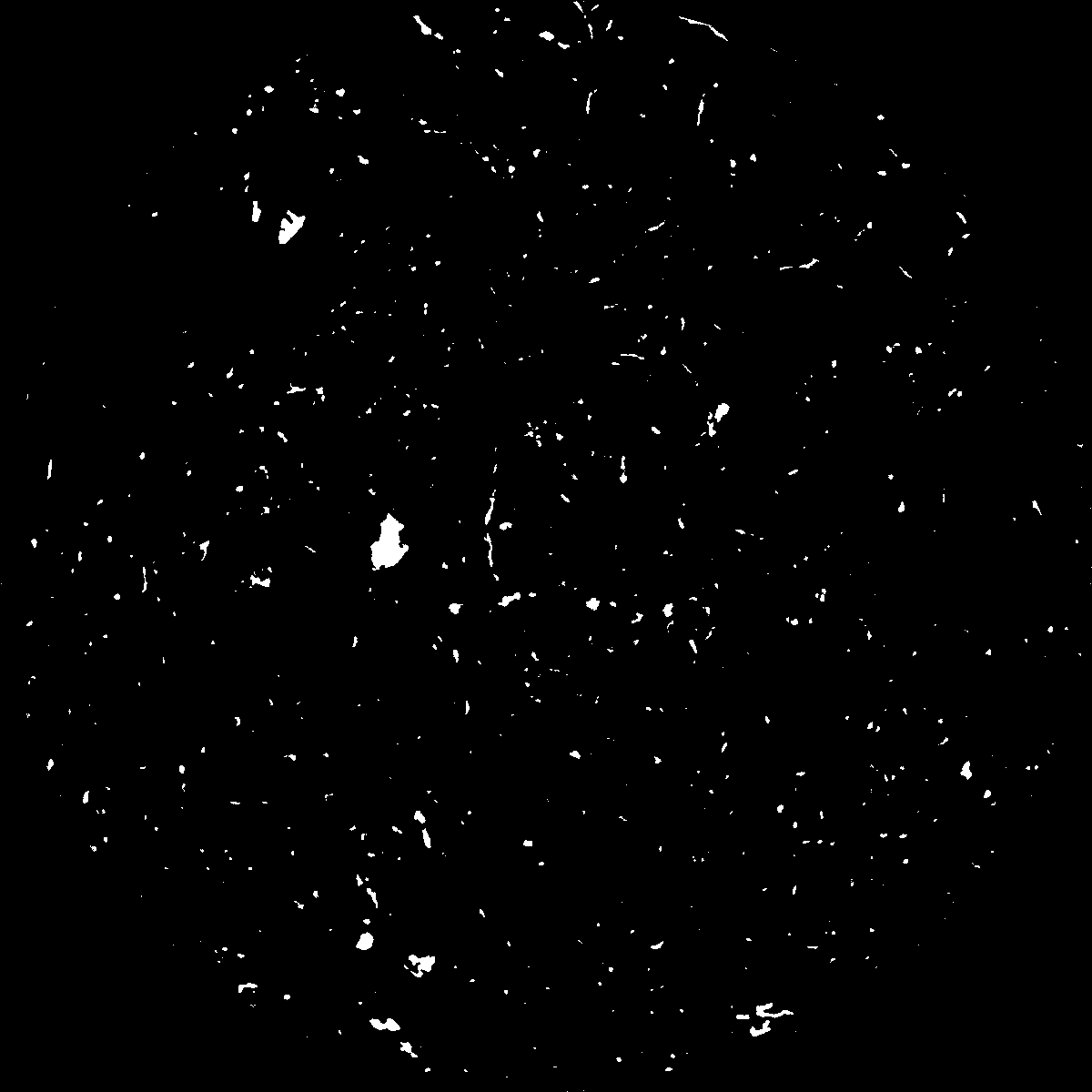
|
|---|
|
| XY Plane Grey |
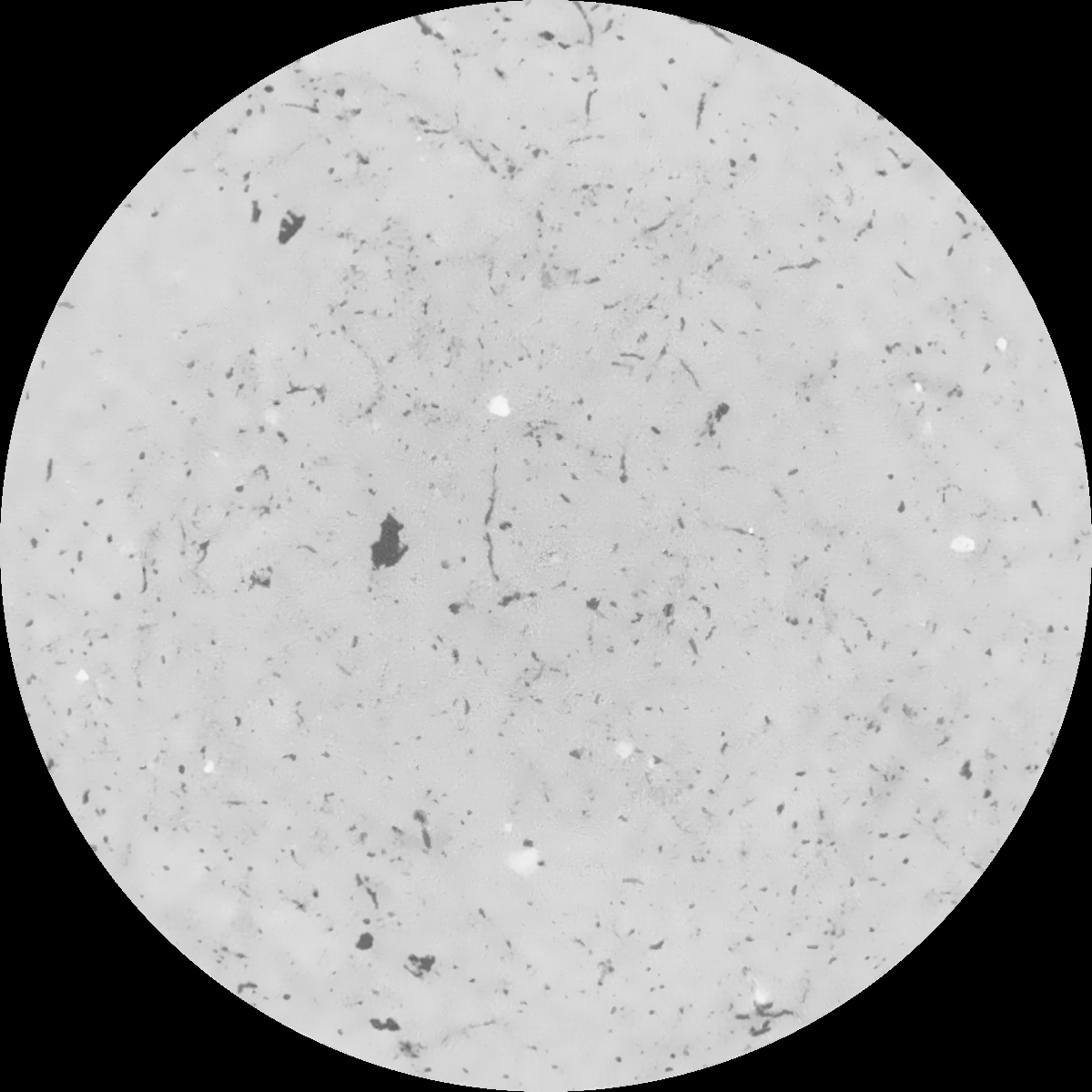
|
|---|
|
| Texture | clayey silt |
|---|
| Sand | 8.3 |
|---|
| Silt | 71.9 |
|---|
| Clay | 19.8 |
|---|
|
|
Results
| Porosity | Surface | Mean Curvature | Euler | MeanPoreSize | Gamma | PoreDist |
| 0.023162842 | 0.173379776 | 0.124273575 | 0.332737035 | 1.55594759871 | 0.399650934353 | 0.887693232 |
| Opening size | Volume | Surface | MeanCurvature | Euler number |
|---|
| 0.12 | 0.023162842 | 0.173379776 | 0.124273575 | 0.332737035 |
| 0.15 | 0.022016747 | 0.140700254 | 0.077413968 | 0.120531644 |
| 0.18 | 0.021237433 | 0.122976185 | 0.057746092 | 0.069739494 |
| 0.21 | 0.020541716 | 0.109944056 | 0.046659494 | 0.053423673 |
| 0.24 | 0.020232525 | 0.105130068 | 0.044560459 | 0.060779407 |
| 0.27 | 0.018342009 | 0.076783623 | 0.024352212 | 0.025007451 |
| 0.3 | 0.017632005 | 0.067960147 | 0.019533466 | 0.019672818 |
| 0.36 | 0.016671146 | 0.056954136 | 0.014438238 | 0.013830672 |
| 0.42 | 0.015207139 | 0.042610613 | 0.008020163 | 0.005938023 |
| 0.48 | 0.014447872 | 0.036365427 | 0.005791978 | 0.003565371 |
| 0.54 | 0.01351705 | 0.02993926 | 0.003836946 | 0.002240981 |
| 0.6 | 0.013091519 | 0.027289305 | 0.003173898 | 0.001550661 |
| 0.66 | 0.012394142 | 0.023698857 | 0.002385108 | 0.001300101 |
| 0.72 | 0.012052808 | 0.021999715 | 0.002080529 | 0.000800259 |
| 0.78 | 0.01156923 | 0.019995744 | 0.001753578 | 0.000769578 |
| 0.84 | 0.011334118 | 0.018980528 | 0.001599091 | 0.000499842 |
| 0.9 | 0.010841956 | 0.017134059 | 0.001312561 | 0.000424418 |
| 1.2 | 0.009454931 | 0.012889013 | 0.000831448 | 0.000278684 |
| 1.5 | 0.008346497 | 0.010230894 | 0.000593378 | 0.000219879 |
| 1.8 | 0.007480557 | 0.008485415 | 0.00045444 | 0.000111218 |
| 2.1 | 0.006561106 | 0.006829842 | 0.00032195 | 0.000083094 |
| 2.7 | 0.005330738 | 0.005146262 | 0.000224115 | 0.000035794 |
| 3.3 | 0.004011765 | 0.003648993 | 0.000150772 | 0.000019176 |
| 3.9 | 0.002904269 | 0.002564113 | 0.000106897 | 0.000016619 |
| 4.5 | 0.002158904 | 0.001995503 | 0.000090087 | 0.000010227 |
| 5.1 | 0.000779067 | 0.000717292 | 0.000034567 | 0.000005113 |
| 5.7 | 0.000368084 | 0.000342754 | 0.00001682 | 0.000002557 |
| 6.3 | 0.0 | 0.0 | 0.0 | 0.0 |
| 6.9 | 0.0 | 0.0 | 0.0 | 0.0 |
| 7.5 | 0.0 | 0.0 | 0.0 | 0.0 |
| 8.1 | 0.0 | 0.0 | 0.0 | 0.0 |
| 8.7 | 0.0 | 0.0 | 0.0 | 0.0 |
| 9.3 | 0.0 | 0.0 | 0.0 | 0.0 |
| 9.9 | 0.0 | 0.0 | 0.0 | 0.0 |
Reference: An open Soil Structure Library based on X-ray CT data
 Soil Structure Library