General Information
Internal Identifier Ad_2_B_1_u
| Soil Type | Haplic Luvisol |
|---|
| Classification | WRB |
|---|
|
| Location | Adenstedt |
|---|
| Latitude | 52.00772222 |
|---|
| Longitude | 9.939417 |
|---|
|
| Landuse | Cropland |
|---|
| Tillage | tillage |
|---|
| Crop | winter wheat, sugarbeets, winter wheat, silage mais |
|---|
|
| Sampling Depth | 25.0 |
|---|
| Sampling Date | March 24, 2021 |
|---|
| Voxel size | 0.06 |
|---|
| Pores white? | True |
|---|
|
| XY Plane |
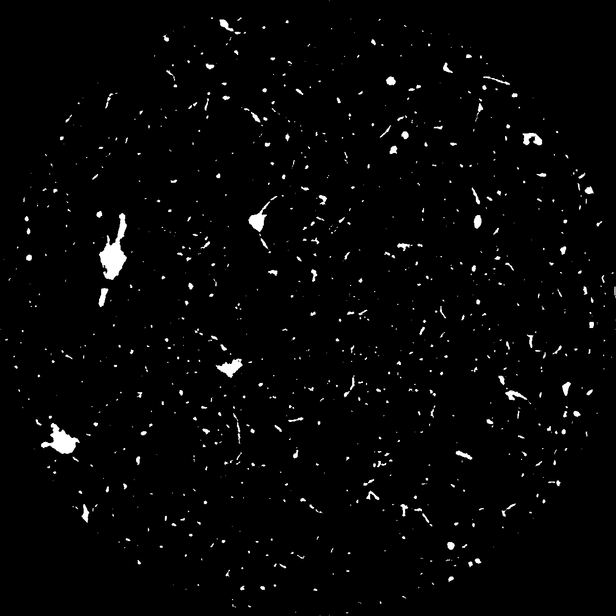
|
|---|
|
| XY Plane Grey |
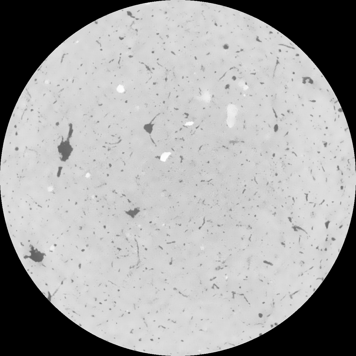
|
|---|
|
| Texture | clayey silt |
|---|
| Sand | 8.3 |
|---|
| Silt | 71.9 |
|---|
| Clay | 19.8 |
|---|
|
|
Results
| Porosity | Surface | Mean Curvature | Euler | MeanPoreSize | Gamma | PoreDist |
| 0.02849597 | 0.267768086 | 0.204494891 | 0.535496967 | 1.08650249111 | 0.373513859351 | 0.574554952 |
| Opening size | Volume | Surface | MeanCurvature | Euler number |
|---|
| 0.12 | 0.02849597 | 0.267768086 | 0.204494891 | 0.535496967 |
| 0.15 | 0.026618436 | 0.215616368 | 0.130882735 | 0.213887693 |
| 0.18 | 0.025371645 | 0.186883154 | 0.098341653 | 0.130094075 |
| 0.21 | 0.024234148 | 0.165178318 | 0.079209801 | 0.099509624 |
| 0.24 | 0.023731334 | 0.157237114 | 0.075532977 | 0.11152116 |
| 0.27 | 0.020664314 | 0.109529446 | 0.039563602 | 0.04445063 |
| 0.3 | 0.019586834 | 0.095689876 | 0.031540782 | 0.034521278 |
| 0.36 | 0.018139305 | 0.07853454 | 0.022892706 | 0.023087625 |
| 0.42 | 0.016063252 | 0.057334842 | 0.012659951 | 0.009535067 |
| 0.48 | 0.015012259 | 0.048409941 | 0.009293939 | 0.005935339 |
| 0.54 | 0.013727177 | 0.03915642 | 0.006232958 | 0.003718917 |
| 0.6 | 0.013134957 | 0.035330672 | 0.005180872 | 0.002439147 |
| 0.66 | 0.012174898 | 0.030134359 | 0.003937822 | 0.002126127 |
| 0.72 | 0.011662957 | 0.027398739 | 0.003363175 | 0.001330335 |
| 0.78 | 0.01100212 | 0.024505696 | 0.002829389 | 0.001200311 |
| 0.84 | 0.010639525 | 0.022839596 | 0.002545507 | 0.000803016 |
| 0.9 | 0.009985836 | 0.020299891 | 0.002129113 | 0.000734393 |
| 1.2 | 0.007963189 | 0.013377877 | 0.001140572 | 0.000362381 |
| 1.5 | 0.006437956 | 0.009332647 | 0.000689074 | 0.000225134 |
| 1.8 | 0.005158545 | 0.006476967 | 0.000414172 | 0.000102333 |
| 2.1 | 0.004136263 | 0.004479256 | 0.000235847 | 0.000056584 |
| 2.7 | 0.003261465 | 0.003123094 | 0.000136655 | 0.000018059 |
| 3.3 | 0.002590691 | 0.002362199 | 0.000099173 | 0.000010835 |
| 3.9 | 0.001877279 | 0.001685491 | 0.000074723 | 0.000014447 |
| 4.5 | 0.001303135 | 0.00115348 | 0.000051938 | 0.000007224 |
| 5.1 | 0.000693353 | 0.000653879 | 0.000032037 | 0.000004816 |
| 5.7 | 0.0 | 0.0 | 0.0 | 0.0 |
| 6.3 | 0.0 | 0.0 | 0.0 | 0.0 |
| 6.9 | 0.0 | 0.0 | 0.0 | 0.0 |
| 7.5 | 0.0 | 0.0 | 0.0 | 0.0 |
| 8.1 | 0.0 | 0.0 | 0.0 | 0.0 |
| 8.7 | 0.0 | 0.0 | 0.0 | 0.0 |
| 9.3 | 0.0 | 0.0 | 0.0 | 0.0 |
| 9.9 | 0.0 | 0.0 | 0.0 | 0.0 |
Reference: An open Soil Structure Library based on X-ray CT data
 Soil Structure Library