General Information
Internal Identifier Ad_2_A_2_u
| Soil Type | Haplic Luvisol |
|---|
| Classification | WRB |
|---|
|
| Location | Adenstedt |
|---|
| Latitude | 52.00772222 |
|---|
| Longitude | 9.939417 |
|---|
|
| Landuse | Cropland |
|---|
| Tillage | tillage |
|---|
| Crop | winter wheat, sugarbeets, winter wheat, silage mais |
|---|
|
| Sampling Depth | 10.0 |
|---|
| Sampling Date | March 24, 2021 |
|---|
| Voxel size | 0.06 |
|---|
| Pores white? | True |
|---|
|
| XY Plane |
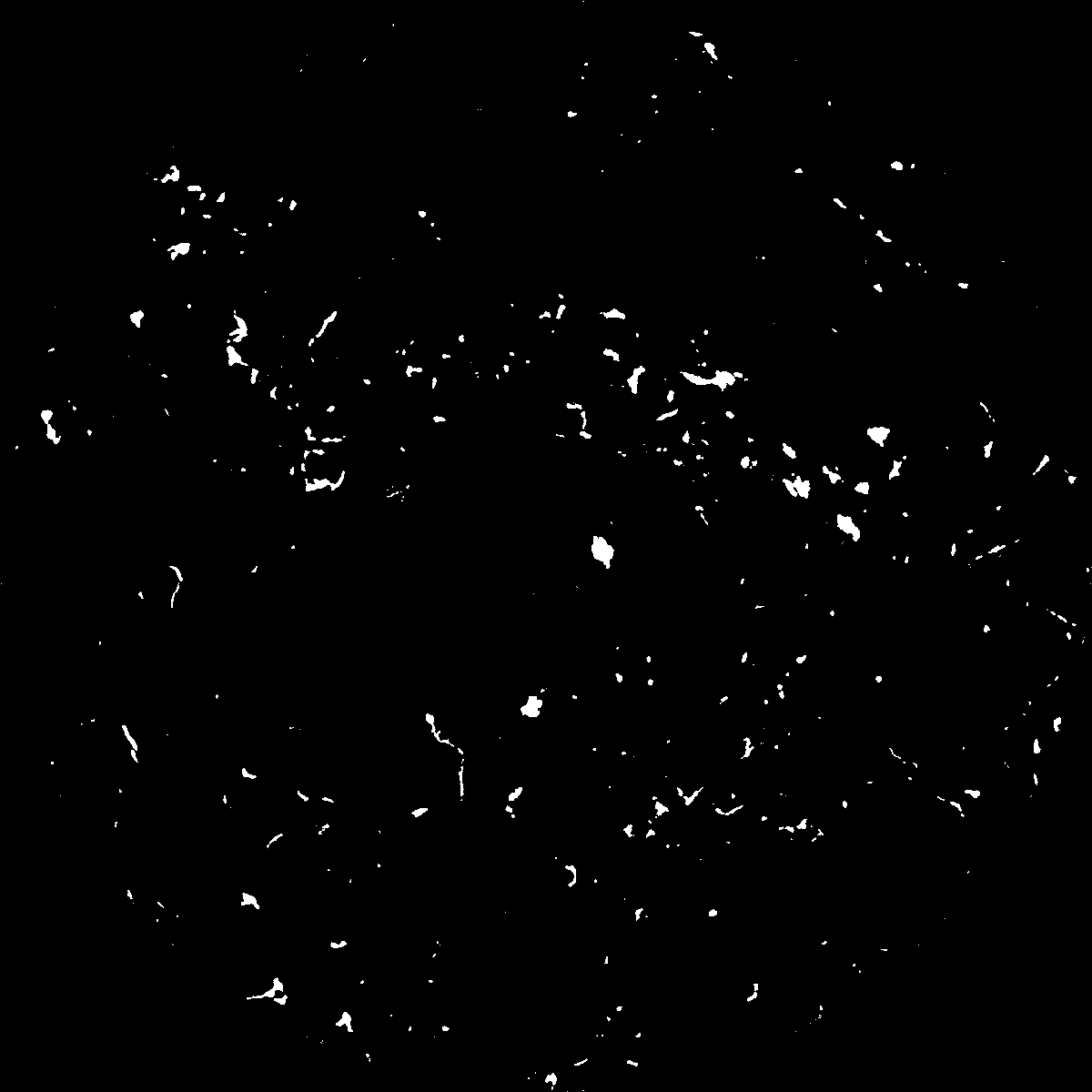
|
|---|
|
| XY Plane Grey |
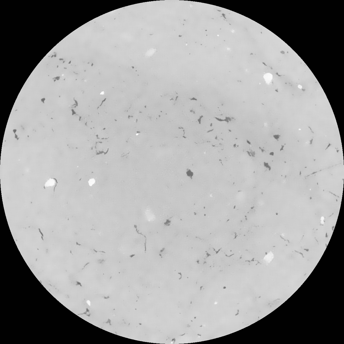
|
|---|
|
| Texture | clayey silt |
|---|
| Sand | 8.3 |
|---|
| Silt | 71.9 |
|---|
| Clay | 19.8 |
|---|
|
|
Results
| Porosity | Surface | Mean Curvature | Euler | MeanPoreSize | Gamma | PoreDist |
| 0.011473777 | 0.131317663 | 0.089251204 | 0.218873137 | 0.509524380551 | 0.00949723809318 | 1.010501152 |
| Opening size | Volume | Surface | MeanCurvature | Euler number |
|---|
| 0.12 | 0.011473777 | 0.131317663 | 0.089251204 | 0.218873137 |
| 0.15 | 0.010673971 | 0.109046675 | 0.059262806 | 0.089403296 |
| 0.18 | 0.0100739 | 0.096427753 | 0.047023645 | 0.056933502 |
| 0.21 | 0.009480462 | 0.086135597 | 0.039418582 | 0.0461295 |
| 0.24 | 0.009190687 | 0.081876005 | 0.037954786 | 0.051591697 |
| 0.27 | 0.007349554 | 0.056325032 | 0.021866448 | 0.024664763 |
| 0.3 | 0.006602069 | 0.047627221 | 0.017699996 | 0.020328234 |
| 0.36 | 0.00563129 | 0.036819317 | 0.012931585 | 0.014054593 |
| 0.42 | 0.004180259 | 0.022589147 | 0.006595074 | 0.006261602 |
| 0.48 | 0.003510944 | 0.016888037 | 0.004407128 | 0.00379958 |
| 0.54 | 0.002786021 | 0.011435917 | 0.002476793 | 0.002026202 |
| 0.6 | 0.002507693 | 0.009537122 | 0.001879098 | 0.001229205 |
| 0.66 | 0.002099661 | 0.00718788 | 0.001255659 | 0.000860805 |
| 0.72 | 0.001914828 | 0.006129885 | 0.000984649 | 0.000518891 |
| 0.78 | 0.0016934 | 0.005071107 | 0.000752254 | 0.0004298 |
| 0.84 | 0.001596374 | 0.004613452 | 0.000666602 | 0.000296165 |
| 0.9 | 0.001422909 | 0.003866203 | 0.000513088 | 0.000225134 |
| 1.2 | 0.000976611 | 0.002216634 | 0.00023374 | 0.000078255 |
| 1.5 | 0.000719173 | 0.001520526 | 0.000148722 | 0.000054177 |
| 1.8 | 0.000373086 | 0.000669717 | 0.00005536 | 0.000012039 |
| 2.1 | 0.000271492 | 0.000498506 | 0.000043743 | 0.000004816 |
| 2.7 | 0.000041344 | 0.000078871 | 0.000007851 | 0.000002408 |
| 3.3 | 0.0 | 0.0 | 0.0 | 0.0 |
| 3.9 | 0.0 | 0.0 | 0.0 | 0.0 |
| 4.5 | 0.0 | 0.0 | 0.0 | 0.0 |
| 5.1 | 0.0 | 0.0 | 0.0 | 0.0 |
| 5.7 | 0.0 | 0.0 | 0.0 | 0.0 |
| 6.3 | 0.0 | 0.0 | 0.0 | 0.0 |
| 6.9 | 0.0 | 0.0 | 0.0 | 0.0 |
| 7.5 | 0.0 | 0.0 | 0.0 | 0.0 |
| 8.1 | 0.0 | 0.0 | 0.0 | 0.0 |
| 8.7 | 0.0 | 0.0 | 0.0 | 0.0 |
| 9.3 | 0.0 | 0.0 | 0.0 | 0.0 |
| 9.9 | 0.0 | 0.0 | 0.0 | 0.0 |
Reference: An open Soil Structure Library based on X-ray CT data
 Soil Structure Library