General Information
Internal Identifier Ad_2_B_2_u
| Soil Type | Haplic Luvisol |
|---|
| Classification | WRB |
|---|
|
| Location | Adenstedt |
|---|
| Latitude | 52.00772222 |
|---|
| Longitude | 9.939417 |
|---|
|
| Landuse | Cropland |
|---|
| Tillage | tillage |
|---|
| Crop | winter wheat, sugarbeets, winter wheat, silage mais |
|---|
|
| Sampling Depth | 25.0 |
|---|
| Sampling Date | March 24, 2021 |
|---|
| Voxel size | 0.06 |
|---|
| Pores white? | True |
|---|
|
| XY Plane |
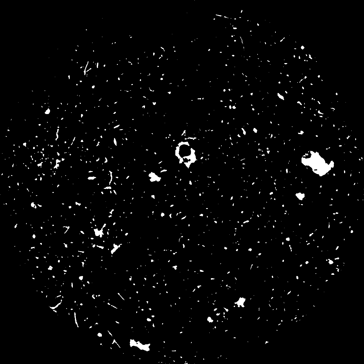
|
|---|
|
| XY Plane Grey |
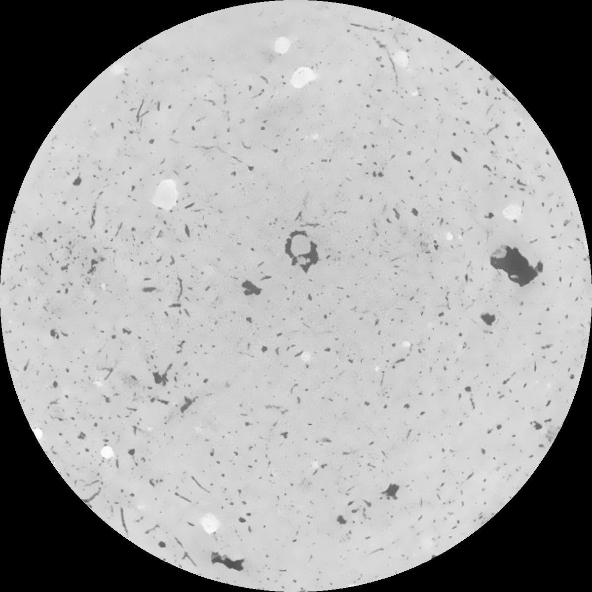
|
|---|
|
| Texture | clayey silt |
|---|
| Sand | 8.3 |
|---|
| Silt | 71.9 |
|---|
| Clay | 19.8 |
|---|
|
|
Results
| Porosity | Surface | Mean Curvature | Euler | MeanPoreSize | Gamma | PoreDist |
| 0.036169823 | 0.328065486 | 0.25497208 | 0.67396613 | 1.25721372163 | 0.282845604415 | 0.495492496 |
| Opening size | Volume | Surface | MeanCurvature | Euler number |
|---|
| 0.12 | 0.036169823 | 0.328065486 | 0.25497208 | 0.67396613 |
| 0.15 | 0.033825883 | 0.262754498 | 0.162181351 | 0.268966552 |
| 0.18 | 0.032171371 | 0.224441155 | 0.118529359 | 0.157019805 |
| 0.21 | 0.03070466 | 0.19646827 | 0.093946992 | 0.119054104 |
| 0.24 | 0.030084548 | 0.186655344 | 0.089385511 | 0.133873188 |
| 0.27 | 0.026375842 | 0.129046235 | 0.045980733 | 0.051806597 |
| 0.3 | 0.025074147 | 0.112289414 | 0.036275047 | 0.03999732 |
| 0.36 | 0.023378946 | 0.092167733 | 0.026094342 | 0.0263027 |
| 0.42 | 0.020980414 | 0.067747903 | 0.014407115 | 0.01111642 |
| 0.48 | 0.019774122 | 0.05753233 | 0.01056184 | 0.006917138 |
| 0.54 | 0.018266168 | 0.046664732 | 0.006955849 | 0.004101764 |
| 0.6 | 0.017591755 | 0.042314586 | 0.005781292 | 0.002750963 |
| 0.66 | 0.016494822 | 0.036406715 | 0.004383049 | 0.002462022 |
| 0.72 | 0.015937766 | 0.033462699 | 0.003776319 | 0.00155908 |
| 0.78 | 0.015178058 | 0.030089702 | 0.003139504 | 0.001391735 |
| 0.84 | 0.014814704 | 0.028420178 | 0.002843645 | 0.000923409 |
| 0.9 | 0.014121991 | 0.025773859 | 0.002405779 | 0.000811444 |
| 1.2 | 0.011900023 | 0.018352668 | 0.001378867 | 0.00046351 |
| 1.5 | 0.010156342 | 0.014001963 | 0.000949707 | 0.000296165 |
| 1.8 | 0.008758382 | 0.010954876 | 0.000673228 | 0.000175773 |
| 2.1 | 0.007607335 | 0.008695033 | 0.000457773 | 0.000098722 |
| 2.7 | 0.005839626 | 0.00605725 | 0.000289854 | 0.000046953 |
| 3.3 | 0.003844871 | 0.00369395 | 0.000178445 | 0.000031302 |
| 3.9 | 0.002715517 | 0.002298628 | 0.00009191 | 0.000016855 |
| 4.5 | 0.002134081 | 0.001850436 | 0.000079418 | 0.000009631 |
| 5.1 | 0.001252255 | 0.001115915 | 0.000051597 | 0.000007224 |
| 5.7 | 0.000750822 | 0.000684257 | 0.000032748 | 0.000004816 |
| 6.3 | 0.0 | 0.0 | 0.0 | 0.0 |
| 6.9 | 0.0 | 0.0 | 0.0 | 0.0 |
| 7.5 | 0.0 | 0.0 | 0.0 | 0.0 |
| 8.1 | 0.0 | 0.0 | 0.0 | 0.0 |
| 8.7 | 0.0 | 0.0 | 0.0 | 0.0 |
| 9.3 | 0.0 | 0.0 | 0.0 | 0.0 |
| 9.9 | 0.0 | 0.0 | 0.0 | 0.0 |
Reference: An open Soil Structure Library based on X-ray CT data
 Soil Structure Library