General Information
Internal Identifier Ad_2_A_3_u
| Soil Type | Haplic Luvisol |
|---|
| Classification | WRB |
|---|
|
| Location | Adenstedt |
|---|
| Latitude | 52.00772222 |
|---|
| Longitude | 9.939417 |
|---|
|
| Landuse | Cropland |
|---|
| Tillage | tillage |
|---|
| Crop | winter wheat, sugarbeets, winter wheat, silage mais |
|---|
|
| Sampling Depth | 10.0 |
|---|
| Sampling Date | March 24, 2021 |
|---|
| Voxel size | 0.06 |
|---|
| Pores white? | True |
|---|
|
| XY Plane |
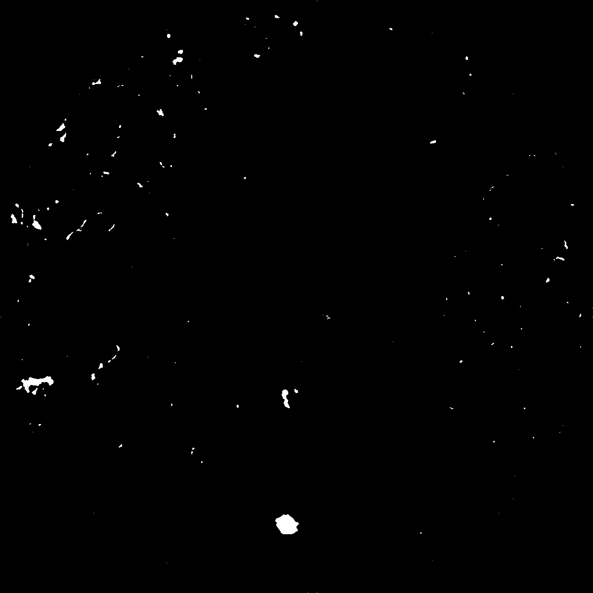
|
|---|
|
| XY Plane Grey |
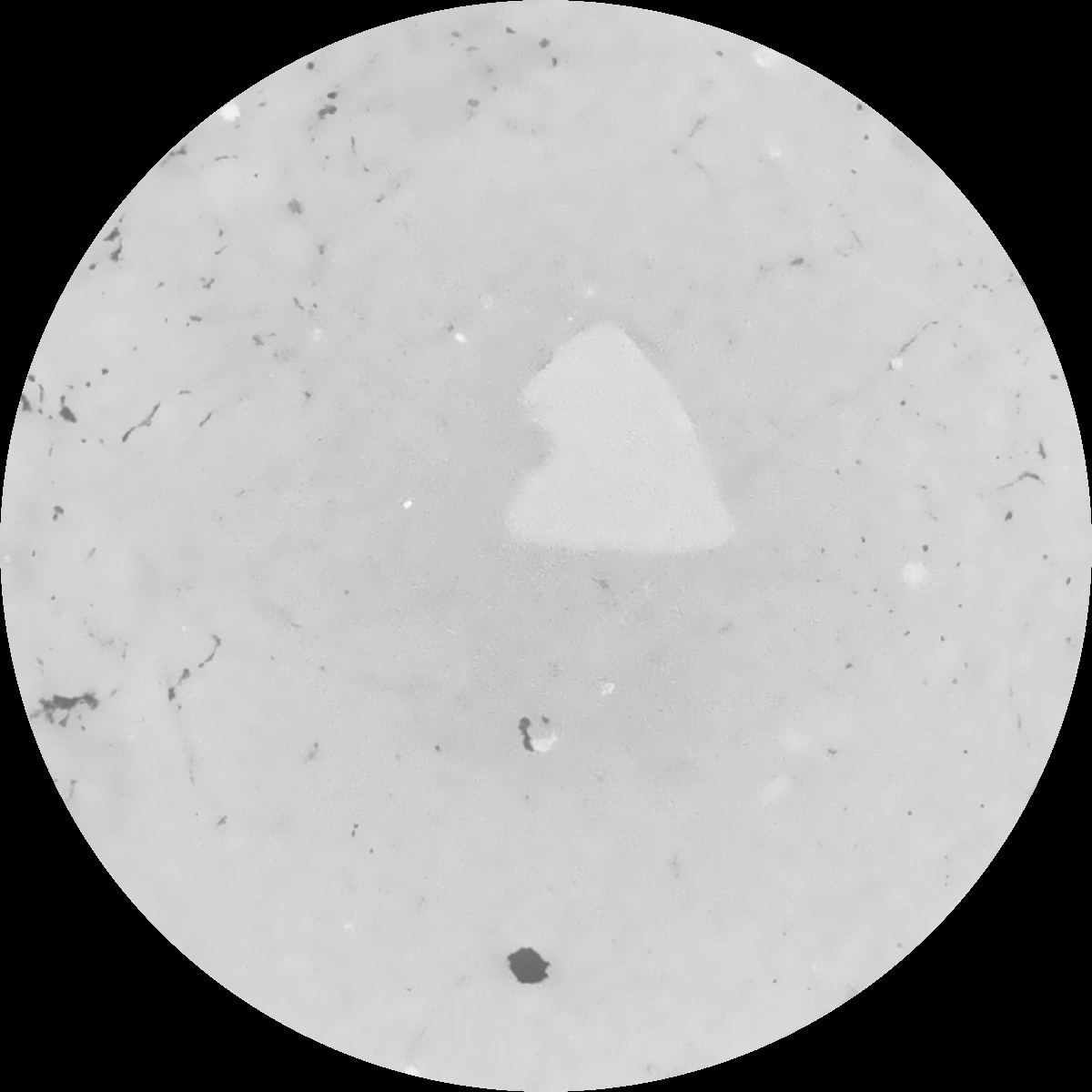
|
|---|
|
| Texture | clayey silt |
|---|
| Sand | 8.3 |
|---|
| Silt | 71.9 |
|---|
| Clay | 19.8 |
|---|
|
|
Results
| Porosity | Surface | Mean Curvature | Euler | MeanPoreSize | Gamma | PoreDist |
| 0.007818856 | 0.064967544 | 0.044127964 | 0.12141921 | 1.07454534309 | 0.0724957277188 | 1.413888154 |
| Opening size | Volume | Surface | MeanCurvature | Euler number |
|---|
| 0.12 | 0.007818856 | 0.064967544 | 0.044127964 | 0.12141921 |
| 0.15 | 0.007410429 | 0.053019181 | 0.026545836 | 0.042225179 |
| 0.18 | 0.007132626 | 0.047022957 | 0.020369143 | 0.024549187 |
| 0.21 | 0.006881053 | 0.042569215 | 0.016904917 | 0.01892446 |
| 0.24 | 0.006760862 | 0.040790542 | 0.01626803 | 0.021248031 |
| 0.27 | 0.005992981 | 0.030124715 | 0.009499433 | 0.009490522 |
| 0.3 | 0.005690327 | 0.026651736 | 0.007866357 | 0.00787847 |
| 0.36 | 0.005274092 | 0.022096953 | 0.005950521 | 0.005599444 |
| 0.42 | 0.004604855 | 0.015748954 | 0.003284839 | 0.002555928 |
| 0.48 | 0.004283591 | 0.013162657 | 0.002383514 | 0.001557876 |
| 0.54 | 0.003896154 | 0.010473048 | 0.0015538 | 0.000964342 |
| 0.6 | 0.003731655 | 0.009463268 | 0.001297244 | 0.000654934 |
| 0.66 | 0.0034573 | 0.008023362 | 0.00097317 | 0.000573067 |
| 0.72 | 0.003317923 | 0.00729861 | 0.000826274 | 0.000355157 |
| 0.78 | 0.003141349 | 0.006522835 | 0.000678496 | 0.000292553 |
| 0.84 | 0.003060845 | 0.006154356 | 0.000616806 | 0.000215502 |
| 0.9 | 0.002897403 | 0.005519541 | 0.000505486 | 0.000168549 |
| 1.2 | 0.002435068 | 0.003978067 | 0.000285237 | 0.000096314 |
| 1.5 | 0.002130409 | 0.003244306 | 0.000207958 | 0.000037322 |
| 1.8 | 0.00182835 | 0.00269038 | 0.000181325 | 0.000032506 |
| 2.1 | 0.001465615 | 0.002036849 | 0.000135657 | 0.000043341 |
| 2.7 | 0.000925671 | 0.00121099 | 0.000077965 | 0.000021671 |
| 3.3 | 0.000410162 | 0.000488746 | 0.000028603 | 0.000003612 |
| 3.9 | 0.000190776 | 0.000271529 | 0.000020517 | 0.000009631 |
| 4.5 | 0.0 | 0.0 | 0.0 | 0.0 |
| 5.1 | 0.0 | 0.0 | 0.0 | 0.0 |
| 5.7 | 0.0 | 0.0 | 0.0 | 0.0 |
| 6.3 | 0.0 | 0.0 | 0.0 | 0.0 |
| 6.9 | 0.0 | 0.0 | 0.0 | 0.0 |
| 7.5 | 0.0 | 0.0 | 0.0 | 0.0 |
| 8.1 | 0.0 | 0.0 | 0.0 | 0.0 |
| 8.7 | 0.0 | 0.0 | 0.0 | 0.0 |
| 9.3 | 0.0 | 0.0 | 0.0 | 0.0 |
| 9.9 | 0.0 | 0.0 | 0.0 | 0.0 |
Reference: An open Soil Structure Library based on X-ray CT data
 Soil Structure Library