General Information
Internal Identifier Ad_2_B_3_u
| Soil Type | Haplic Luvisol |
|---|
| Classification | WRB |
|---|
|
| Location | Adenstedt |
|---|
| Latitude | 52.00772222 |
|---|
| Longitude | 9.939417 |
|---|
|
| Landuse | Cropland |
|---|
| Tillage | tillage |
|---|
| Crop | winter wheat, sugarbeets, winter wheat, silage mais |
|---|
|
| Sampling Depth | 25.0 |
|---|
| Sampling Date | March 24, 2021 |
|---|
| Voxel size | 0.06 |
|---|
| Pores white? | True |
|---|
|
| XY Plane |
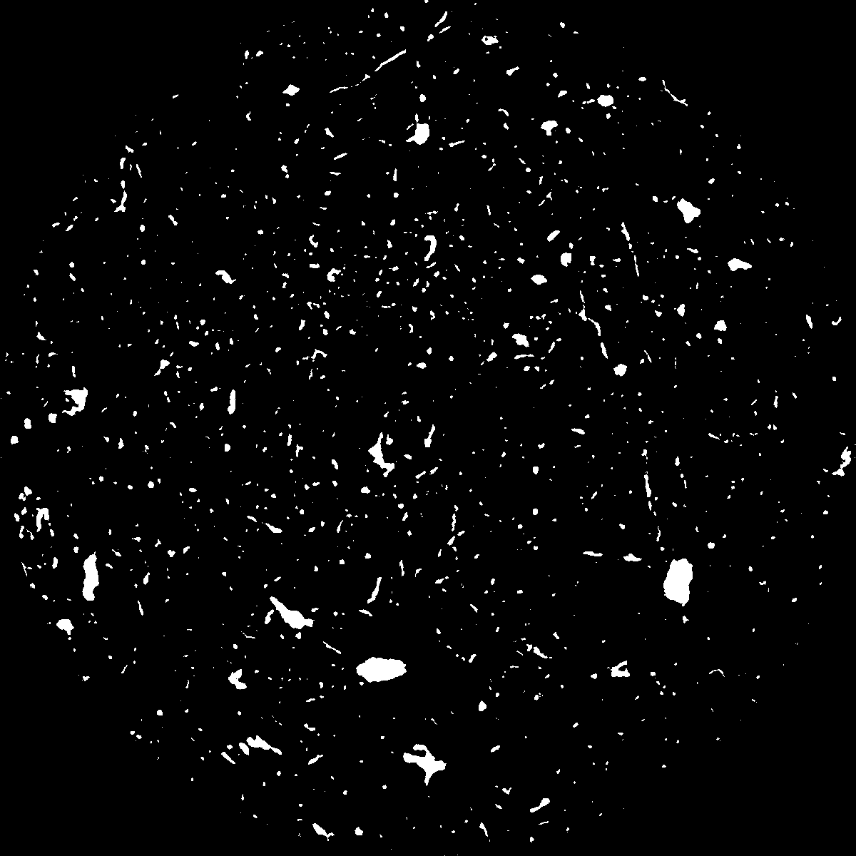
|
|---|
|
| XY Plane Grey |
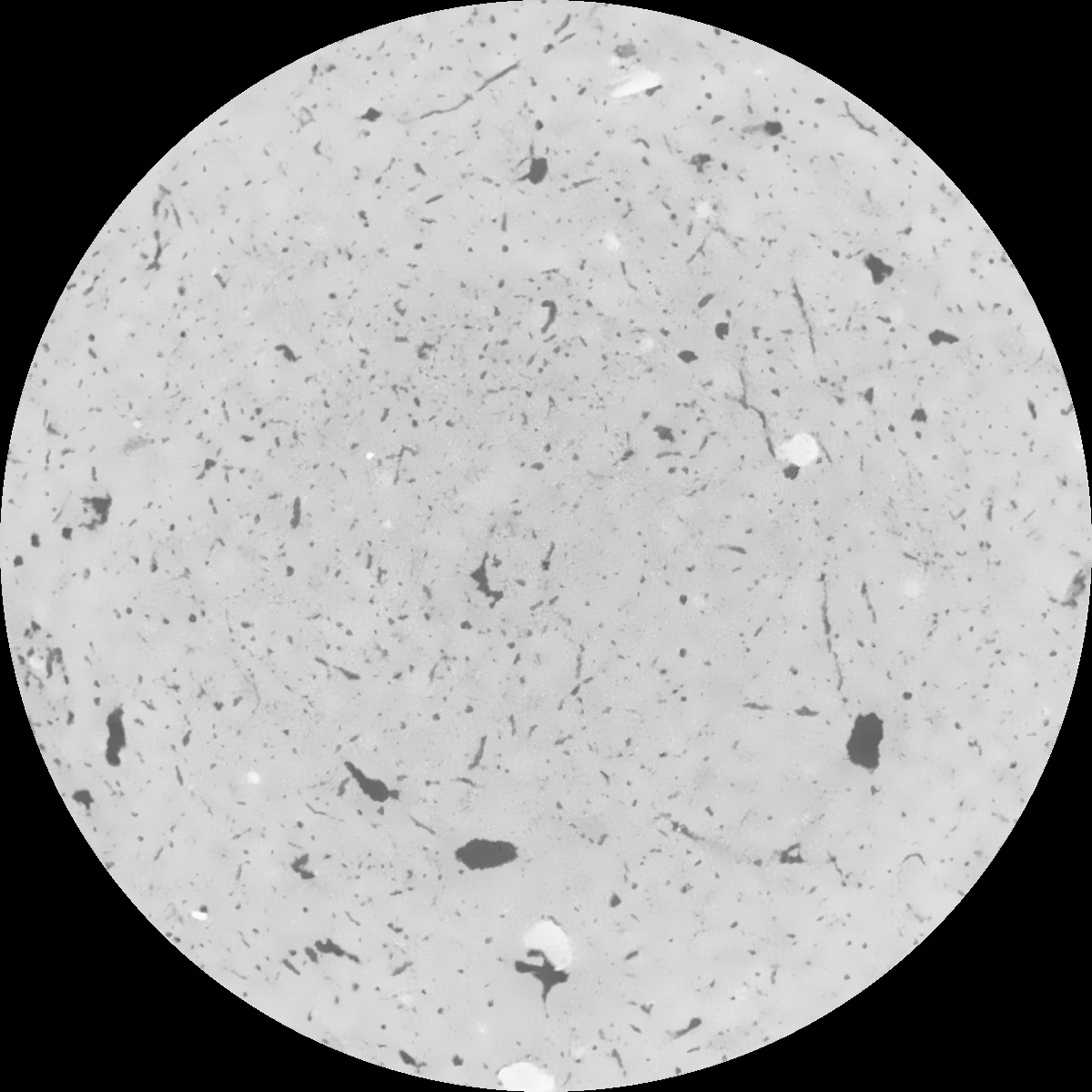
|
|---|
|
| Texture | clayey silt |
|---|
| Sand | 8.3 |
|---|
| Silt | 71.9 |
|---|
| Clay | 19.8 |
|---|
|
|
Results
| Porosity | Surface | Mean Curvature | Euler | MeanPoreSize | Gamma | PoreDist |
| 0.042765454 | 0.388540876 | 0.278445761 | 0.654221196 | 1.09920715205 | 0.461368377832 | 0.466022107 |
| Opening size | Volume | Surface | MeanCurvature | Euler number |
|---|
| 0.12 | 0.042765454 | 0.388540876 | 0.278445761 | 0.654221196 |
| 0.15 | 0.040320197 | 0.321925929 | 0.187629268 | 0.276110629 |
| 0.18 | 0.038636597 | 0.283495794 | 0.14500985 | 0.173635743 |
| 0.21 | 0.037036217 | 0.253201141 | 0.11885831 | 0.136823401 |
| 0.24 | 0.036311861 | 0.241811561 | 0.113733292 | 0.155686461 |
| 0.27 | 0.031725533 | 0.171516469 | 0.06224121 | 0.06639513 |
| 0.3 | 0.030036129 | 0.149907727 | 0.049920964 | 0.052950926 |
| 0.36 | 0.027751643 | 0.122921776 | 0.03641566 | 0.035740852 |
| 0.42 | 0.024464008 | 0.089340199 | 0.020289068 | 0.015175445 |
| 0.48 | 0.022786765 | 0.075054079 | 0.014877825 | 0.00948691 |
| 0.54 | 0.020699318 | 0.059925503 | 0.009860927 | 0.005928115 |
| 0.6 | 0.019745652 | 0.053705118 | 0.008133531 | 0.003939235 |
| 0.66 | 0.018219145 | 0.045286667 | 0.006064767 | 0.003334866 |
| 0.72 | 0.017438857 | 0.041062195 | 0.005143198 | 0.002096029 |
| 0.78 | 0.016391409 | 0.036366175 | 0.004245332 | 0.001854041 |
| 0.84 | 0.015867055 | 0.033955477 | 0.003824304 | 0.00130144 |
| 0.9 | 0.014889618 | 0.03009997 | 0.00317576 | 0.001176232 |
| 1.2 | 0.011853795 | 0.019664106 | 0.001656003 | 0.000540561 |
| 1.5 | 0.009678525 | 0.013813683 | 0.000990725 | 0.00031302 |
| 1.8 | 0.008202931 | 0.010431057 | 0.000636971 | 0.000167345 |
| 2.1 | 0.006988841 | 0.00815331 | 0.000445806 | 0.000102333 |
| 2.7 | 0.005241743 | 0.00554719 | 0.00027904 | 0.000045749 |
| 3.3 | 0.0038081 | 0.00385694 | 0.000191545 | 0.000040933 |
| 3.9 | 0.002766268 | 0.002820959 | 0.000148863 | 0.000031302 |
| 4.5 | 0.001389655 | 0.001314076 | 0.000064522 | 0.000012039 |
| 5.1 | 0.001077433 | 0.001081719 | 0.000057654 | 0.000012039 |
| 5.7 | 0.0 | 0.0 | 0.0 | 0.0 |
| 6.3 | 0.0 | 0.0 | 0.0 | 0.0 |
| 6.9 | 0.0 | 0.0 | 0.0 | 0.0 |
| 7.5 | 0.0 | 0.0 | 0.0 | 0.0 |
| 8.1 | 0.0 | 0.0 | 0.0 | 0.0 |
| 8.7 | 0.0 | 0.0 | 0.0 | 0.0 |
| 9.3 | 0.0 | 0.0 | 0.0 | 0.0 |
| 9.9 | 0.0 | 0.0 | 0.0 | 0.0 |
Reference: An open Soil Structure Library based on X-ray CT data
 Soil Structure Library