General Information
Internal Identifier Ad_3_B_1_o
| Soil Type | Haplic Luvisol |
|---|
| Classification | WRB |
|---|
|
| Location | Adenstedt |
|---|
| Latitude | 52.00772222 |
|---|
| Longitude | 9.939417 |
|---|
|
| Landuse | Cropland |
|---|
| Tillage | tillage |
|---|
| Crop | winter wheat, sugarbeets, winter wheat, silage mais |
|---|
|
| Sampling Depth | 15.0 |
|---|
| Sampling Date | March 24, 2021 |
|---|
| Voxel size | 0.06 |
|---|
| Pores white? | True |
|---|
|
| XY Plane |
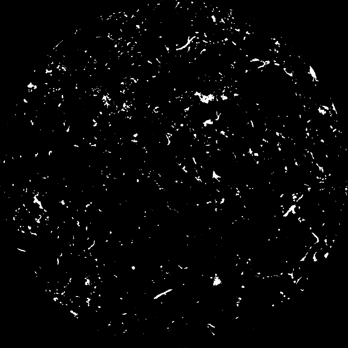
|
|---|
|
| XY Plane Grey |
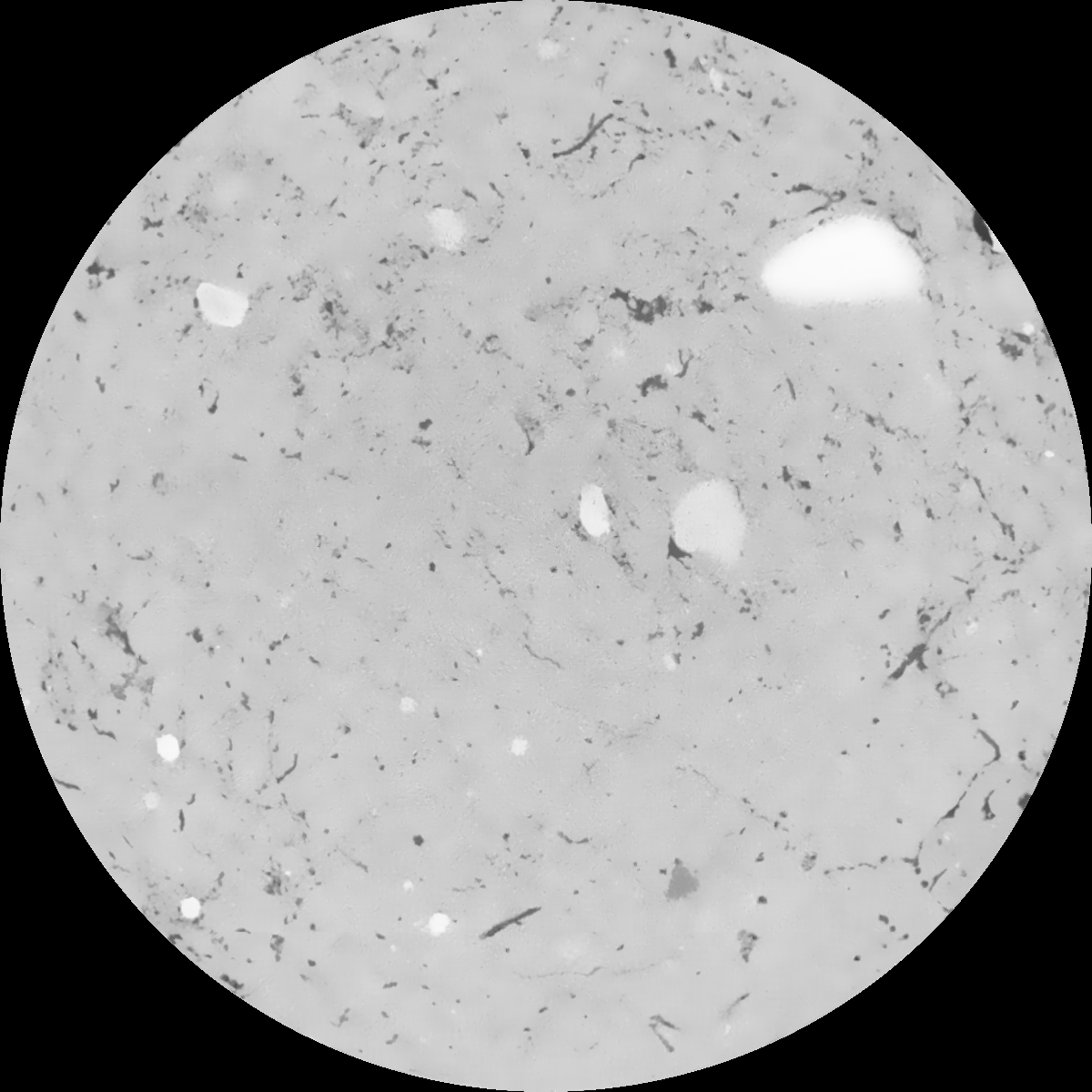
|
|---|
|
| Texture | clayey silt |
|---|
| Sand | 8.3 |
|---|
| Silt | 71.9 |
|---|
| Clay | 19.8 |
|---|
|
|
Results
| Porosity | Surface | Mean Curvature | Euler | MeanPoreSize | Gamma | PoreDist |
| 0.032554029 | 0.36735459 | 0.231357308 | 0.413856568 | 0.601851188754 | 0.370025687415 | 0.616755022 |
| Opening size | Volume | Surface | MeanCurvature | Euler number |
|---|
| 0.12 | 0.032554029 | 0.36735459 | 0.231357308 | 0.413856568 |
| 0.15 | 0.030624554 | 0.314794358 | 0.167493072 | 0.172334345 |
| 0.18 | 0.02910406 | 0.282570678 | 0.136469025 | 0.110601914 |
| 0.21 | 0.027542128 | 0.255128975 | 0.116311661 | 0.096020839 |
| 0.24 | 0.026758509 | 0.243393107 | 0.112308096 | 0.119223234 |
| 0.27 | 0.021641731 | 0.171738734 | 0.067926116 | 0.063148863 |
| 0.3 | 0.019449582 | 0.145722051 | 0.055304655 | 0.054608081 |
| 0.36 | 0.016474285 | 0.112356314 | 0.040812512 | 0.04179499 |
| 0.42 | 0.011858828 | 0.066688831 | 0.020537493 | 0.019385185 |
| 0.48 | 0.00967917 | 0.048060499 | 0.013450036 | 0.011984708 |
| 0.54 | 0.007301314 | 0.029980091 | 0.007031733 | 0.005913734 |
| 0.6 | 0.006394331 | 0.023796317 | 0.005139266 | 0.003831271 |
| 0.66 | 0.005150675 | 0.016205545 | 0.002939207 | 0.002109309 |
| 0.72 | 0.004644951 | 0.01331196 | 0.002196311 | 0.001351236 |
| 0.78 | 0.004072388 | 0.010513016 | 0.001554384 | 0.000897415 |
| 0.84 | 0.00382293 | 0.009296325 | 0.001299599 | 0.000649411 |
| 0.9 | 0.003422122 | 0.007587648 | 0.000959876 | 0.000483223 |
| 1.2 | 0.002518454 | 0.004360239 | 0.000415587 | 0.000191755 |
| 1.5 | 0.001917761 | 0.002780783 | 0.000226752 | 0.000079259 |
| 1.8 | 0.001546013 | 0.00191921 | 0.000135837 | 0.0000473 |
| 2.1 | 0.001281172 | 0.001381295 | 0.000083191 | 0.000024289 |
| 2.7 | 0.000962034 | 0.000819537 | 0.000036419 | 0.000005113 |
| 3.3 | 0.000842473 | 0.000642527 | 0.000023553 | 0.000002557 |
| 3.9 | 0.000793165 | 0.000604892 | 0.000023007 | 0.000002557 |
| 4.5 | 0.000733893 | 0.000562789 | 0.000021928 | 0.000005113 |
| 5.1 | 0.000675262 | 0.000525479 | 0.000021128 | 0.00000767 |
| 5.7 | 0.000609888 | 0.000485299 | 0.000020043 | 0.000002557 |
| 6.3 | 0.000530108 | 0.000438196 | 0.000019034 | 0.000002557 |
| 6.9 | 0.0 | 0.0 | 0.0 | 0.0 |
| 7.5 | 0.0 | 0.0 | 0.0 | 0.0 |
| 8.1 | 0.0 | 0.0 | 0.0 | 0.0 |
| 8.7 | 0.0 | 0.0 | 0.0 | 0.0 |
| 9.3 | 0.0 | 0.0 | 0.0 | 0.0 |
| 9.9 | 0.0 | 0.0 | 0.0 | 0.0 |
Reference: An open Soil Structure Library based on X-ray CT data
 Soil Structure Library