General Information
Internal Identifier Ad_3_B_2_o
| Soil Type | Haplic Luvisol |
|---|
| Classification | WRB |
|---|
|
| Location | Adenstedt |
|---|
| Latitude | 52.00772222 |
|---|
| Longitude | 9.939417 |
|---|
|
| Landuse | Cropland |
|---|
| Tillage | tillage |
|---|
| Crop | winter wheat, sugarbeets, winter wheat, silage mais |
|---|
|
| Sampling Depth | 15.0 |
|---|
| Sampling Date | March 24, 2021 |
|---|
| Voxel size | 0.06 |
|---|
| Pores white? | True |
|---|
|
| XY Plane |
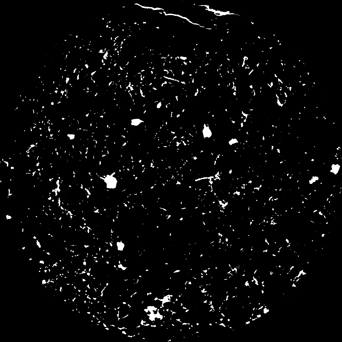
|
|---|
|
| XY Plane Grey |
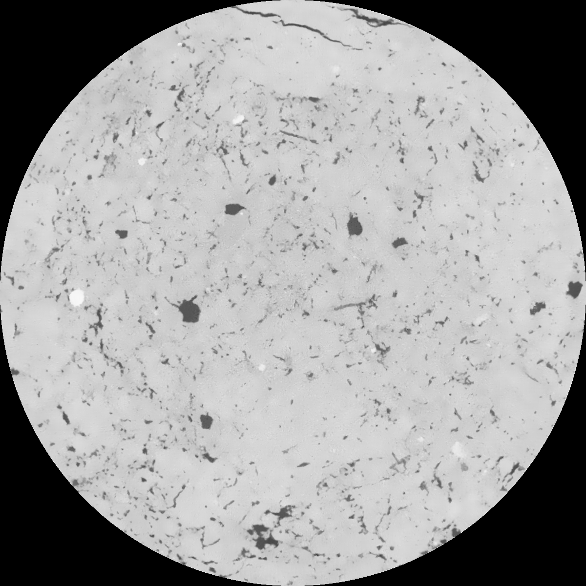
|
|---|
|
| Texture | clayey silt |
|---|
| Sand | 8.3 |
|---|
| Silt | 71.9 |
|---|
| Clay | 19.8 |
|---|
|
|
Results
| Porosity | Surface | Mean Curvature | Euler | MeanPoreSize | Gamma | PoreDist |
| 0.056888345 | 0.499903025 | 0.285140999 | 0.510379167 | 0.877601018624 | 0.642565404241 | 0.525010099 |
| Opening size | Volume | Surface | MeanCurvature | Euler number |
|---|
| 0.12 | 0.056888345 | 0.499903025 | 0.285140999 | 0.510379167 |
| 0.15 | 0.05438478 | 0.43123193 | 0.201951902 | 0.19181349 |
| 0.18 | 0.052368015 | 0.388818386 | 0.162019809 | 0.11172624 |
| 0.21 | 0.050429634 | 0.355126353 | 0.137935276 | 0.094716264 |
| 0.24 | 0.04946346 | 0.340770272 | 0.133324625 | 0.122281731 |
| 0.27 | 0.04343865 | 0.258165062 | 0.084162409 | 0.062004084 |
| 0.3 | 0.040753254 | 0.227029075 | 0.069937705 | 0.055307988 |
| 0.36 | 0.037053446 | 0.186592128 | 0.053676972 | 0.044101807 |
| 0.42 | 0.031025415 | 0.129370166 | 0.030276568 | 0.022046749 |
| 0.48 | 0.027951822 | 0.104304708 | 0.021676952 | 0.014356082 |
| 0.54 | 0.024309107 | 0.078327173 | 0.013431714 | 0.008051167 |
| 0.6 | 0.022752067 | 0.068410374 | 0.010793365 | 0.005465027 |
| 0.66 | 0.020354552 | 0.055282759 | 0.007639995 | 0.003938654 |
| 0.72 | 0.019224334 | 0.049306565 | 0.006391964 | 0.002635997 |
| 0.78 | 0.017738715 | 0.042557274 | 0.005081586 | 0.002095247 |
| 0.84 | 0.017061623 | 0.039376322 | 0.004480666 | 0.001473959 |
| 0.9 | 0.015851643 | 0.034565703 | 0.00363113 | 0.00114414 |
| 1.2 | 0.012473051 | 0.023290351 | 0.002071222 | 0.000602112 |
| 1.5 | 0.009923781 | 0.016544776 | 0.001311184 | 0.000351551 |
| 1.8 | 0.007549098 | 0.011198207 | 0.000804952 | 0.000182807 |
| 2.1 | 0.005959645 | 0.008015401 | 0.000510738 | 0.000118888 |
| 2.7 | 0.003597632 | 0.004270071 | 0.000257663 | 0.000049856 |
| 3.3 | 0.001878871 | 0.001767807 | 0.000084229 | 0.00001534 |
| 3.9 | 0.001238992 | 0.00105763 | 0.00004421 | 0.000005113 |
| 4.5 | 0.000694254 | 0.000547144 | 0.000021652 | 0.000002557 |
| 5.1 | 0.000625914 | 0.000500812 | 0.000020515 | 0.000002557 |
| 5.7 | 0.000569448 | 0.000464548 | 0.000019657 | 0.000002557 |
| 6.3 | 0.000430187 | 0.000378592 | 0.000017643 | 0.000002557 |
| 6.9 | 0.0 | 0.0 | 0.0 | 0.0 |
| 7.5 | 0.0 | 0.0 | 0.0 | 0.0 |
| 8.1 | 0.0 | 0.0 | 0.0 | 0.0 |
| 8.7 | 0.0 | 0.0 | 0.0 | 0.0 |
| 9.3 | 0.0 | 0.0 | 0.0 | 0.0 |
| 9.9 | 0.0 | 0.0 | 0.0 | 0.0 |
Reference: An open Soil Structure Library based on X-ray CT data
 Soil Structure Library