General Information
Internal Identifier Ad_3_B_3_o
| Soil Type | Haplic Luvisol |
|---|
| Classification | WRB |
|---|
|
| Location | Adenstedt |
|---|
| Latitude | 52.00772222 |
|---|
| Longitude | 9.939417 |
|---|
|
| Landuse | Cropland |
|---|
| Tillage | tillage |
|---|
| Crop | winter wheat, sugarbeets, winter wheat, silage mais |
|---|
|
| Sampling Depth | 15.0 |
|---|
| Sampling Date | March 24, 2021 |
|---|
| Voxel size | 0.06 |
|---|
| Pores white? | True |
|---|
|
| XY Plane |
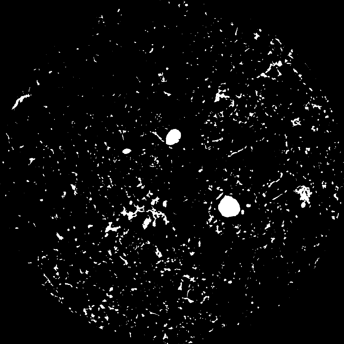
|
|---|
|
| XY Plane Grey |
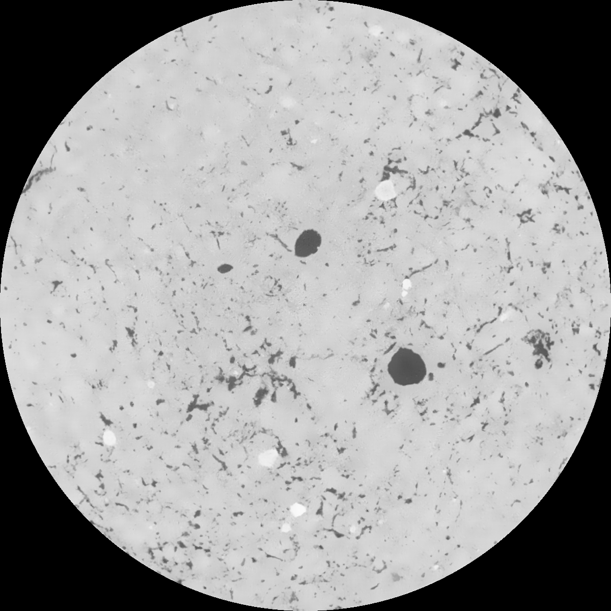
|
|---|
|
| Texture | clayey silt |
|---|
| Sand | 8.3 |
|---|
| Silt | 71.9 |
|---|
| Clay | 19.8 |
|---|
|
|
Results
| Porosity | Surface | Mean Curvature | Euler | MeanPoreSize | Gamma | PoreDist |
| 0.044985341 | 0.484618375 | 0.305145005 | 0.56384558 | 0.645640810325 | 0.452162394661 | 0.502875815 |
| Opening size | Volume | Surface | MeanCurvature | Euler number |
|---|
| 0.12 | 0.044985341 | 0.484618375 | 0.305145005 | 0.56384558 |
| 0.15 | 0.042456007 | 0.416202486 | 0.220479517 | 0.231859861 |
| 0.18 | 0.040500602 | 0.374128129 | 0.17871096 | 0.14457988 |
| 0.21 | 0.038516634 | 0.338953889 | 0.152389771 | 0.124534528 |
| 0.24 | 0.037531823 | 0.324119733 | 0.14720854 | 0.153276517 |
| 0.27 | 0.031221963 | 0.23479673 | 0.090728229 | 0.080062781 |
| 0.3 | 0.028442986 | 0.201632996 | 0.074501569 | 0.06894723 |
| 0.36 | 0.024609831 | 0.158543037 | 0.05584095 | 0.053526994 |
| 0.42 | 0.018583075 | 0.099151135 | 0.029784001 | 0.026171722 |
| 0.48 | 0.015552984 | 0.073329401 | 0.020150062 | 0.016899673 |
| 0.54 | 0.012098849 | 0.047048912 | 0.010918522 | 0.008864352 |
| 0.6 | 0.010741654 | 0.037707382 | 0.008022964 | 0.005781395 |
| 0.66 | 0.008860282 | 0.026211997 | 0.004727992 | 0.003564285 |
| 0.72 | 0.008058214 | 0.021507014 | 0.00348591 | 0.002068485 |
| 0.78 | 0.007159932 | 0.016889212 | 0.00235491 | 0.001321267 |
| 0.84 | 0.006799631 | 0.015060826 | 0.001944102 | 0.0008713 |
| 0.9 | 0.006191954 | 0.012377354 | 0.001389925 | 0.000604047 |
| 1.2 | 0.004934715 | 0.007698945 | 0.000572218 | 0.000197713 |
| 1.5 | 0.004356358 | 0.006159271 | 0.000383967 | 0.000102265 |
| 1.8 | 0.003881957 | 0.005126063 | 0.000283469 | 0.000064086 |
| 2.1 | 0.003521918 | 0.004479829 | 0.00023398 | 0.000036815 |
| 2.7 | 0.002744287 | 0.003365139 | 0.000166435 | 0.000009545 |
| 3.3 | 0.001227111 | 0.001457119 | 0.000078637 | 0.000013635 |
| 3.9 | 0.000242664 | 0.000319085 | 0.000020134 | 0.000002727 |
| 4.5 | 0.0 | 0.0 | 0.0 | 0.0 |
| 5.1 | 0.0 | 0.0 | 0.0 | 0.0 |
| 5.7 | 0.0 | 0.0 | 0.0 | 0.0 |
| 6.3 | 0.0 | 0.0 | 0.0 | 0.0 |
| 6.9 | 0.0 | 0.0 | 0.0 | 0.0 |
| 7.5 | 0.0 | 0.0 | 0.0 | 0.0 |
| 8.1 | 0.0 | 0.0 | 0.0 | 0.0 |
| 8.7 | 0.0 | 0.0 | 0.0 | 0.0 |
| 9.3 | 0.0 | 0.0 | 0.0 | 0.0 |
| 9.9 | 0.0 | 0.0 | 0.0 | 0.0 |
Reference: An open Soil Structure Library based on X-ray CT data
 Soil Structure Library