General Information
Internal Identifier Ad_3_B_1_u
| Soil Type | Haplic Luvisol |
|---|
| Classification | WRB |
|---|
|
| Location | Adenstedt |
|---|
| Latitude | 52.00772222 |
|---|
| Longitude | 9.939417 |
|---|
|
| Landuse | Cropland |
|---|
| Tillage | tillage |
|---|
| Crop | winter wheat, sugarbeets, winter wheat, silage mais |
|---|
|
| Sampling Depth | 25.0 |
|---|
| Sampling Date | March 24, 2021 |
|---|
| Voxel size | 0.06 |
|---|
| Pores white? | True |
|---|
|
| XY Plane |
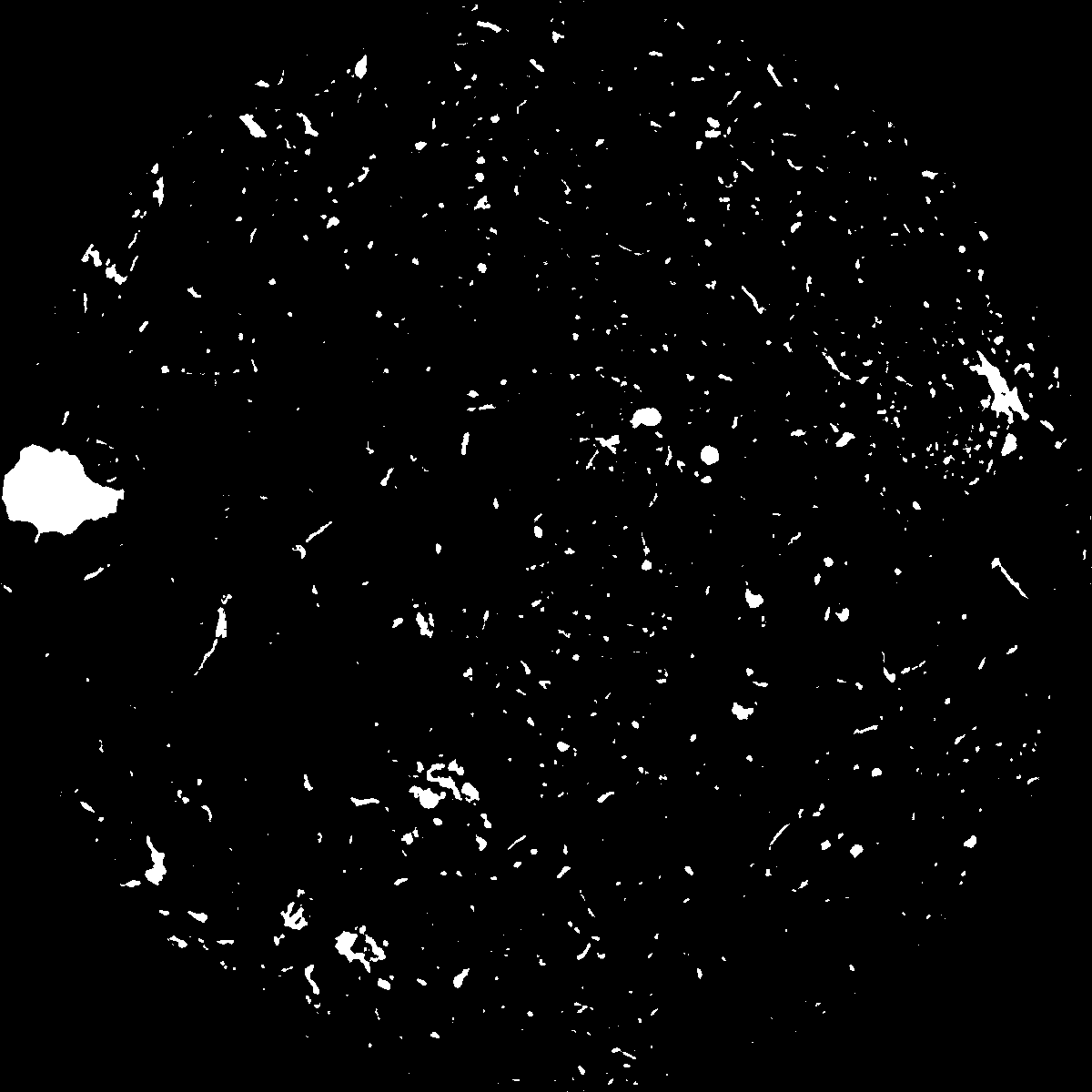
|
|---|
|
| XY Plane Grey |
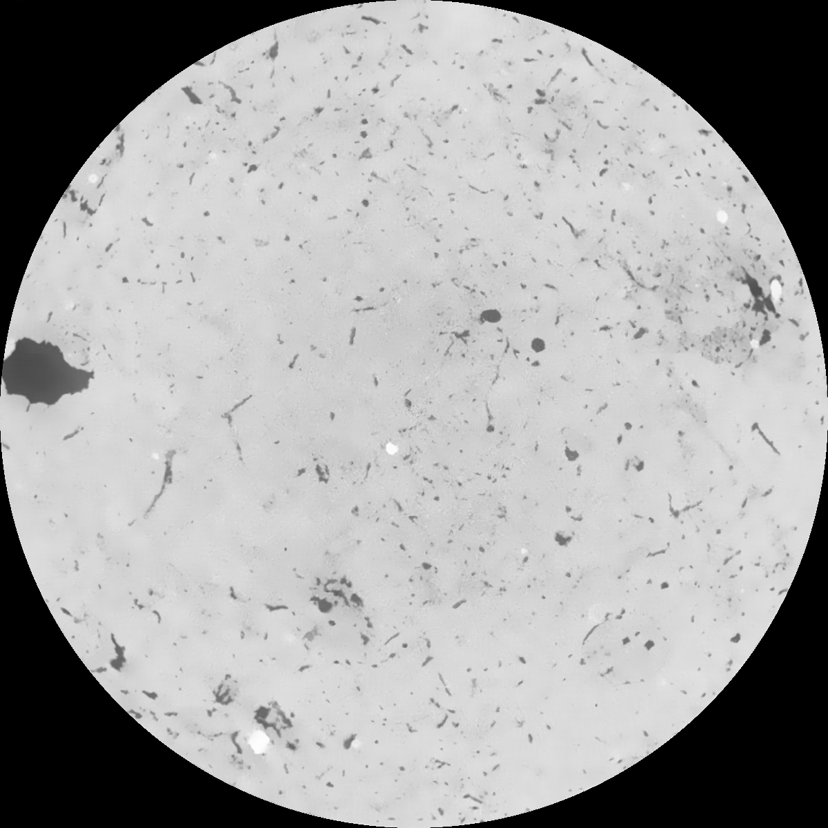
|
|---|
|
| Texture | clayey silt |
|---|
| Sand | 8.3 |
|---|
| Silt | 71.9 |
|---|
| Clay | 19.8 |
|---|
|
|
Results
| Porosity | Surface | Mean Curvature | Euler | MeanPoreSize | Gamma | PoreDist |
| 0.0486375 | 0.425056834 | 0.269730484 | 0.520613473 | 1.23458826174 | 0.577169743668 | 0.5286747 |
| Opening size | Volume | Surface | MeanCurvature | Euler number |
|---|
| 0.12 | 0.0486375 | 0.425056834 | 0.269730484 | 0.520613473 |
| 0.15 | 0.046358718 | 0.363013639 | 0.190500265 | 0.216972143 |
| 0.18 | 0.044653178 | 0.325252132 | 0.151026634 | 0.133450009 |
| 0.21 | 0.042978722 | 0.294739714 | 0.126713144 | 0.10897065 |
| 0.24 | 0.04218852 | 0.282631599 | 0.122047465 | 0.132034196 |
| 0.27 | 0.03709467 | 0.209160922 | 0.073643502 | 0.063114441 |
| 0.3 | 0.03493878 | 0.183233435 | 0.06065591 | 0.053982687 |
| 0.36 | 0.031899376 | 0.148988706 | 0.045628883 | 0.041115162 |
| 0.42 | 0.027079755 | 0.102051351 | 0.025332079 | 0.020154869 |
| 0.48 | 0.024569411 | 0.081143832 | 0.017859035 | 0.0132588 |
| 0.54 | 0.021558231 | 0.059093393 | 0.01049059 | 0.007275305 |
| 0.6 | 0.020289587 | 0.050788055 | 0.008178717 | 0.004880702 |
| 0.66 | 0.018393079 | 0.039965815 | 0.005371415 | 0.003225309 |
| 0.72 | 0.017509576 | 0.035116915 | 0.004261834 | 0.001997308 |
| 0.78 | 0.016418542 | 0.030019802 | 0.003209018 | 0.001467582 |
| 0.84 | 0.015938293 | 0.027786508 | 0.002800731 | 0.001016111 |
| 0.9 | 0.015092601 | 0.02439061 | 0.002196431 | 0.000794589 |
| 1.2 | 0.012812615 | 0.016764451 | 0.001119445 | 0.000309408 |
| 1.5 | 0.01127003 | 0.012784663 | 0.000696774 | 0.000175773 |
| 1.8 | 0.010267423 | 0.010654529 | 0.000503616 | 0.000127616 |
| 2.1 | 0.009272157 | 0.00887491 | 0.000364316 | 0.00008909 |
| 2.7 | 0.007918043 | 0.00706234 | 0.000273658 | 0.000030098 |
| 3.3 | 0.006768542 | 0.005797443 | 0.000218164 | 0.000031302 |
| 3.9 | 0.00579896 | 0.005012854 | 0.000203715 | 0.000024078 |
| 4.5 | 0.003360425 | 0.002771064 | 0.000114258 | 0.000015651 |
| 5.1 | 0.001704666 | 0.001242339 | 0.00004487 | 0.000004816 |
| 5.7 | 0.001249752 | 0.000873082 | 0.000028899 | 0.000002408 |
| 6.3 | 0.000834099 | 0.000633708 | 0.000023739 | 0.000002408 |
| 6.9 | 0.0 | 0.0 | 0.0 | 0.0 |
| 7.5 | 0.0 | 0.0 | 0.0 | 0.0 |
| 8.1 | 0.0 | 0.0 | 0.0 | 0.0 |
| 8.7 | 0.0 | 0.0 | 0.0 | 0.0 |
| 9.3 | 0.0 | 0.0 | 0.0 | 0.0 |
| 9.9 | 0.0 | 0.0 | 0.0 | 0.0 |
Reference: An open Soil Structure Library based on X-ray CT data
 Soil Structure Library