General Information
Internal Identifier Ad_3_B_3_u
| Soil Type | Haplic Luvisol |
|---|
| Classification | WRB |
|---|
|
| Location | Adenstedt |
|---|
| Latitude | 52.00772222 |
|---|
| Longitude | 9.939417 |
|---|
|
| Landuse | Cropland |
|---|
| Tillage | tillage |
|---|
| Crop | winter wheat, sugarbeets, winter wheat, silage mais |
|---|
|
| Sampling Depth | 25.0 |
|---|
| Sampling Date | March 24, 2021 |
|---|
| Voxel size | 0.06 |
|---|
| Pores white? | True |
|---|
|
| XY Plane |
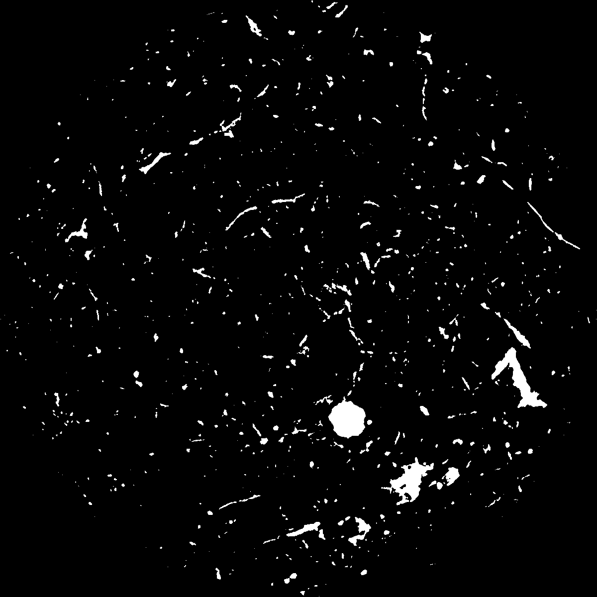
|
|---|
|
| XY Plane Grey |
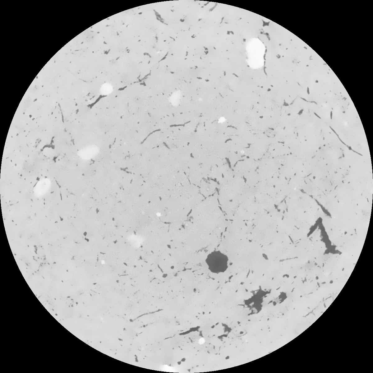
|
|---|
|
| Texture | clayey silt |
|---|
| Sand | 8.3 |
|---|
| Silt | 71.9 |
|---|
| Clay | 19.8 |
|---|
|
|
Results
| Porosity | Surface | Mean Curvature | Euler | MeanPoreSize | Gamma | PoreDist |
| 0.049339869 | 0.487448106 | 0.320427496 | 0.623958795 | 1.11700917577 | 0.486054253101 | 0.465460866 |
| Opening size | Volume | Surface | MeanCurvature | Euler number |
|---|
| 0.12 | 0.049339869 | 0.487448106 | 0.320427496 | 0.623958795 |
| 0.15 | 0.04668967 | 0.416260187 | 0.230010131 | 0.27437999 |
| 0.18 | 0.044760977 | 0.373456909 | 0.184817074 | 0.173780214 |
| 0.21 | 0.042811459 | 0.337813683 | 0.156236013 | 0.144825874 |
| 0.24 | 0.041868088 | 0.323355615 | 0.150644727 | 0.173531002 |
| 0.27 | 0.035635128 | 0.232784711 | 0.090244657 | 0.08721336 |
| 0.3 | 0.033016033 | 0.20083467 | 0.073777721 | 0.075015216 |
| 0.36 | 0.029302491 | 0.158322442 | 0.054332472 | 0.055571865 |
| 0.42 | 0.023630497 | 0.101306016 | 0.028151593 | 0.025241442 |
| 0.48 | 0.020866995 | 0.077352895 | 0.018867513 | 0.01558839 |
| 0.54 | 0.01781808 | 0.05410142 | 0.010519503 | 0.007673803 |
| 0.6 | 0.016596752 | 0.045831828 | 0.008032978 | 0.005016746 |
| 0.66 | 0.014824534 | 0.035382837 | 0.005154084 | 0.003137422 |
| 0.72 | 0.014022614 | 0.030867438 | 0.004056354 | 0.001890159 |
| 0.78 | 0.013051441 | 0.026185329 | 0.003026512 | 0.001353209 |
| 0.84 | 0.012641906 | 0.024232956 | 0.002636672 | 0.000910166 |
| 0.9 | 0.011921258 | 0.021286235 | 0.002086139 | 0.000656138 |
| 1.2 | 0.009925067 | 0.014583066 | 0.001147356 | 0.000339506 |
| 1.5 | 0.008465228 | 0.010581346 | 0.000665822 | 0.0001842 |
| 1.8 | 0.007503417 | 0.008521072 | 0.000488779 | 0.000108353 |
| 2.1 | 0.006669819 | 0.006816572 | 0.000323889 | 0.000081867 |
| 2.7 | 0.005794563 | 0.005531553 | 0.000245444 | 0.000038526 |
| 3.3 | 0.004031284 | 0.003434686 | 0.000157452 | 0.000042137 |
| 3.9 | 0.002663166 | 0.001785909 | 0.000067178 | 0.00002769 |
| 4.5 | 0.002101966 | 0.001154693 | 0.000031864 | 0.000002408 |
| 5.1 | 0.002035206 | 0.001109423 | 0.00003056 | 0.000009631 |
| 5.7 | 0.001984673 | 0.001078524 | 0.000030223 | 0.000019263 |
| 6.3 | 0.00193825 | 0.001052074 | 0.000029598 | 0.000002408 |
| 6.9 | 0.00188245 | 0.001022938 | 0.000028753 | 0.000002408 |
| 7.5 | 0.001809933 | 0.000987916 | 0.000028144 | 0.000002408 |
| 8.1 | 0.001735947 | 0.000954314 | 0.000027898 | 0.000004816 |
| 8.7 | 0.001653632 | 0.000917416 | 0.000026917 | 0.000002408 |
| 9.3 | 0.001537646 | 0.000869044 | 0.000025869 | 0.000002408 |
| 9.9 | 0.001223304 | 0.000742375 | 0.000023858 | 0.000002408 |
Reference: An open Soil Structure Library based on X-ray CT data
 Soil Structure Library