General Information
Internal Identifier Ad_4_A_1_u
| Soil Type | Haplic Luvisol |
|---|
| Classification | WRB |
|---|
|
| Location | Adenstedt |
|---|
| Latitude | 52.00772222 |
|---|
| Longitude | 9.939417 |
|---|
|
| Landuse | Cropland |
|---|
| Tillage | tillage |
|---|
| Crop | winter wheat, sugarbeets, winter wheat, silage mais |
|---|
|
| Sampling Depth | 10.0 |
|---|
| Sampling Date | March 24, 2021 |
|---|
| Voxel size | 0.06 |
|---|
| Pores white? | True |
|---|
|
| XY Plane |
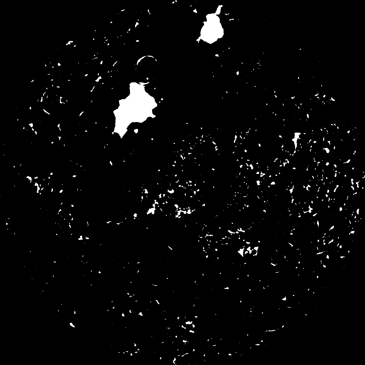
|
|---|
|
| XY Plane Grey |
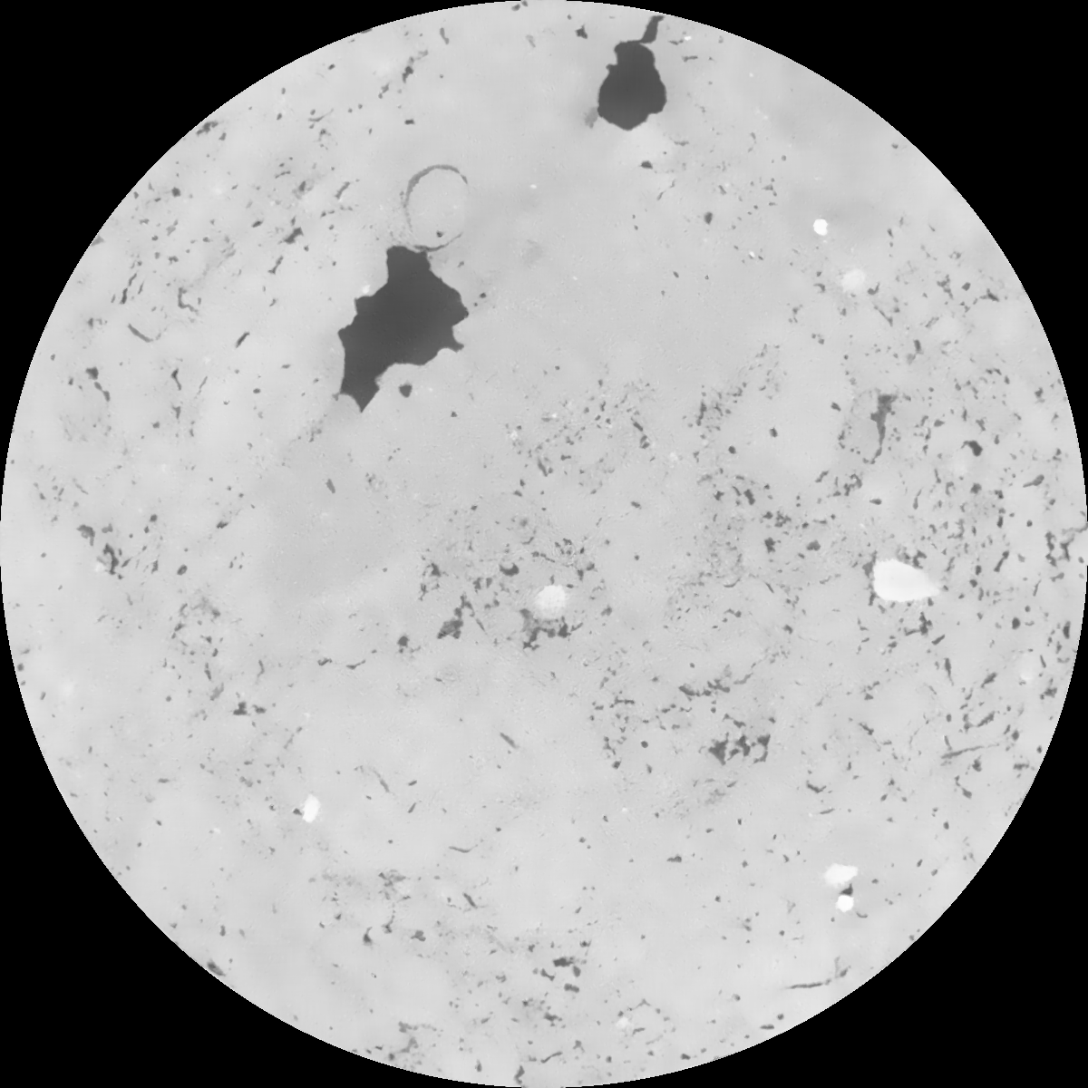
|
|---|
|
| Texture | clayey silt |
|---|
| Sand | 8.3 |
|---|
| Silt | 71.9 |
|---|
| Clay | 19.8 |
|---|
|
|
Results
| Porosity | Surface | Mean Curvature | Euler | MeanPoreSize | Gamma | PoreDist |
| 0.059592845 | 0.311337197 | 0.178041292 | 0.413546224 | 2.09473834399 | 0.62941558925 | 0.707465952 |
| Opening size | Volume | Surface | MeanCurvature | Euler number |
|---|
| 0.12 | 0.059592845 | 0.311337197 | 0.178041292 | 0.413546224 |
| 0.15 | 0.057974607 | 0.265684503 | 0.119625877 | 0.165123408 |
| 0.18 | 0.056719313 | 0.238938703 | 0.09335849 | 0.100874872 |
| 0.21 | 0.055560125 | 0.218569769 | 0.078230044 | 0.083827328 |
| 0.24 | 0.054992586 | 0.210108457 | 0.075234772 | 0.096466108 |
| 0.27 | 0.051535593 | 0.161625934 | 0.044385212 | 0.047340044 |
| 0.3 | 0.050075232 | 0.144352056 | 0.035854299 | 0.039017327 |
| 0.36 | 0.048145408 | 0.122904271 | 0.026521607 | 0.02745365 |
| 0.42 | 0.0451384 | 0.094369414 | 0.014311858 | 0.011744867 |
| 0.48 | 0.043612057 | 0.082256541 | 0.010204311 | 0.007073647 |
| 0.54 | 0.041693502 | 0.069511062 | 0.00646167 | 0.004002441 |
| 0.6 | 0.040830958 | 0.064467987 | 0.005296373 | 0.00249513 |
| 0.66 | 0.039384475 | 0.057504179 | 0.003946895 | 0.002072553 |
| 0.72 | 0.038661299 | 0.054025428 | 0.003341405 | 0.001178038 |
| 0.78 | 0.037662903 | 0.05020787 | 0.002802756 | 0.001122658 |
| 0.84 | 0.037182823 | 0.048297496 | 0.002562895 | 0.000578485 |
| 0.9 | 0.036238846 | 0.045303324 | 0.002256861 | 0.000669983 |
| 1.2 | 0.032971036 | 0.03629926 | 0.001457697 | 0.000448461 |
| 1.5 | 0.030061298 | 0.030068463 | 0.001031417 | 0.000241386 |
| 1.8 | 0.027810951 | 0.026212162 | 0.000829205 | 0.000163132 |
| 2.1 | 0.02558102 | 0.023071493 | 0.000709645 | 0.000195637 |
| 2.7 | 0.021554394 | 0.018486015 | 0.000565557 | 0.000059594 |
| 3.3 | 0.017102232 | 0.014583268 | 0.000489483 | 0.000033108 |
| 3.9 | 0.012167909 | 0.010467546 | 0.000421287 | 0.000039729 |
| 4.5 | 0.007929458 | 0.006942058 | 0.000309484 | 0.000043341 |
| 5.1 | 0.004104627 | 0.00352859 | 0.000155908 | 0.000019263 |
| 5.7 | 0.001339864 | 0.001012412 | 0.000039829 | 0.000009631 |
| 6.3 | 0.000754163 | 0.00055272 | 0.000020938 | 0.000002408 |
| 6.9 | 0.0 | 0.0 | 0.0 | 0.0 |
| 7.5 | 0.0 | 0.0 | 0.0 | 0.0 |
| 8.1 | 0.0 | 0.0 | 0.0 | 0.0 |
| 8.7 | 0.0 | 0.0 | 0.0 | 0.0 |
| 9.3 | 0.0 | 0.0 | 0.0 | 0.0 |
| 9.9 | 0.0 | 0.0 | 0.0 | 0.0 |
Reference: An open Soil Structure Library based on X-ray CT data
 Soil Structure Library