General Information
Internal Identifier Ad_4_B_3_u
| Soil Type | Haplic Luvisol |
|---|
| Classification | WRB |
|---|
|
| Location | Adenstedt |
|---|
| Latitude | 52.00772 |
|---|
| Longitude | 9.939417 |
|---|
|
| Landuse | Cropland |
|---|
| Tillage | tillage |
|---|
| Crop | winter wheat, sugarbeets, winter wheat, silage mais |
|---|
|
| Sampling Depth | 25.0 |
|---|
| Sampling Date | March 24, 2021 |
|---|
| Voxel size | 0.06 |
|---|
| Pores white? | True |
|---|
|
| XY Plane |
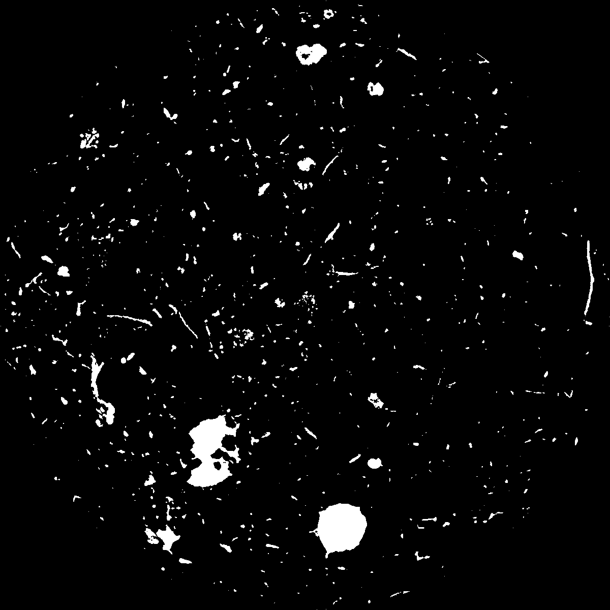
|
|---|
|
| XY Plane Grey |
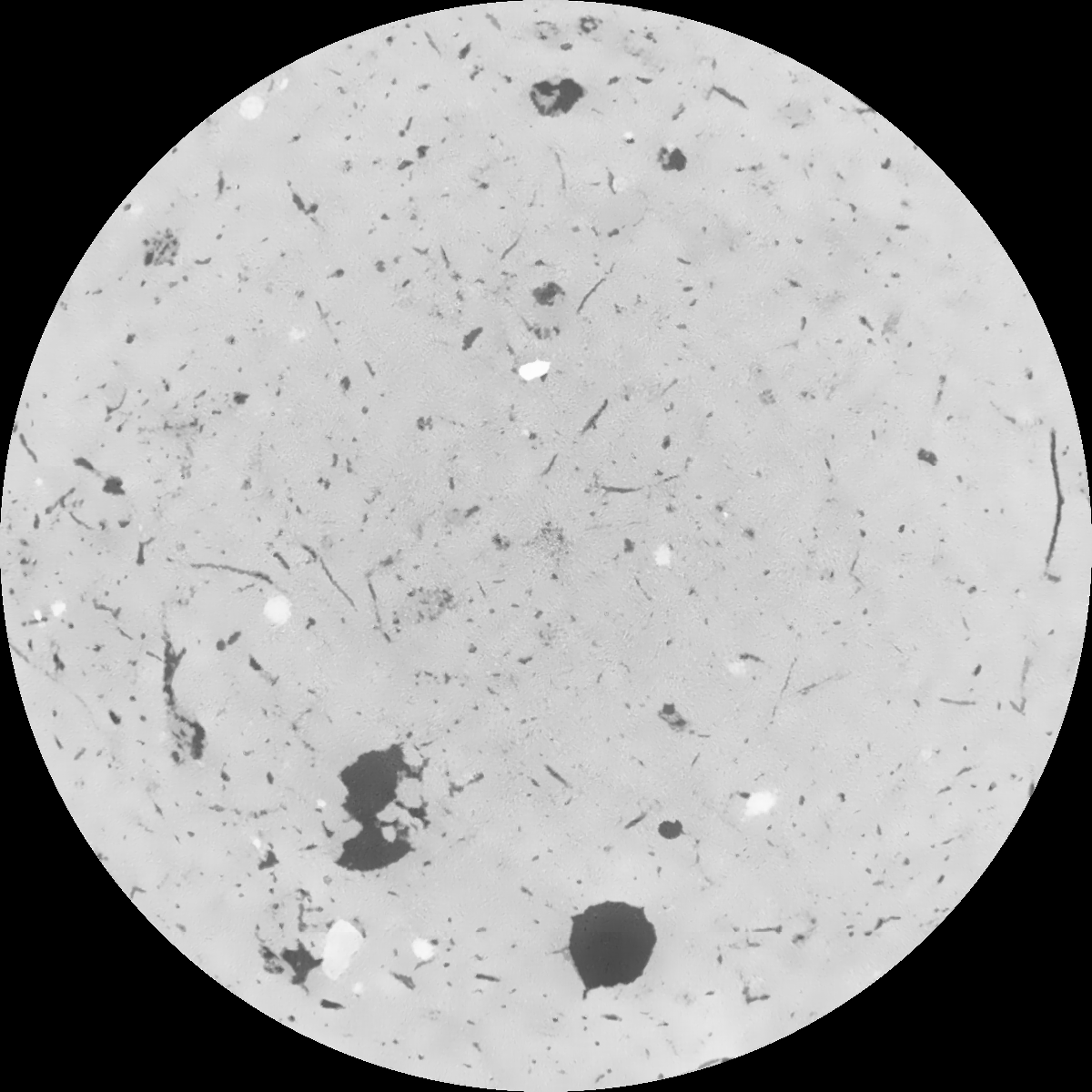
|
|---|
|
| Texture | clayey silt |
|---|
| Sand | 8.3 |
|---|
| Silt | 71.9 |
|---|
| Clay | 19.8 |
|---|
|
|
Results
| Porosity | Surface | Mean Curvature | Euler | MeanPoreSize | Gamma | PoreDist |
| 0.034367878 | 0.347462213 | 0.25093903 | 0.549286697 | 1.05973963991 | 0.454193393633 | 0.55855968 |
| Opening size | Volume | Surface | MeanCurvature | Euler number |
|---|
| 0.12 | 0.034367878 | 0.347462213 | 0.25093903 | 0.549286697 |
| 0.15 | 0.032112084 | 0.284843484 | 0.168494305 | 0.218725054 |
| 0.18 | 0.03044428 | 0.247586245 | 0.128920342 | 0.131874075 |
| 0.21 | 0.028895328 | 0.218956808 | 0.105473117 | 0.105851287 |
| 0.24 | 0.028181091 | 0.207923551 | 0.101005053 | 0.126622564 |
| 0.27 | 0.023707982 | 0.141324043 | 0.054926282 | 0.055722356 |
| 0.3 | 0.021982371 | 0.119826904 | 0.043332969 | 0.044995405 |
| 0.36 | 0.019707849 | 0.093378247 | 0.030783517 | 0.032360237 |
| 0.42 | 0.016330261 | 0.058976937 | 0.014634676 | 0.013079416 |
| 0.48 | 0.014802256 | 0.045856733 | 0.009594739 | 0.007572673 |
| 0.54 | 0.013131386 | 0.033358202 | 0.005260276 | 0.003635846 |
| 0.6 | 0.012492064 | 0.029205139 | 0.004100374 | 0.002380155 |
| 0.66 | 0.011540423 | 0.023854402 | 0.002736486 | 0.001602421 |
| 0.72 | 0.011131749 | 0.021652458 | 0.00224472 | 0.000901738 |
| 0.78 | 0.010619104 | 0.019365025 | 0.001799632 | 0.000693459 |
| 0.84 | 0.010383622 | 0.018282789 | 0.001607601 | 0.000465918 |
| 0.9 | 0.009959296 | 0.016638821 | 0.001327439 | 0.000365992 |
| 1.2 | 0.008770619 | 0.012973368 | 0.000899985 | 0.000227541 |
| 1.5 | 0.007662196 | 0.010205097 | 0.000634155 | 0.000196239 |
| 1.8 | 0.006626983 | 0.008004283 | 0.000446854 | 0.00009511 |
| 2.1 | 0.005857783 | 0.006527249 | 0.000318233 | 0.000066216 |
| 2.7 | 0.004723393 | 0.005012883 | 0.0002496 | 0.000045749 |
| 3.3 | 0.003584916 | 0.003513701 | 0.00015845 | 0.000022875 |
| 3.9 | 0.002764809 | 0.00267497 | 0.00012628 | 0.000015651 |
| 4.5 | 0.001699407 | 0.001584955 | 0.000072424 | 0.000008427 |
| 5.1 | 0.000677135 | 0.000617613 | 0.000028236 | 0.000003612 |
| 5.7 | 0.0 | 0.0 | 0.0 | 0.0 |
| 6.3 | 0.0 | 0.0 | 0.0 | 0.0 |
| 6.9 | 0.0 | 0.0 | 0.0 | 0.0 |
| 7.5 | 0.0 | 0.0 | 0.0 | 0.0 |
| 8.1 | 0.0 | 0.0 | 0.0 | 0.0 |
| 8.7 | 0.0 | 0.0 | 0.0 | 0.0 |
| 9.3 | 0.0 | 0.0 | 0.0 | 0.0 |
| 9.9 | 0.0 | 0.0 | 0.0 | 0.0 |
Reference: An open Soil Structure Library based on X-ray CT data
 Soil Structure Library