General Information
Internal Identifier leuther
| Soil Type | Fluvic Gleysol |
|---|
| Classification | FAO |
|---|
|
| Location | Giessen |
|---|
| Latitude | 50°32'00 |
|---|
| Longitude | 8°41'18.0 |
|---|
|
| Landuse | Grassland |
|---|
| Tillage | No tillage |
|---|
| Crop | gras |
|---|
|
| Sampling Depth | -5.0 |
|---|
| Sample Height | 5.0 |
|---|
| Sampling Date | March 1, 2020 |
|---|
| Voxel size | 0.048 |
|---|
| Pores white? | True |
|---|
|
| XY Plane |
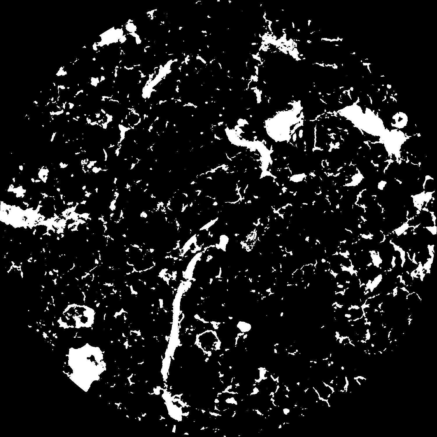
|
|---|
|
| XY Plane Grey |
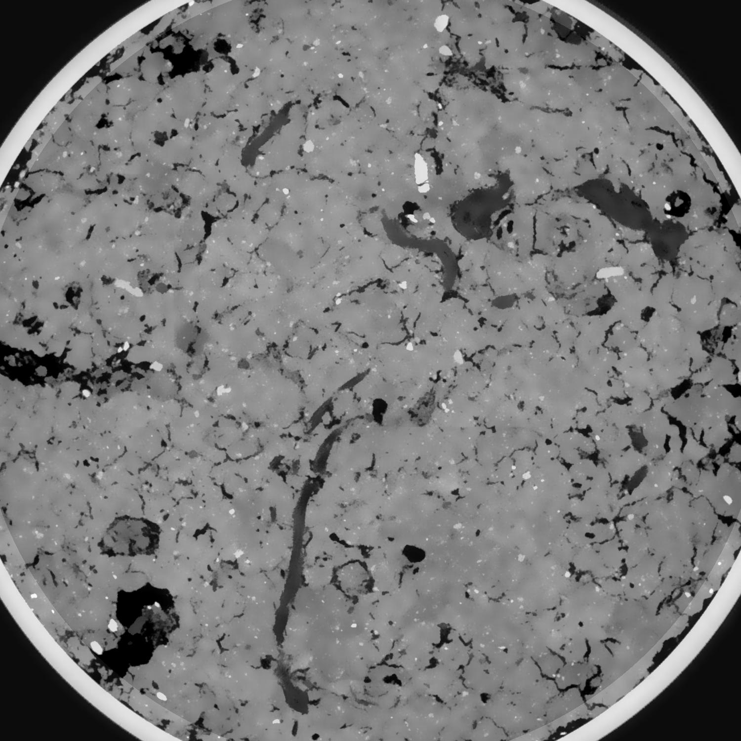
|
|---|
|
| Texture | silt clay |
|---|
| Sand | 20.0 |
|---|
| Silt | 40.0 |
|---|
| Clay | 40.0 |
|---|
|
|
Results
| Porosity | Surface | Mean Curvature | Euler | MeanPoreSize | Gamma | PoreDist |
| 0.104435118 | 0.886269882 | 0.365394423 | 0.371566127 | 0.705252098236 | 0.865334746187 | 0.427751835 |
| Opening size | Volume | Surface | MeanCurvature | Euler number |
|---|
| 0.096 | 0.104435118 | 0.886269882 | 0.365394423 | 0.371566127 |
| 0.12 | 0.102368681 | 0.796768788 | 0.275999292 | 0.009026847 |
| 0.144 | 0.100165896 | 0.748090693 | 0.238539095 | -0.029536595 |
| 0.168 | 0.097955738 | 0.707192073 | 0.215834277 | 0.007093843 |
| 0.192 | 0.096750219 | 0.686501553 | 0.212395003 | 0.080863553 |
| 0.216 | 0.088901313 | 0.575729772 | 0.162643439 | 0.057848006 |
| 0.24 | 0.084974442 | 0.527761478 | 0.145439316 | 0.06646409 |
| 0.288 | 0.079850724 | 0.465250343 | 0.124432318 | 0.072908386 |
| 0.336 | 0.069246587 | 0.357213193 | 0.086494232 | 0.05467134 |
| 0.384 | 0.062903019 | 0.300170449 | 0.068405838 | 0.042945393 |
| 0.432 | 0.054217726 | 0.230498528 | 0.046939251 | 0.034590833 |
| 0.48 | 0.050103749 | 0.19962213 | 0.038032445 | 0.02400479 |
| 0.528 | 0.043317445 | 0.155466123 | 0.026390348 | 0.019024461 |
| 0.576 | 0.040123639 | 0.134836347 | 0.021207985 | 0.011481479 |
| 0.624 | 0.036147074 | 0.113202746 | 0.016423461 | 0.009133447 |
| 0.672 | 0.034372648 | 0.103390396 | 0.014349311 | 0.006145818 |
| 0.72 | 0.031048065 | 0.087468281 | 0.011222968 | 0.004761445 |
| 0.96 | 0.022576477 | 0.052925176 | 0.005666666 | 0.002393515 |
| 1.2 | 0.017040888 | 0.035067671 | 0.003258307 | 0.001196757 |
| 1.44 | 0.013398966 | 0.025294166 | 0.002156113 | 0.000582744 |
| 1.68 | 0.010144197 | 0.017776702 | 0.001435947 | 0.000449139 |
| 2.16 | 0.005932132 | 0.009557957 | 0.000726713 | 0.000150661 |
| 2.64 | 0.002843774 | 0.004470279 | 0.000352147 | 0.00008528 |
| 3.12 | 0.000850156 | 0.001330235 | 0.000109901 | 0.000028427 |
Reference: An open Soil Structure Library based on X-ray CT data
 Soil Structure Library