General Information
Internal Identifier leuther
| Soil Type | Fluvic Gleysol |
|---|
| Classification | FAO |
|---|
|
| Location | Giessen |
|---|
| Latitude | 50°32'00 |
|---|
| Longitude | 8°41'18.0 |
|---|
|
| Landuse | Grassland |
|---|
| Tillage | No tillage |
|---|
| Crop | gras |
|---|
|
| Sampling Depth | -5.0 |
|---|
| Sample Height | 5.0 |
|---|
| Sampling Date | March 1, 2020 |
|---|
| Voxel size | 0.048 |
|---|
| Pores white? | True |
|---|
|
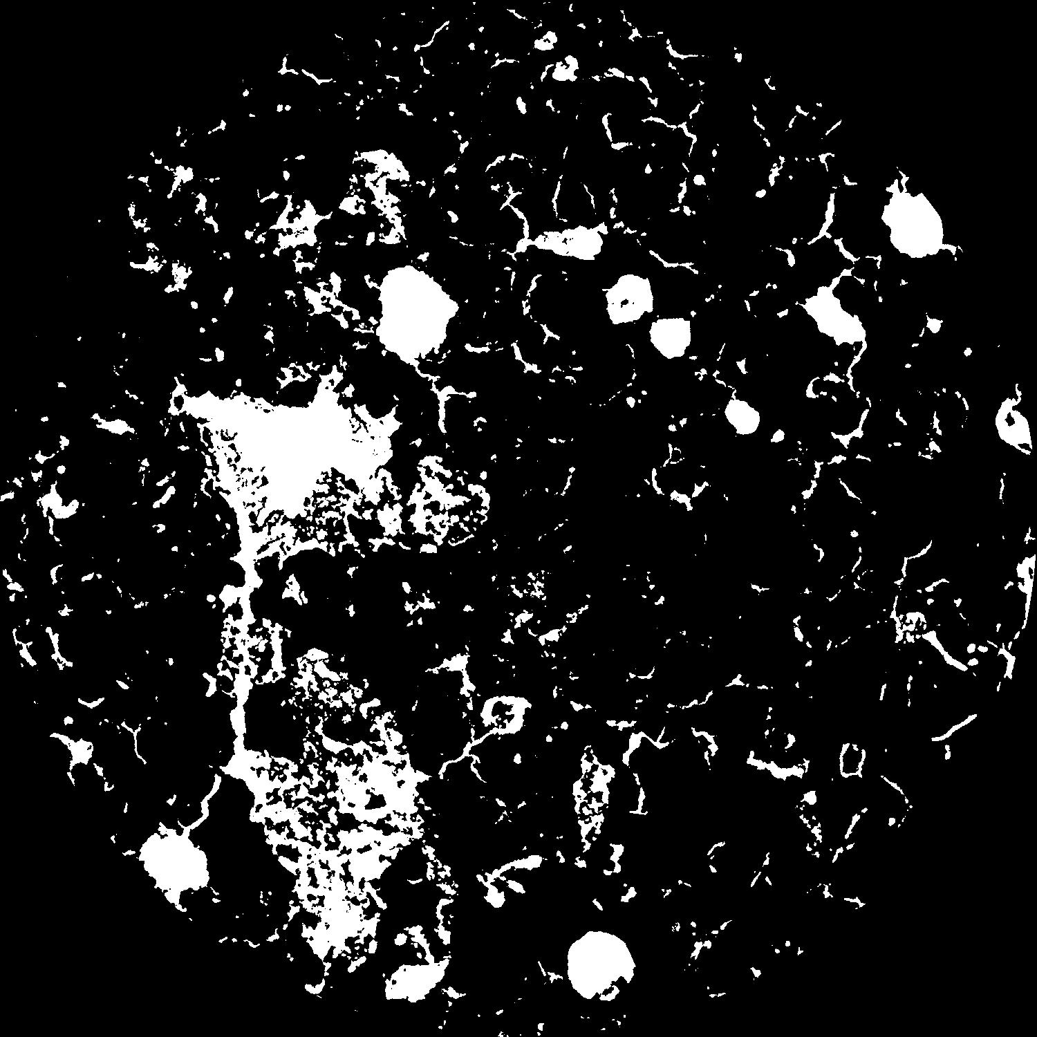
| XY Plane |
|
|---|
|
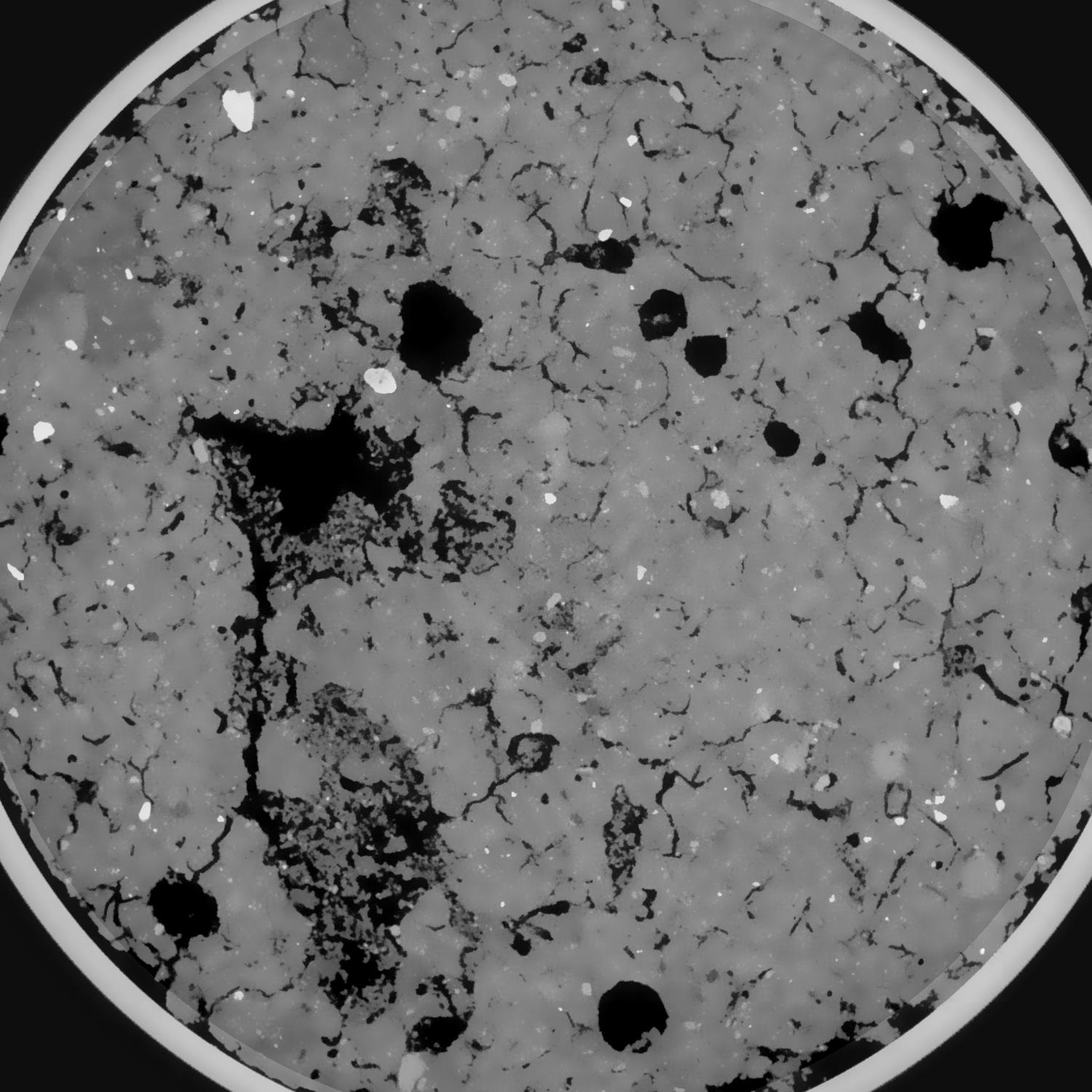
| XY Plane Grey |
|
|---|
|
| Texture | silt clay |
|---|
| Sand | 20.0 |
|---|
| Silt | 40.0 |
|---|
| Clay | 40.0 |
|---|
|
|
Results
| Porosity | Surface | Mean Curvature | Euler | MeanPoreSize | Gamma | PoreDist |
| 0.127405868 | 0.853552485 | 0.25893495 | -0.006250996 | 1.08194357311 | 0.89650675515 | 0.526071227 |
| Opening size | Volume | Surface | MeanCurvature | Euler number |
|---|
| 0.096 | 0.127405868 | 0.853552485 | 0.25893495 | -0.006250996 |
| 0.12 | 0.125913248 | 0.785713458 | 0.201985654 | -0.149155469 |
| 0.144 | 0.124234151 | 0.749296441 | 0.176572188 | -0.173573865 |
| 0.168 | 0.122484643 | 0.717857479 | 0.161539908 | -0.131843707 |
| 0.192 | 0.121474533 | 0.700832495 | 0.160020022 | -0.059120093 |
| 0.216 | 0.114633957 | 0.6097664 | 0.128523378 | -0.057228307 |
| 0.24 | 0.110973326 | 0.567408372 | 0.117676522 | -0.030911018 |
| 0.288 | 0.105957192 | 0.50926493 | 0.104012218 | 0.007115163 |
| 0.336 | 0.095151483 | 0.40725159 | 0.078441441 | 0.018522732 |
| 0.384 | 0.088303218 | 0.350138373 | 0.06553399 | 0.020324975 |
| 0.432 | 0.078392422 | 0.276114559 | 0.047958677 | 0.024230781 |
| 0.48 | 0.073487542 | 0.241392275 | 0.039809155 | 0.017728211 |
| 0.528 | 0.065120774 | 0.188862041 | 0.027840431 | 0.01702039 |
| 0.576 | 0.061278218 | 0.164764744 | 0.02235051 | 0.010220762 |
| 0.624 | 0.056468684 | 0.139341926 | 0.017380116 | 0.008607556 |
| 0.672 | 0.054355092 | 0.127856018 | 0.015140226 | 0.005946832 |
| 0.72 | 0.050546552 | 0.109657748 | 0.011691827 | 0.005230483 |
| 0.96 | 0.041860599 | 0.074461202 | 0.005937883 | 0.002143361 |
| 1.2 | 0.036329798 | 0.057889023 | 0.004057404 | 0.00140285 |
| 1.44 | 0.032024117 | 0.047551803 | 0.003154592 | 0.000778887 |
| 1.68 | 0.027768103 | 0.038592359 | 0.002417425 | 0.000764674 |
| 2.16 | 0.02023508 | 0.024778084 | 0.001412097 | 0.000318377 |
| 2.64 | 0.015032168 | 0.016759376 | 0.000844542 | 0.00009665 |
| 3.12 | 0.010905983 | 0.011906568 | 0.000636367 | 0.00009665 |
| 3.6 | 0.006779694 | 0.007024673 | 0.000376415 | 0.000062538 |
| 4.08 | 0.003529479 | 0.003141736 | 0.000137466 | 0.000017056 |
| 4.56 | 0.002934113 | 0.002694711 | 0.000124986 | 0.000017056 |
| 5.04 | 0.00188711 | 0.001929337 | 0.000103409 | 0.000017056 |
Reference: An open Soil Structure Library based on X-ray CT data
 Soil Structure Library