General Information
Internal Identifier leuther
| Soil Type | Fluvic Gleysol |
|---|
| Classification | FAO |
|---|
|
| Location | Giessen |
|---|
| Latitude | 50°32'00 |
|---|
| Longitude | 8°41'18.0 |
|---|
|
| Landuse | Grassland |
|---|
| Tillage | No tillage |
|---|
| Crop | gras |
|---|
|
| Sampling Depth | -5.0 |
|---|
| Sample Height | 5.0 |
|---|
| Sampling Date | March 1, 2020 |
|---|
| Voxel size | 0.048 |
|---|
| Pores white? | True |
|---|
|
| XY Plane |
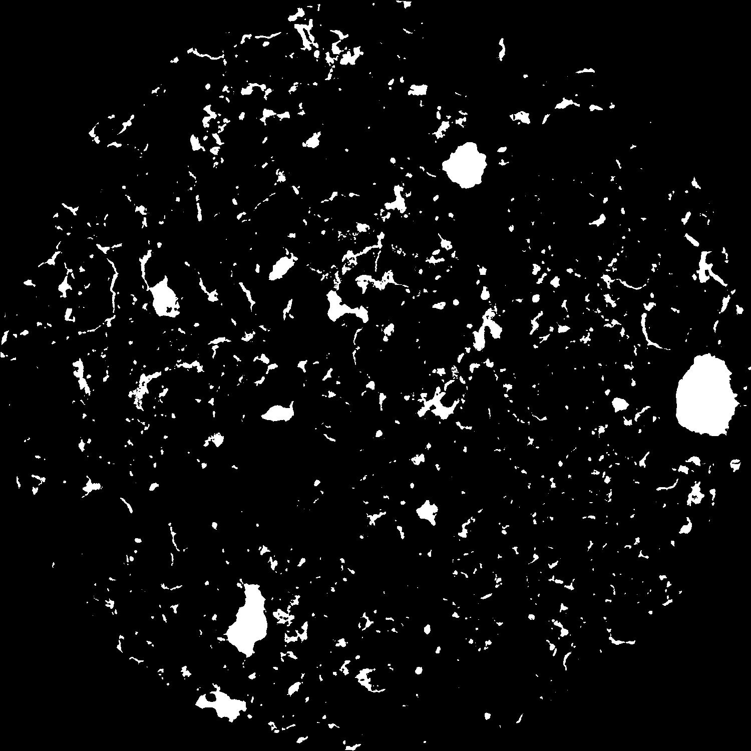
|
|---|
|
| XY Plane Grey |
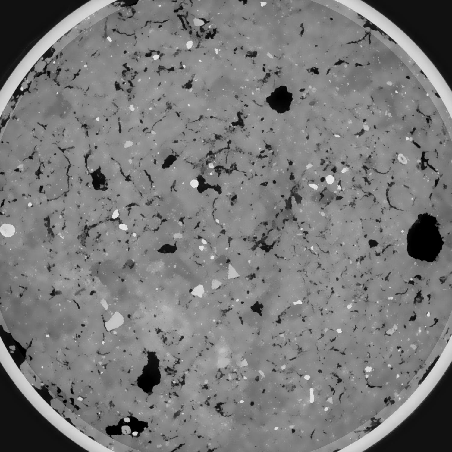
|
|---|
|
| Texture | silt clay |
|---|
| Sand | 20.0 |
|---|
| Silt | 40.0 |
|---|
| Clay | 40.0 |
|---|
|
|
Results
| Porosity | Surface | Mean Curvature | Euler | MeanPoreSize | Gamma | PoreDist |
| 0.086610587 | 0.701075438 | 0.335825413 | 0.478410114 | 1.20148202226 | 0.79338954254 | 0.493540597 |
| Opening size | Volume | Surface | MeanCurvature | Euler number |
|---|
| 0.096 | 0.086610587 | 0.701075438 | 0.335825413 | 0.478410114 |
| 0.12 | 0.084658306 | 0.623738547 | 0.246219908 | 0.090159031 |
| 0.144 | 0.082674876 | 0.578144913 | 0.207403597 | 0.033071435 |
| 0.168 | 0.080812761 | 0.542518815 | 0.18530571 | 0.054065855 |
| 0.192 | 0.079817101 | 0.525175438 | 0.181457983 | 0.110253751 |
| 0.216 | 0.07364317 | 0.434261917 | 0.134635645 | 0.070919949 |
| 0.24 | 0.070659174 | 0.396312598 | 0.11911216 | 0.073449911 |
| 0.288 | 0.066778375 | 0.347900307 | 0.100913485 | 0.069296794 |
| 0.336 | 0.058938885 | 0.265512667 | 0.069137983 | 0.048568162 |
| 0.384 | 0.054197544 | 0.221550839 | 0.054105185 | 0.036951657 |
| 0.432 | 0.047685858 | 0.16749826 | 0.036144002 | 0.029120146 |
| 0.48 | 0.044642879 | 0.144003561 | 0.02889992 | 0.020506905 |
| 0.528 | 0.039837079 | 0.110839554 | 0.019086117 | 0.015212462 |
| 0.576 | 0.037729737 | 0.096537003 | 0.015010751 | 0.009402078 |
| 0.624 | 0.035184319 | 0.081914339 | 0.011300824 | 0.007073944 |
| 0.672 | 0.034074975 | 0.07559499 | 0.009871809 | 0.004799821 |
| 0.72 | 0.032075791 | 0.065661096 | 0.00771666 | 0.003844689 |
| 0.96 | 0.026991636 | 0.044511619 | 0.004000206 | 0.001930162 |
| 1.2 | 0.023606894 | 0.033371852 | 0.002407007 | 0.001029041 |
| 1.44 | 0.021272907 | 0.027297872 | 0.001721273 | 0.000582744 |
| 1.68 | 0.018958798 | 0.022282771 | 0.001303161 | 0.000429241 |
| 2.16 | 0.015374451 | 0.015251793 | 0.000710394 | 0.000190458 |
| 2.64 | 0.013295361 | 0.011736541 | 0.000425319 | 0.000150661 |
| 3.12 | 0.012242845 | 0.010449452 | 0.000355252 | 0.00004264 |
| 3.6 | 0.010035342 | 0.008351244 | 0.000296253 | 0.000019899 |
| 4.08 | 0.007697179 | 0.006254053 | 0.000233207 | 0.000025584 |
| 4.56 | 0.005936899 | 0.004567576 | 0.00015329 | 0.000008528 |
| 5.04 | 0.004427182 | 0.003584797 | 0.000130336 | 0.000008528 |
| 5.52 | 0.000955701 | 0.000856305 | 0.000039873 | 0.000005685 |
Reference: An open Soil Structure Library based on X-ray CT data
 Soil Structure Library