General Information
Internal Identifier leuther
| Soil Type | Haplic Chernozem |
|---|
| Classification | FAO |
|---|
|
| Location | Bad Lauchstädt |
|---|
| Latitude | 51.39178 |
|---|
| Longitude | 11.87701 |
|---|
|
| Landuse | Grassland |
|---|
| Tillage | No tillage |
|---|
| Crop | gras |
|---|
|
| Sampling Depth | 5.0 |
|---|
| Sample Height | 5.0 |
|---|
| Sampling Date | March 1, 2020 |
|---|
| Voxel size | 0.048 |
|---|
| Pores white? | True |
|---|
|
| XY Plane |
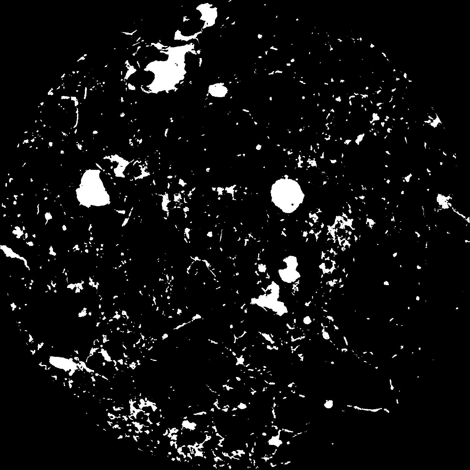
|
|---|
|
| XY Plane Grey |
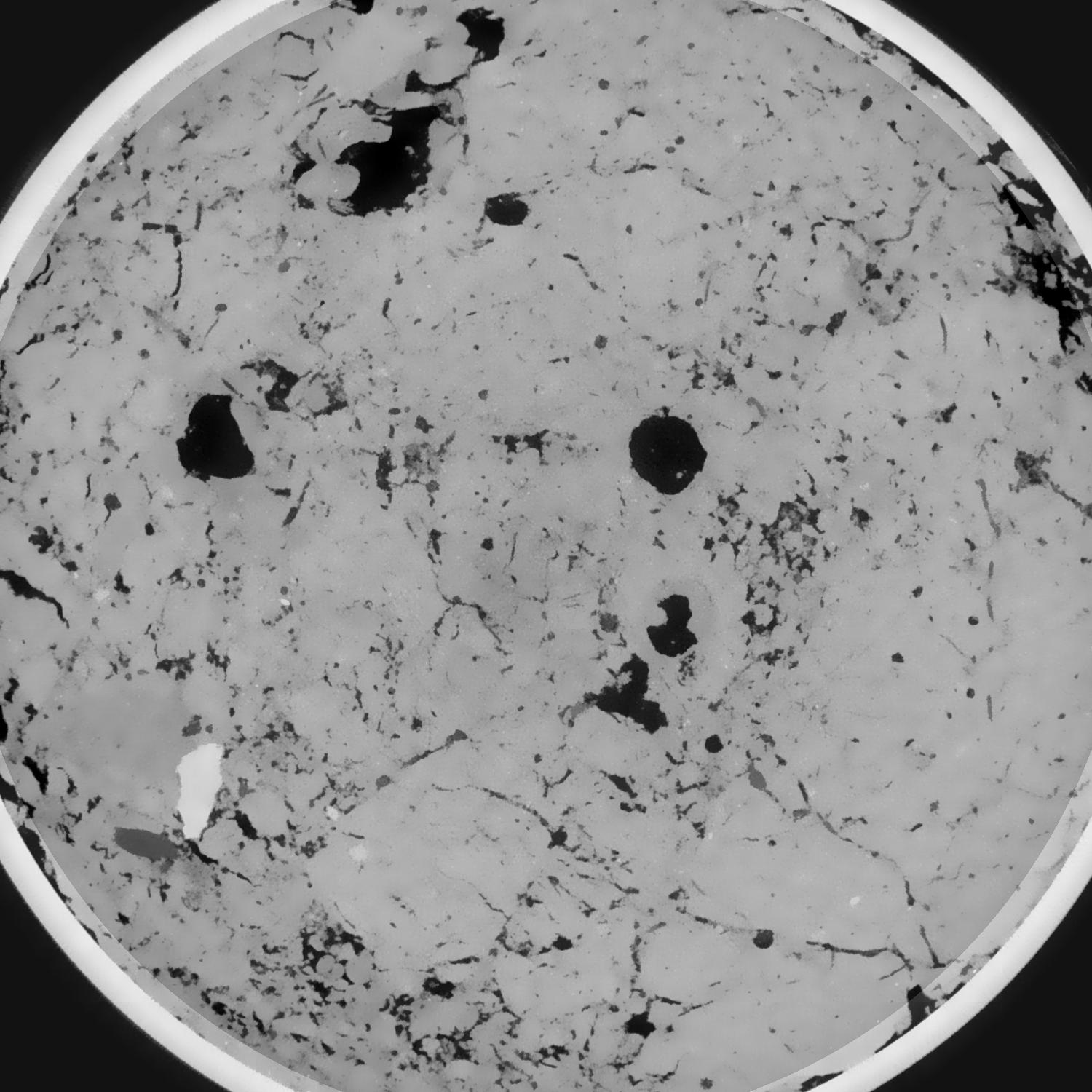
|
|---|
|
| Texture | silty loam |
|---|
| Sand | 11.0 |
|---|
| Silt | 68.0 |
|---|
| Clay | 21.0 |
|---|
|
|
Results
| Porosity | Surface | Mean Curvature | Euler | MeanPoreSize | Gamma | PoreDist |
| 0.09728756 | 0.721443192 | 0.351577528 | 0.70470668 | 1.28120459393 | 0.822692374516 | 0.484812044 |
| Opening size | Volume | Surface | MeanCurvature | Euler number |
|---|
| 0.096 | 0.09728756 | 0.721443192 | 0.351577528 | 0.70470668 |
| 0.12 | 0.09521322 | 0.636072599 | 0.249834619 | 0.143228535 |
| 0.144 | 0.093237052 | 0.589788246 | 0.207121079 | 0.057010844 |
| 0.168 | 0.091373299 | 0.553469779 | 0.182534526 | 0.064413115 |
| 0.192 | 0.0903876 | 0.536107299 | 0.178393137 | 0.121834722 |
| 0.216 | 0.08408805 | 0.442236389 | 0.127049391 | 0.06702125 |
| 0.24 | 0.080901815 | 0.401834895 | 0.110483672 | 0.069218621 |
| 0.288 | 0.076799895 | 0.350666971 | 0.091787123 | 0.067862675 |
| 0.336 | 0.068674106 | 0.266051315 | 0.059830628 | 0.044862763 |
| 0.384 | 0.063972118 | 0.223550478 | 0.046050278 | 0.033959764 |
| 0.432 | 0.057788647 | 0.173659163 | 0.030152535 | 0.024806419 |
| 0.48 | 0.055020759 | 0.153313656 | 0.024401274 | 0.017225061 |
| 0.528 | 0.050373364 | 0.123630166 | 0.016713167 | 0.013226868 |
| 0.576 | 0.048222634 | 0.110036083 | 0.013405266 | 0.008377301 |
| 0.624 | 0.045465174 | 0.095486786 | 0.010307585 | 0.006518205 |
| 0.672 | 0.044225927 | 0.08879336 | 0.008958582 | 0.004596571 |
| 0.72 | 0.042020514 | 0.078854539 | 0.007162157 | 0.003956974 |
| 0.96 | 0.03571996 | 0.054957971 | 0.003668552 | 0.00161747 |
| 1.2 | 0.031382448 | 0.042812752 | 0.002461359 | 0.001009142 |
| 1.44 | 0.027990249 | 0.034819105 | 0.001804538 | 0.000608328 |
| 1.68 | 0.02496438 | 0.028957156 | 0.001425583 | 0.000562845 |
| 2.16 | 0.020881716 | 0.022066317 | 0.000993774 | 0.000264367 |
| 2.64 | 0.017287628 | 0.017263502 | 0.000755396 | 0.0001933 |
| 3.12 | 0.014149787 | 0.0137248 | 0.000606811 | 0.000119391 |
| 3.6 | 0.010926825 | 0.010407256 | 0.000474117 | 0.000065381 |
| 4.08 | 0.007455119 | 0.006897679 | 0.00031024 | 0.000034112 |
| 4.56 | 0.00439626 | 0.00391617 | 0.00017614 | 0.000028427 |
| 5.04 | 0.00239769 | 0.002011793 | 0.000086563 | 0.000011371 |
| 5.52 | 0.001556126 | 0.001248015 | 0.000049847 | 0.000005685 |
| 6.0 | 0.000806063 | 0.000749776 | 0.000036834 | 0.000005685 |
Reference: An open Soil Structure Library based on X-ray CT data
 Soil Structure Library