General Information
Internal Identifier leuther
| Soil Type | Haplic Chernozem |
|---|
| Classification | FAO |
|---|
|
| Location | Bad Lauchstädt |
|---|
| Latitude | 51.39178 |
|---|
| Longitude | 11.87701 |
|---|
|
| Landuse | Grassland |
|---|
| Tillage | No tillage |
|---|
| Crop | gras |
|---|
|
| Sampling Depth | 5.0 |
|---|
| Sample Height | 5.0 |
|---|
| Sampling Date | March 1, 2020 |
|---|
| Voxel size | 0.048 |
|---|
| Pores white? | True |
|---|
|
| XY Plane |
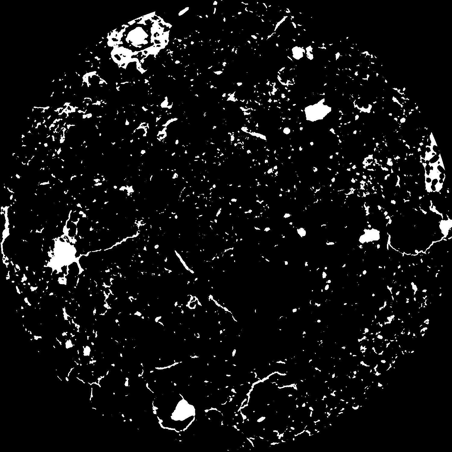
|
|---|
|
| XY Plane Grey |
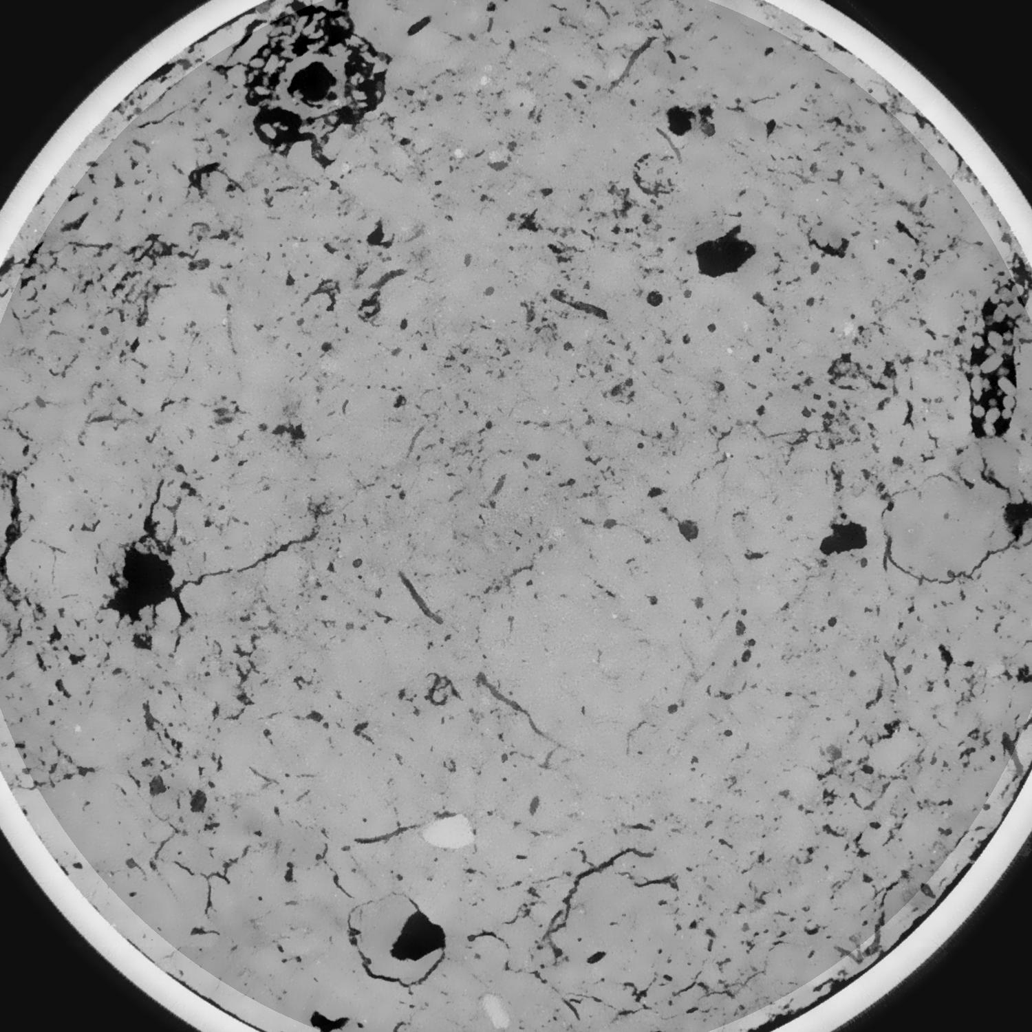
|
|---|
|
| Texture | silty loam |
|---|
| Sand | 11.0 |
|---|
| Silt | 68.0 |
|---|
| Clay | 21.0 |
|---|
|
|
Results
| Porosity | Surface | Mean Curvature | Euler | MeanPoreSize | Gamma | PoreDist |
| 0.082560211 | 0.743998192 | 0.418203093 | 1.008571036 | 0.890815778789 | 0.76705526438 | 0.404045134 |
| Opening size | Volume | Surface | MeanCurvature | Euler number |
|---|
| 0.096 | 0.082560211 | 0.743998192 | 0.418203093 | 1.008571036 |
| 0.12 | 0.080159963 | 0.648611514 | 0.292096147 | 0.258883165 |
| 0.144 | 0.077992581 | 0.595934288 | 0.237779387 | 0.121420631 |
| 0.168 | 0.07593897 | 0.554854128 | 0.207348962 | 0.113125405 |
| 0.192 | 0.074878204 | 0.535983663 | 0.202206179 | 0.173223766 |
| 0.216 | 0.068053103 | 0.430264746 | 0.13815653 | 0.088339461 |
| 0.24 | 0.064801753 | 0.387888685 | 0.118918934 | 0.083643297 |
| 0.288 | 0.060711084 | 0.335839101 | 0.098219427 | 0.072851809 |
| 0.336 | 0.052671141 | 0.250178922 | 0.063779232 | 0.045221951 |
| 0.384 | 0.048001652 | 0.206915153 | 0.048982695 | 0.033755104 |
| 0.432 | 0.041864085 | 0.155879601 | 0.031966048 | 0.025220509 |
| 0.48 | 0.039112086 | 0.134737346 | 0.025482606 | 0.017287184 |
| 0.528 | 0.034739293 | 0.105359374 | 0.017170484 | 0.012676508 |
| 0.576 | 0.032748913 | 0.092036119 | 0.013535088 | 0.007919078 |
| 0.624 | 0.030366742 | 0.078544126 | 0.010176206 | 0.005334478 |
| 0.672 | 0.029321885 | 0.072690108 | 0.0088745 | 0.003738694 |
| 0.72 | 0.027437338 | 0.063809539 | 0.007146736 | 0.002926554 |
| 0.96 | 0.022275755 | 0.042709206 | 0.003672876 | 0.001430506 |
| 1.2 | 0.018978247 | 0.032731832 | 0.002512142 | 0.000946072 |
| 1.44 | 0.016109691 | 0.025684568 | 0.001889004 | 0.000558524 |
| 1.68 | 0.013641331 | 0.02027311 | 0.00139733 | 0.000450239 |
| 2.16 | 0.009423513 | 0.012670437 | 0.00083035 | 0.000179526 |
| 2.64 | 0.00567823 | 0.006704018 | 0.000416003 | 0.000128233 |
| 3.12 | 0.003661099 | 0.003654118 | 0.000190228 | 0.000037045 |
| 3.6 | 0.002719272 | 0.002401398 | 0.000102976 | 0.000011398 |
| 4.08 | 0.002152329 | 0.001873081 | 0.000083346 | 0.000017098 |
| 4.56 | 0.001676853 | 0.001367656 | 0.000053905 | 0.000005699 |
| 5.04 | 0.001347462 | 0.001151753 | 0.000048564 | 0.000005699 |
| 5.52 | 0.00053262 | 0.000568591 | 0.000032139 | 0.000005699 |
Reference: An open Soil Structure Library based on X-ray CT data
 Soil Structure Library