General Information
Internal Identifier leuther
| Soil Type | Haplic Chernozem |
|---|
| Classification | FAO |
|---|
|
| Location | Bad Lauchstädt |
|---|
| Latitude | 51.39178 |
|---|
| Longitude | 11.87701 |
|---|
|
| Landuse | Grassland |
|---|
| Tillage | No tillage |
|---|
| Crop | gras |
|---|
|
| Sampling Depth | 5.0 |
|---|
| Sample Height | 5.0 |
|---|
| Sampling Date | March 1, 2020 |
|---|
| Voxel size | 0.048 |
|---|
| Pores white? | True |
|---|
|
| XY Plane |
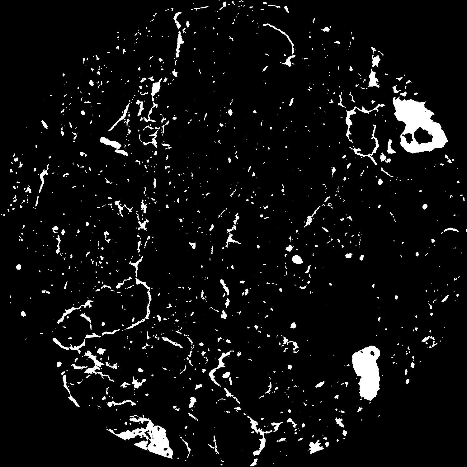
|
|---|
|
| XY Plane Grey |
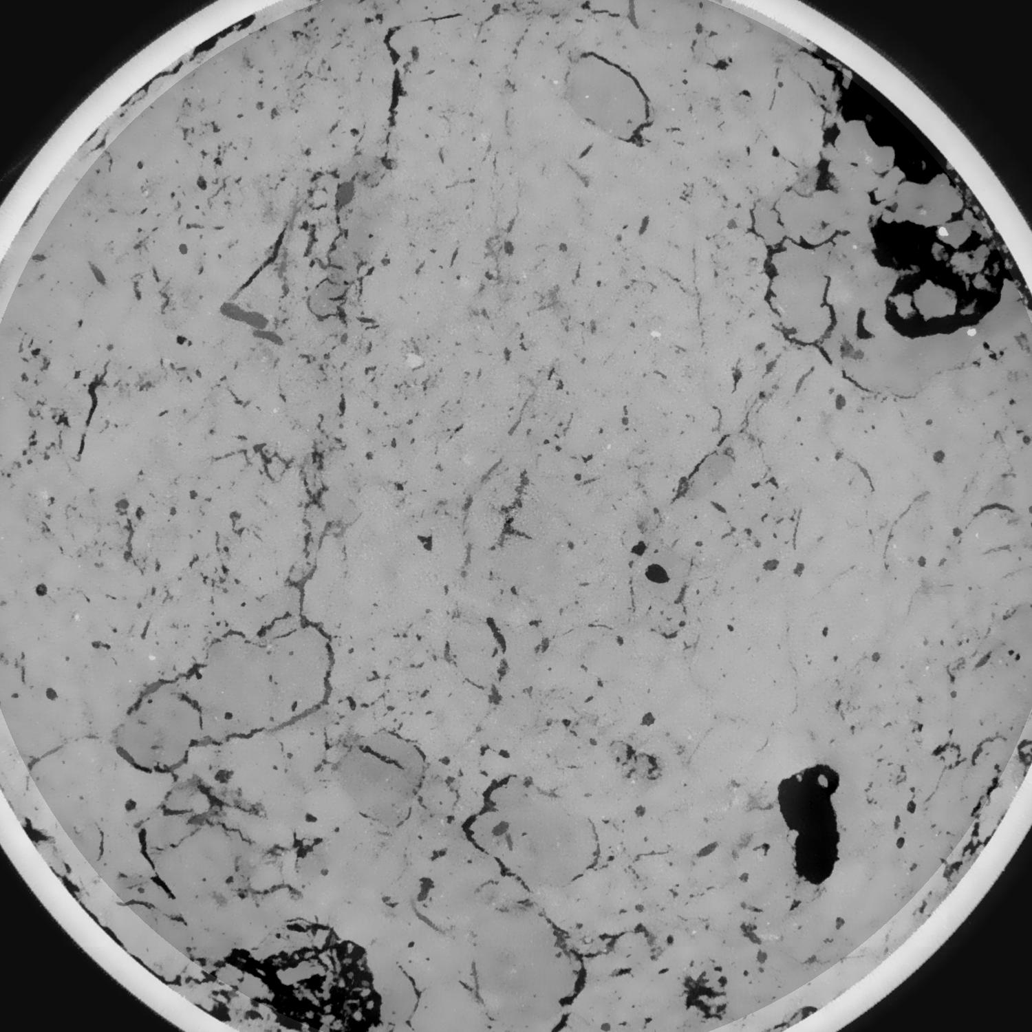
|
|---|
|
| Texture | silty loam |
|---|
| Sand | 11.0 |
|---|
| Silt | 68.0 |
|---|
| Clay | 21.0 |
|---|
|
|
Results
| Porosity | Surface | Mean Curvature | Euler | MeanPoreSize | Gamma | PoreDist |
| 0.066690841 | 0.644066916 | 0.375788717 | 0.993466656 | 0.885389920766 | 0.747222101812 | 0.449513443 |
| Opening size | Volume | Surface | MeanCurvature | Euler number |
|---|
| 0.096 | 0.066690841 | 0.644066916 | 0.375788717 | 0.993466656 |
| 0.12 | 0.064351886 | 0.549012535 | 0.249367617 | 0.206250793 |
| 0.144 | 0.062119049 | 0.496984001 | 0.20162139 | 0.099253483 |
| 0.168 | 0.06010387 | 0.458012356 | 0.17542226 | 0.09956979 |
| 0.192 | 0.05908555 | 0.440288862 | 0.171330943 | 0.153668289 |
| 0.216 | 0.052635069 | 0.342191549 | 0.114598044 | 0.08088772 |
| 0.24 | 0.049699265 | 0.304264088 | 0.09759863 | 0.076183008 |
| 0.288 | 0.046250268 | 0.260706378 | 0.079921645 | 0.064337162 |
| 0.336 | 0.03943542 | 0.187738897 | 0.049821602 | 0.039029739 |
| 0.384 | 0.035718172 | 0.152929812 | 0.0372971 | 0.027788012 |
| 0.432 | 0.030918799 | 0.112586492 | 0.023325931 | 0.01915938 |
| 0.48 | 0.028740505 | 0.095602082 | 0.017906732 | 0.012525479 |
| 0.528 | 0.025344815 | 0.072317174 | 0.010997362 | 0.008521771 |
| 0.576 | 0.023872777 | 0.062744764 | 0.008488484 | 0.005002498 |
| 0.624 | 0.022034016 | 0.052577087 | 0.006077986 | 0.003352571 |
| 0.672 | 0.021248195 | 0.048249168 | 0.005145381 | 0.002016102 |
| 0.72 | 0.019915133 | 0.042115701 | 0.004021491 | 0.001602908 |
| 0.96 | 0.016383314 | 0.028725342 | 0.002174639 | 0.000713828 |
| 1.2 | 0.013894115 | 0.021550121 | 0.001459347 | 0.00051578 |
| 1.44 | 0.011896545 | 0.016760611 | 0.001046583 | 0.000270713 |
| 1.68 | 0.010271331 | 0.013246298 | 0.000748456 | 0.000256465 |
| 2.16 | 0.008134889 | 0.009492157 | 0.000484869 | 0.000142481 |
| 2.64 | 0.006419657 | 0.007149274 | 0.00037657 | 0.000091188 |
| 3.12 | 0.004640563 | 0.004799758 | 0.000241301 | 0.000068391 |
| 3.6 | 0.003788884 | 0.003755549 | 0.000174494 | 0.000028496 |
| 4.08 | 0.002298943 | 0.002235431 | 0.000107509 | 0.000019947 |
| 4.56 | 0.000981658 | 0.000960442 | 0.000050846 | 0.000008549 |
| 5.04 | 0.00054914 | 0.000468991 | 0.000020966 | 0.00000285 |
| 5.52 | 0.000474456 | 0.00042008 | 0.00001973 | 0.00000285 |
| 6.0 | 0.000336499 | 0.000329696 | 0.000017342 | 0.00000285 |
Reference: An open Soil Structure Library based on X-ray CT data
 Soil Structure Library